St. Lawrence O’Toole Church
Butte–Anaconda Historic District
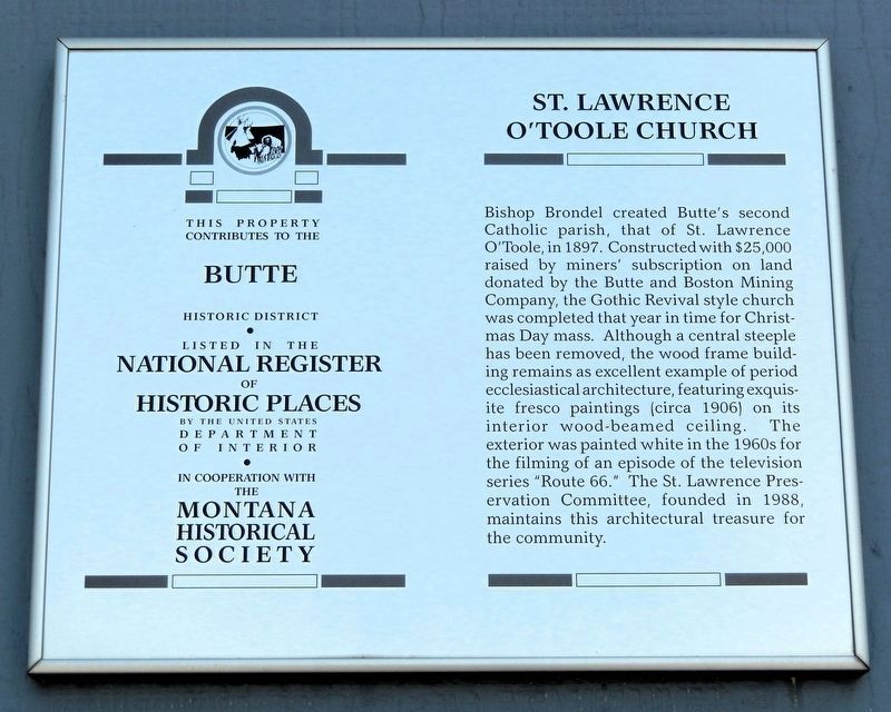
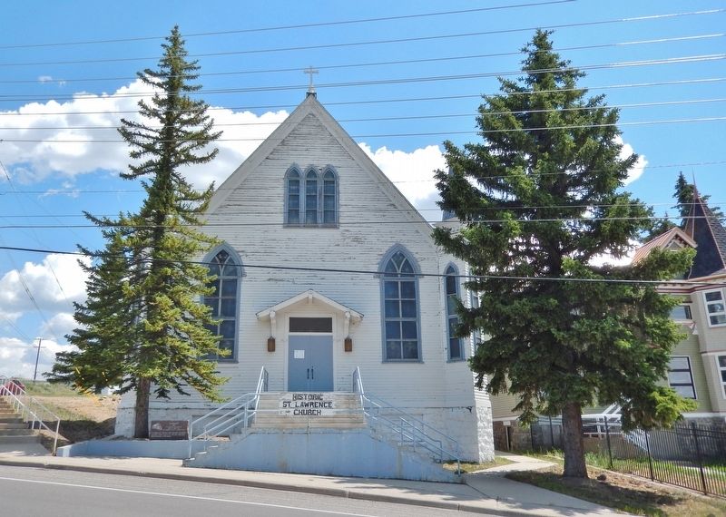
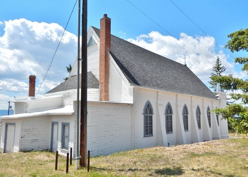
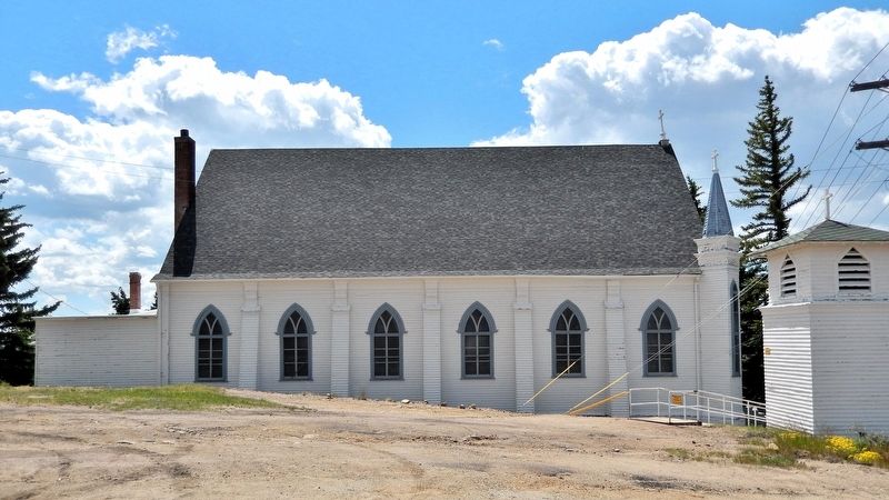
Bishop Brondel created Butte's second Catholic parish, that of St. Lawrence O'Toole, in 1897. Constructed with $25,000 raised by miners' subscription on land donated by the Butte and Boston Mining Company, the Gothic Revival style church was completed that year in time for Christmas Day mass. Although a central steeple has been removed, the wood frame building remains as excellent example of period ecclesiastical architecture, featuring exquisite fresco paintings (circa 1906) on its interior wood-beamed ceiling. The exterior was painted white in the 1960s for the filming of an episode of the television series “Route 66.” The St. Lawrence Preservation Committee, founded in 1988, maintains this architectural treasure for the community.
Erected by Montana Historical Society.
Topics and series. This historical marker is listed in these topic lists: Architecture • Religion & Religious Structures. In addition, it is included in the Montana National Register Sign Program, and the National Register of Historic Places (NRHP) series lists. A significant historical year for this entry is 1897.
Location. 46° 1.634′ N, 112° 32.085′ W.
this page online

Regionally, this marker is in andspecifically outhwest Montana, in Gold West Country, in Mining Country. It is also in the American Mountain West and in the Lewis & Clark Corridor. Globally, it is in North America, the Rocky Mountains, the Western Hemisphere, the Western World, and the Anglosphere. Historically, it finds itself in what was once Rupert’s Land and also the Louisiana Purchase.
Other nearby markers. At least 8 other markers are within walking distance of this marker: Walkerville and the Lex (about 800 feet away, measured in a direct line); Butte-Anaconda Historic District (approx. 0.2 miles away); Butte-Anaconda-Walkerville (approx. 0.2 miles away); 1600 North Main (approx. 0.2 miles away); Caplice & McCune Store (approx. ¼ mile away); Mines of Centerville

Regarding St. Lawrence O’Toole Church. Saint Lawrence O'Toole Church is a contributing property in Butte–Anaconda Historic District, National Register of Historic Places № 66000438.
From the National Register Nomination prepared by Derek Strahn, 1/2006:
Throughout the Butte-Anaconda NHL district, churches harbored ethnic groups drawn to the Butte-Anaconda industrial frontier. Such institutions reflected the workers’ ties to homeland, ancestral beliefs and communally held values. The most visible architectural expressions of Walkerville’s cultural heritage were the churches.The second-oldest Catholic parish in the landmark district, St. Lawrence O'Toole, erected an impressive wooden Gothic Revival church across Main Street from the Lexington Mine. Within a decade, St. Lawrence's parish numbered 5,000, and included Irish-Catholics from both Walkerville and nearby Centerville. By 1900 the parish had erected a school behind the church to educate the congregation's children.
Located just west of the Continental Divide,
on the northern slope of the Summit Valley in southwestern Montana's Silver Bow County, the city of Butte is concentrated on a furrowed outcropping that once was appropriately nicknamed the “Richest Hill on Earth.” Both Butte and Walkerville owe their life to mining and a labyrinth of precious metals deposited deep beneath the earth's surface. These geologic patterns directed mining and milling operations to be concentrated mostly along the steeply sloping upper Butte Hill and on the ridge crests. It was mining, smelting, and railroading that shaped the built environment of the Butte-Anaconda Historic District throughout the period of significance from 1876-1934. Supported by complex technology, outside capital, and railroads, the mines on Butte Hill represented industrial mining on a colossal scale. In 1961, Butte's national prominence as a copper-producing center was recognized with its designation as a National Historic Landmark.Photographed by Cosmos Mariner, July 6, 20243. St. Lawrence O’Toole Church (west/front elevation)
Also see . . .
1. St. Lawrence O'Toole Church History.
Excerpt: The church was officially dedicated by Bishop Brondel on January 16, 1898. By the time of the first Mass, the church was fully(Submitted on August 14, 2026, by Cosmos Mariner of Cape Canaveral, Florida.)paid for. At its peak in 1900, the church had 5,000 parishioners.Photographed by Cosmos Mariner, July 6, 20244. St. Lawrence O’Toole Church (southeast elevation)In 1903 an artist was commissioned to paint murals on the ceiling. There are more than sixty paintings of the life of Christ, saints, emblems of organizations and Catholic symbols. In 1906, the church acquired the frescos on the walls and the ceiling. This was the first work of this kind done in Butte. The Schatzlein Company engaged the European artist, Mr. Tolston, who came from New York, according to a story printed in the Butte Montana Catholic, September 22, 1906. According to an article in the Montana Standard in December of 1953, the church was renovated that year under the direction of Reverend J.W. McCormack.
St. Lawrence was the second Catholic parish of Silver Bow County. The parish was made up of the towns of Centerville and Walkerville and the church was placed exactly equal distance from the center of each business district. The congregation was predominantly Irish but also contained other ethnicities. The parish maintained an Italian speaking priest for the Italian immigrants and a priest who spoke German. The church was closed by the Helena Diocese in 1987
and through the action of the parishioners it was saved from being destroyed. It was then deeded to the town of Walkerville.Photographed by Cosmos Mariner, July 6, 20245. St. Lawrence O’Toole Church (northeast elevation)

2. Butte–Anaconda Historic District (Wikipedia).
Excerpt: The Butte–Anaconda Historic District is a National Historic Landmark that spans parts of Walkerville, Butte and Anaconda, Montana. It was declared an National Historic Landmark in 1961. The district's national significance relates to its long history of copper production as well as to its role in the development of the labor union movement in the United States. As the source of nearly one-third of all the world's copper in the early 1900s, Butte's mines provided one of the metals that were critical to American industrialization. Walkerville represents some of the earliest mines in the district and preserves the early mining camp flavor present in the 1890s to 1910s. Butte itself is an urban metropolis where industrial relics such as mine yards and head frames are juxtaposed with a wide variety of residential and business structures. Anaconda was created as a(Submitted on August 14, 2026, by Cosmos Mariner of Cape Canaveral, Florida.)company town that contained the smelters for Butte's ore.Photographed by Cosmos Mariner, July 6, 20246. St. Lawrence O’Toole Church (north elevation)
Credits. This page was last revised on August 14, 2026. It was originally submitted on August 12, 2026, by Cosmos Mariner of Cape Canaveral, Florida. This page has been viewed 21 times since then. Photos: 1, 2, 3, 4, 5, 6. submitted on August 14, 2026, by Cosmos Mariner of Cape Canaveral, Florida.
