Centre-Ville in Reims in Marne, Alsace, Lorraine, Champagne-Ardenne, France — Western Europe
Cathédrale
Quartier Centre
| — | De l’Antiquité à la cité des sacres | — |
Photographed by James Hulse
1. Cathédrale Marker

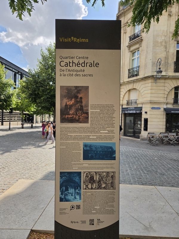
Le cœur de ville forme un ovale de 50 hectares, trace d’une enceinte antique centrée sur le forum et axée suivant le cardo et le decumanus. Le contexte historique de cette fortification, datée du IVᵉ siècle, est mieux compris grâce aux fouilles menées à l’emplacement de la médiathèque Falala : l’époque est encore prospère, mais la frontière est sous la menace des « invasions barbares »… Alliée de Rome, capitale de la Gaule Belgique, la cité des Rèmes atteignait dix fois cette superficie durant la Pax Romana, tirant avantage de sa situation au carrefour de la via agrippa de l’Océan (vers la Grande-Bretagne) et des routes menant au limes germanique. Après la « Chute de l’Empire », cette position frontalière devient symbolique, le baptême de Clovis marquant l’union des élites romaines, converties au catholicisme, avec la noblesse franque, autrefois considérée comme barbare !
Cette position de « carrefour » s’impose dans l’histoire de Reims. « Ville des sacres » sous l’Ancien Régime, elle bénéficie également de sa situation géographique dans les échanges internationaux, pour son commerce et son industrie
this page online
Sur le plan symbolique — à la Révolution — ou stratégique — durant les conflits —, cette position peut s’avérer délicate. Ainsi, Reims est la plus grande ville détruite pendant la Première Guerre mondiale, l’incendie de la cathédrale symbolisant un désastre pour toute l’Humanité. Mais la destruction fait également de Reims l’épicentre d’un renouveau artistique : l’Art déco (secteur Erlon).
Incendie de la cathédrale, dessin de Gustave Fraipont © BM, Reims
Ancien couvent des Cordeliers, vue de l’ancien cloître détruit pendant la Grande Guerre © Reims, BM
Intérieur du cryptoportique lors de sa découverte dans les années 1930
Baptême de Clovis, gravure sur bois anonyme, particulièrement colorée (XVIᵉ siècle) © BM Reims
Photographed by James Hulse
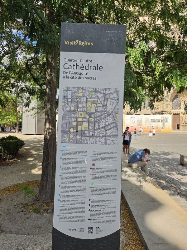
2. Cathédrale Marker - Reverse Side
As an ally of Rome and the capital of Gallia Belgica, the Remi tribe’s city became ten times larger during the Pax Romana by taking advantage of its location at the crossroads of the Via Agrippa (towards Great Britain) and the roads leading to the Limes Germankus. After the fall of the Empire, this border position became symbolic: the baptism of Clovis marked the union between Roman elites who converted to Catholicism and the Frankish nobility, who had once been considered barbarians!
This location at a “crossroads” is vital to the history of Reims. As the city where coronations took place until the fall of the French monarchy, its location was also an advantage in international exchanges, trade and industry (Lundy quarter), particularly with regard to champagne (Saint-Nicaise hill).
This position could prove to be precarious in terms of symbolism (during the Revolution) and strategy (during conflicts). In addition, Reims was the largest city to be destroyed during the First World War and the fire in the cathedral symbolised

Photographed by James Hulse, August 5, 2026
3. Cathédrale Marker
The reverse of the marker, with the cathedral in the background.
Fire at the cathedral, drawing by Gustave Fraipont © Reims Municipal Library
Former Cordeliers convent, view of the old cloister destroyed during the Great War © Reims Municipal Library
Interior of the cryptoporticus when it was discovered in the 1930s
Baptism of Clovis, anonymous wood engraving, particularly coloured, 16th century © Reims Municipal Library
Als Verbündete des römischen Reiches und Provinzhauptstadt der Gallia Belgica wuchs die Stadt der Rèmes während der Pax Romana auf das Zehnfache an, dank ihrer Lage an der Kreuzung zwischen der Via Agrippa zur Nordsee (nach Großbritannien) und den Straßen, die zum
Photographed by James Hulse, August 5, 2026
4. Cathédrale Marker
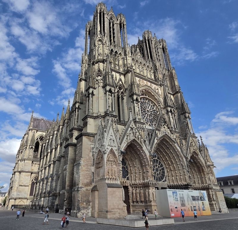
The view of the cathedral.
Diese Position als „Kreuzung“ hat sich in der Geschichte von Reims fortgesetzt. Während der Königszeit profitierte die Stadt der Krönungen von ihrer geografischen Lage im internationalen Austausch, im Handel und in der Industrie (Sektor Lundy), vor allem beim Champagner (Saint-Nicaise-Hügel).
Auf symbolischer Ebene - während der Revolution - oder strategisch - im Krieg -, konnte sich diese Position als schwierig erweisen. So war Reims die größte Stadt, die im Ersten Weltkrieg zerstört wurde, und das Feuer in der Kathedrale stellte eine Katastrophe für die gesamte Menschheit dar. Aber die Zerstörung machte Reims auch zum Zentrum einer künstlerischen Erneuerung: dem Art Déco (Sektor Erlon).
Brand der Kathedrale, Zeichnung von Gustave Fraipont © Stadtbibliothek Reims
Ehemaliges Cordeliers-Kloster, Blick auf den ehemaligen Kreuzgang, der im Ersten Weltkrieg zerstört wurde © Stadtbibliothek Reims
Inneres des Kryptoportikus bei seiner Entdeckung in den 1930er Jahren
Taufe Chlodwigs, anonymer Holzschnitt, farbig gestaltet, 16. Jahrhundert © Stadtbibliothek Reims
Erected by Historic Monument, City of Reims, Greater Reims Urban Community.
Topics. This historical marker is listed in this topic list: Religion & Religious Structures. A significant historical year for this entry is 1930.
Location. 49° 15.198′ N, 4° 1.934′ E. Marker is in Reims, Grand Est (Alsace, Lorraine, Champagne-Ardenne), in Marne. It is in Centre-Ville. It is at the intersection of Rue Rockefeller and Rue Tronsson Ducoudray, on the left when traveling east on Rue Rockefeller. Touch for map. Marker is at or near this postal address: 20 Rue Tronsson Ducoudray, Reims, Grand Est 51100, France. Touch for directions.

Regionally, it is in the North Atlantic Region, Europe, the European Union, Atlantic Europe, the Schengen Area, Western Europe, a coastal Mediterranean country, and the Western World. Historically, it finds itself in what was once a French colony, the Roman Empire, and specifically the Holy Roman Empire.
Other nearby markers. At least 8 other markers are within walking distance of this marker: Cathédrale Notre-Dame (a few steps from this marker); Médiathèque Jean Falala / Jean Falala Multimedia Library (within shouting distance of this marker); Statue de Jeanne d’Arc / Statue of Joan of Arc (within shouting distance of this marker); Cavalcade du sacre des rois de France (within shouting distance of this marker); Musée des Beaux-Arts (about 90 meters away, measured in a direct line); Le Trésor / The Treasury (about 90 meters away); Palais du Tau / Palace of Tau (about 90 meters away); Architectures romantiques et modernistes / Romantic and Modernist Architecture (about 90 meters away). Touch for a list and map of all markers in Reims.
Other markers no longer nearby. Médiathèque Jean Falala (was within shouting distance of this marker but has been replaced with another marker now near it); Cathédral Notre-Dame (was within shouting distance of this marker but has been replaced with another marker now near it).
Credits. This page was last revised on August 13, 2026. It was originally submitted on August 12, 2026, by James Hulse of Medina, Texas. This page has been viewed 14 times since then. Photos: 1, 2, 3, 4. submitted on August 13, 2026, by James Hulse of Medina, Texas.
