Holmes Chapel in Cheshire East, England, United Kingdom — Northwestern Europe (the British Isles)
Welcome to the Holmes Chapel Conservation Area
Photographed by Ray Gurganus, May 10, 2026
1. Welcome to the Holmes Chapel Conservation Area Marker
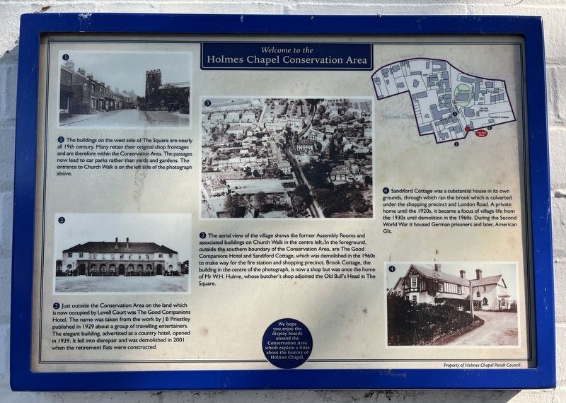
2. Just outside the Conservation Area on the land which is now occupied by Lovell Court was The Good Companions Hotel. The name was taken from the work by JB Priestley published in 1929 about a group of travelling entertainers. The elegant building, advertised as a country hotel, opened in 1939. It fell into disrepair and was demolished in 2001 when the retirement flats were constructed.
3. The aerial view of the village shows the former Assembly Rooms and associated buildings on Church Walk in the centre left. In the foreground, outside the southern boundary of the Conservation Area, are The Good Companions Hotel and Sandford Cottage, which was demolished in the 1960s to make way for the fire station and shopping precinct. Brook Cottage, the building in the centre of the photograph, is now a shop but was once the
this page online
4. Sandford Cottage was a substantial house in its own grounds, through which ran the brook which is culverted under the shopping precinct and London Road. A private home until the 1920s, it became a focus of village life from the 1930s until demolition in the 1960s. During the Second World War it housed German prisoners and later, American GIs.
We hope you enjoy the display boards around the Conservation Area which explain a little about the history of Holmes Chapel.
Erected by Holmes Chapel Parish Council.
Topics. This historical marker is listed in this topic list: Notable Buildings.
Location. 53° 12.085′ N, 2° 21.44′ W. Marker is in Holmes Chapel, England, in Cheshire East. It is on The Square, on the right when traveling north. Touch for map. Marker is at or near this postal address: 19a The Square, Holmes Chapel, England CW4 7AQ, United Kingdom. Touch for directions.

Regionally, this marker is in North West England. Globally, it is on the Atlantic Ocean, in the North Atlantic Region, in Europe, in Atlantic Europe, on one of the British Isles, in the Western World, and in the Anglosphere. Historically, it finds itself in what was once the Roman Empire.
Other nearby markers. At least 5 other markers are within 19 kilometers of this marker, measured as the crow flies: Manchester - Goostrey - Crewe (approx. 3.1 kilometers away); Milton House & Gardens (approx. 12.3 kilometers away); Crewe (approx. 13 kilometers away); Hartford's Listed Sites and its Conservation Area (approx. 13.5 kilometers away); The Great Church of St Mary's (approx. 18.5 kilometers away).
Credits. This page was last revised on August 13, 2026. It was originally submitted on August 13, 2026, by Ray Gurganus of Washington, District of Columbia. This page has been viewed 10 times since then. Photo 1. submitted on August 13, 2026, by Ray Gurganus of Washington, District of Columbia. • Andrew Ruppenstein was the editor who published this page.
