Mueller Community in Austin in Travis County, Texas — The American South (West South Central)
Mueller Airport
Photographed by Larry D. Moore, August 12, 2026
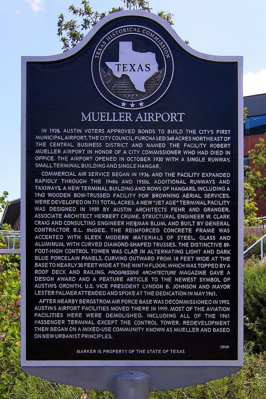
1. Mueller Airport Marker
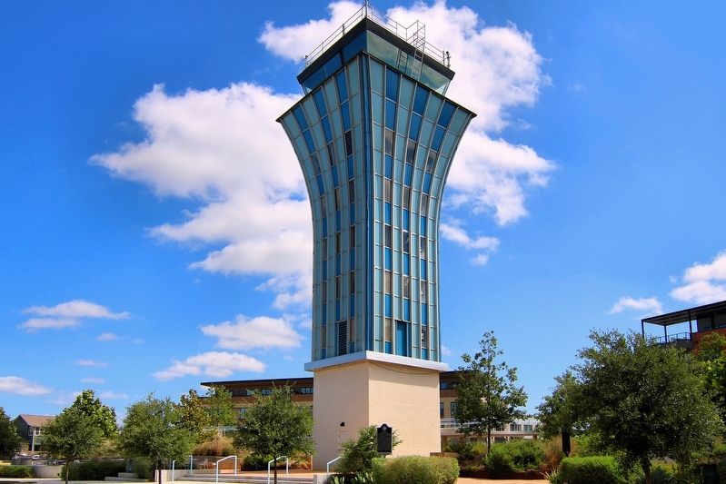
Commercial air service began in 1936, and the facility expanded rapidly through the 1940s and 1950s. Additional runways and taxiways, a new terminal building and rows of hangars, including a 1943 wooden bow-trussed facility for Browning Aerial Services, were developed on 711 total acres. A new "jet age" terminal facility was designed in 1959 by Austin architects Fehr and Granger, associate architect Herbert Crume, structural engineer W. Clark Craig and consulting engineer Herman Blum, and built by general contractor B.L. McGee. The reinforced concrete frame was accented with sleek modern materials of steel glass and aluminum, with curved diamond-shaped trusses. The distinctive 89-foot-high control tower was clad in alternating light and dark blue porcelain panels, curving outward from 18 feet wide at the base to nearly 30 feet wide at the ninth floor, which was topped by a roof deck and railing. Progressive Architecture magazine gave a design award and a feature article to the newest symbol of Austin's growth. U.S. Vice President Lyndon B. Johnson and Mayor Lester Palmer attended and spoke at the dedication in May 1961.
After nearby Bergstrom Air Force Base was decommissioned in 1993, Austin's airport facilities moved there in 1999. Most of the aviation facilities here were demolished, including all of the 1961 passenger terminal except the control tower. Redevelopment then began on a mixed-use community known as Mueller and based on new urbanist
this page online
Erected 2018 by Texas Historical Commission. (Marker Number 20052.)
Topics. This historical marker is listed in these topic lists: Air & Space • Architecture. A significant historical month for this entry is May 1961.
Location. 30° 17.516′ N, 97° 41.94′ W. Marker is in Austin, Texas, in Travis County. It is in Mueller Community. It is on Berkman Drive 0.2 miles north of Manor Road, on the right when traveling north. Touch for map. Marker is in this post office area: Austin TX 78723, United States of America. Touch for directions.

Regionally, this marker is in Central Texas. It is also in the American South. Globally, it is in North America, a Gulf of Mexico state, the Western Hemisphere, the Western World, and the Anglosphere. Historically, it finds itself in what was once New Spain, the Republic of Texas, one of the Confederate States of America, and the Antebellum South.
Other nearby markers. At least 8 other markers are within 2 miles of this marker, measured as the crow flies: Evergreen Cemetery (approx. 0.9 miles away); Maud Anna Berry Smith Fuller (approx. 1.1 miles away); Bethany Cemetery (approx.
Photographed by Larry D. Moore, August 12, 2026
2. Mueller Airport Marker Area
Another marker is no longer nearby. Site of Pecan Springs School (was approx. 0.8 miles away but has been confirmed missing).
Credits. This page was last revised on August 13, 2026. It was originally submitted on August 13, 2026, by Larry D. Moore of Del Valle, Texas. This page has been viewed 20 times since then. Photos: 1, 2. submitted on August 13, 2026, by Larry D. Moore of Del Valle, Texas.
