Butte in Silver Bow County, Montana — The American West (Mountains)
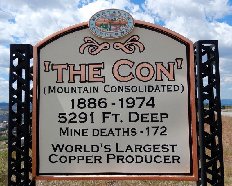
The Con
(Mountain Consolidated)
Photographed by Cosmos Mariner, July 6, 2024
1. The Con Marker
5291 Ft. Deep
Mine deaths — 172
World’s Largest Copper Producer
Erected by Montana's Copperway.
Topics. This historical marker is listed in these topic lists: Industry & Commerce • Natural Resources. A significant historical year for this entry is 1886.
Location. 46° 1.441′ N, 112° 31.86′ W. Marker is in Butte, Montana, in Silver Bow County. It can be reached from Wells Street just south of East Center Street. The marker is on the Butte, Anaconda & Pacific (BA&P) Hill Trail, overlooking the historic Mountain Consolidated Mine site. Touch for map. Marker is in this post office area: Butte MT 59701, United States of America. Touch for directions.

Regionally, this marker is in andspecifically outhwest Montana, in Gold West Country, in Mining Country. It is also in the American Mountain West and in the Lewis & Clark Corridor. Globally, it is in North America, the Rocky Mountains, the Western Hemisphere, the Western World, and the Anglosphere. Historically, it finds itself in what was once Rupert’s Land and also the Louisiana Purchase.
Other nearby markers. At least 8 other markers are within walking
this page online
Related markers. Click here for a list of markers that are related to this marker. Mountain Consolidated Mine
Also see . . . Mountain Con Mine (Story of Butte).
(by Nancy Woodruff & Butte Historical Society) Excerpt: Standing at an elevation of 6,135 feet, the “Con” is more than a mile high and a mile deep, the deepest on the hill. Originally called the Mountain Consolidated, the name was later shortened by tongue-twisted immigrant miners.(Submitted on August 15, 2026, by Cosmos Mariner of Cape Canaveral, Florida.)The Con was a copper mine and one of the biggest producers in the industry. Mammoth ore bins, now gone, housed the copper
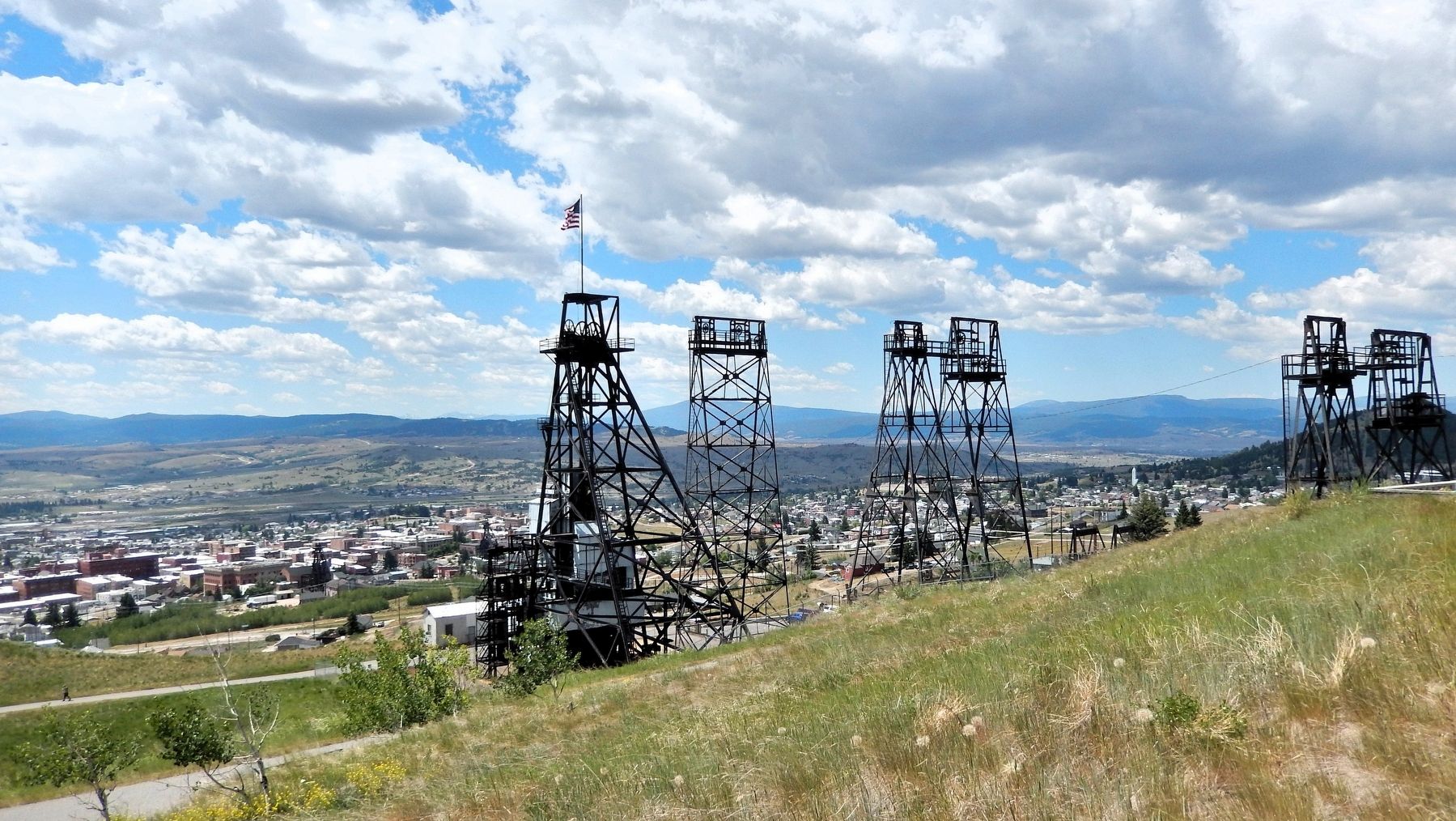
until it was loaded onto horse-drawn wagons, and in later years into train cars of the Butte, Anaconda and Pacific Railway. Mining waste was also dropped into the bins for shipment to dumping sites.Photographed by Cosmos Mariner, July 6, 20242. The Con MarkerLooking west along the Butte, Anaconda & Pacific (BA&P) Hill Trail. The historic Mountain Consolidated Mine site is in the background.The headframe of the Con, the second tallest of those remaining on the hill, was erected in 1928. The Con is a consolidation of the Mountain, Burnett, Loweville, and Buffalo Mines. The Mountain Consolidated Mining Company was formed to operate the mine, and by 1887 the mine was owned by the Chambers Syndicate. In 1891 it became the property of the newly incorporated Anaconda Mining Company (to be renamed the Anaconda Copper Mining Company in 1895).

Photographed by Cosmos Mariner, July 6, 2024
3. Mountain Consolidated Mine Site
The city of Butte, Montana is in the background.
Credits. This page was last revised on August 15, 2026. It was originally submitted on August 14, 2026, by Cosmos Mariner of Cape Canaveral, Florida. This page has been viewed 15 times since then. Photos: 1, 2, 3. submitted on August 15, 2026, by Cosmos Mariner of Cape Canaveral, Florida.
