Crewe in Cheshire East, England, United Kingdom — Northwestern Europe (the British Isles)
Crewe
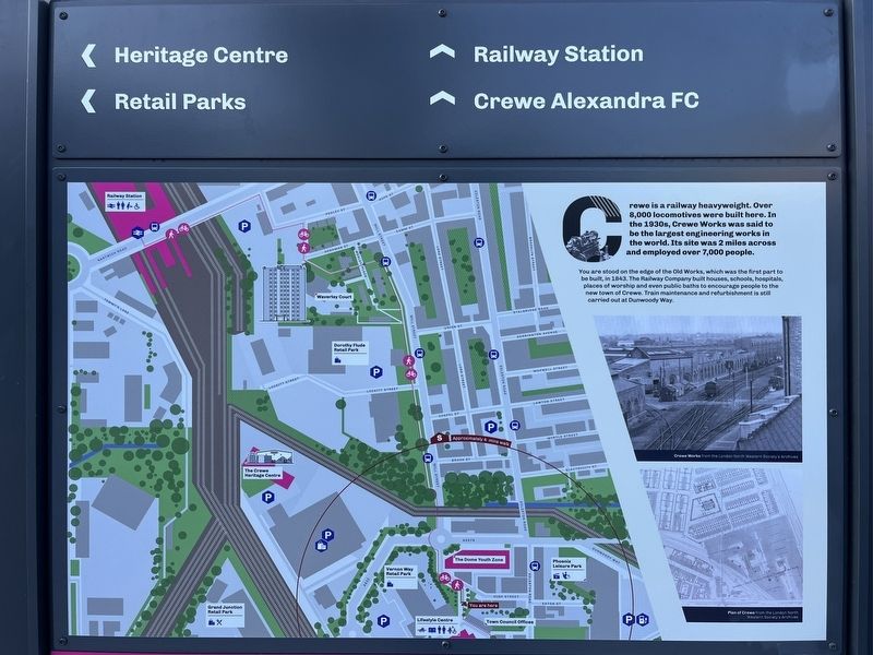
Photographed by Ray Gurganus, May 10, 2026
1. Crewe Marker, Side One
You are stood on the edge of the Old Works, which was the first part to be built, in 1843. The Railway Company built houses, schools, hospitals places of worship and even public baths to encourage people to the new town of Crewe Train maintenance and refurbishment is still carried out at Dunwoody Way.
Crewe's Iron Bridge is a glimpse into the past. You are standing close to where the Iron Bridge once stood. Built around 1855 by the London & North Western Railway, the bridge provided access over the Chester line, which ran where Chantry Court stands today.
Initially maintained by the Railway Company, the bridge was a popular feature of Crewe. In 1935, a count revealed that 3,111 people used the bridge in a single day. By 1937 the ironwork needed replacing and the bridge was demolished forcing residents to detour around High Street and over Chester Bridge. The new pedestrian and cycle link, opened in
this page online
Topics. This historical marker is listed in these topic lists: Bridges & Viaducts • Railroads & Streetcars.
Location. 53° 5.747′ N, 2° 26.407′ W. Marker is in Crewe, England, in Cheshire East. It is on High Street. Touch for map. Marker is at or near this postal address: 27 High Street, Crewe, England CW1 2DU, United Kingdom. Touch for directions.

Regionally, this marker is in North West England. Globally, it is on the Atlantic Ocean, in the North Atlantic Region, in Europe, in Atlantic Europe, on one of the British Isles, in the Western World, and in the Anglosphere. Historically, it finds itself in what was once the Roman Empire.
Other nearby markers. At least 5 other markers are within 19 kilometers of this marker, measured as the crow flies: The Great Church of St Mary's (approx. 6.3 kilometers away); Milton House & Gardens (approx. 8.9 kilometers away); Welcome to the Holmes Chapel Conservation Area (approx. 13 kilometers away);
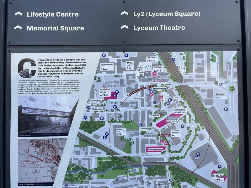
Photographed by Ray Gurganus, May 10, 2026
2. Crewe Marker, Side Two
Credits. This page was last revised on August 16, 2026. It was originally submitted on August 15, 2026, by Ray Gurganus of Washington, District of Columbia. This page has been viewed 18 times since then. Photos: 1, 2. submitted on August 15, 2026, by Ray Gurganus of Washington, District of Columbia. • Andrew Ruppenstein was the editor who published this page.
Editor’s want-list for this marker. photo of the marker within its surroundings • Can you help?
