Canton in Norfolk County, Massachusetts — The American Northeast (New England)
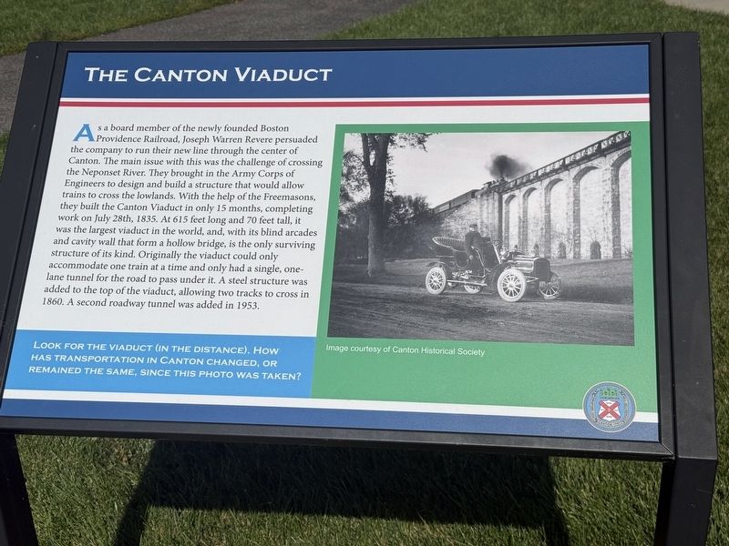
The Canton Viaduct
| — | Paul Revere Heritage Site | — |
Photographed by G.W.Bartlett, August 14, 2026
1. The Canton Viaduct Marker
Look for the viaduct (in the distance). How has transportation in Canton changed, or remained the same, since this photo was taken?
(Illustration captions)
1. Image courtesy of Canton
this page online
Erected 2025 by Paul Revere Heritage Site.
Topics. This historical marker is listed in these topic lists: Bridges & Viaducts • Industry & Commerce. A significant historical date for this entry is July 28, 1835.
Location. 42° 9.345′ N, 71° 9.026′ W. Marker is in Canton, Massachusetts, in Norfolk County. It can be reached from Rolling Mill Way. Touch for map. Marker is at or near this postal address: 2 Rolling Mill Way, Canton MA 02021, United States of America. Touch for directions.

Regionally, this marker is in Greater Boston. It is also in the American Northeast, in New England, and on the Eastern Seaboard. Globally, it is in the North Atlantic Region, North America, the Western Hemisphere, the Western World, and the Anglosphere. Historically, it finds itself in what was once one of the original Thirteen Colonies.
Other nearby markers. At least 8 other markers are within walking distance of this marker: Paul Revere Heritage Site (a few steps from this marker); Birthplace of U.S. Copper Industry (a few steps from this marker); A Long, Rich History (within shouting distance of this marker); Made in Canton
Photographed by G.W.Bartlett, September 8, 2026
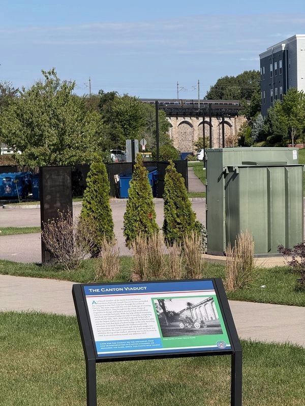
2. The Canton Viaduct Marker (wide)
An Amtrak train crosses the viaduct in the distance beyond the marker.
Related marker. Click here for another marker that is related to this marker. The markers at the Canton Viaduct

Photographed by G.W.Bartlett, August 14, 2026
3. The Canton Viaduct Marker (wide)
The recently renovated historic Revere Rolling Mill building at 2 Rolling Mill Way currently houses a Paul Revere Museum in Rolling Mill Hall and The Northern Spy restaurant.
Photographed by G.W.Bartlett, August 14, 2026
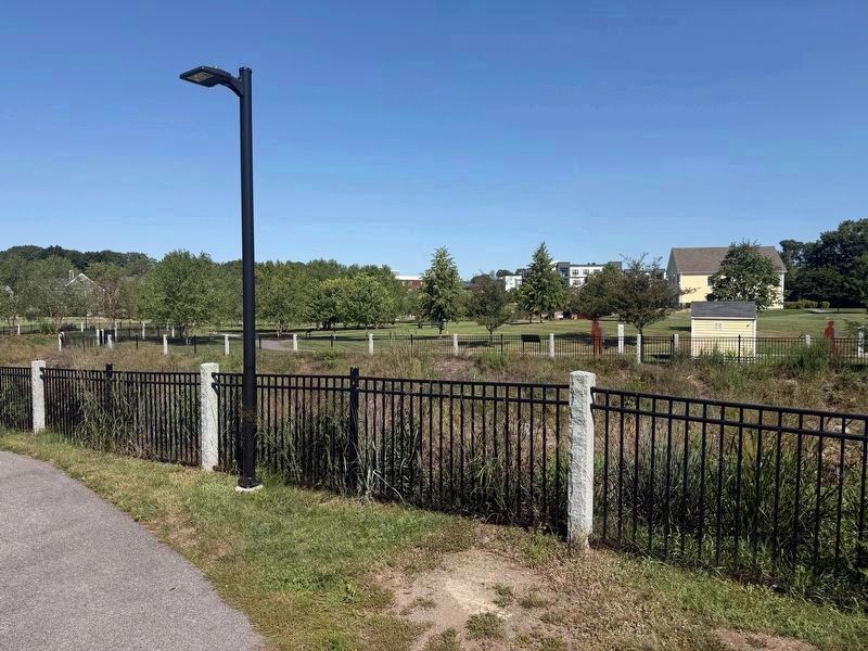
4. MBTA Traversing The Canton Viaduct
From a high point near the dam at the Revere Heritage site, in the distance behind trees and between two buildings, a silver and purple double-decker commuter rail car can be seen traversing the Canton Viaduct.
Photographed by G.W.Bartlett, August 14, 2026
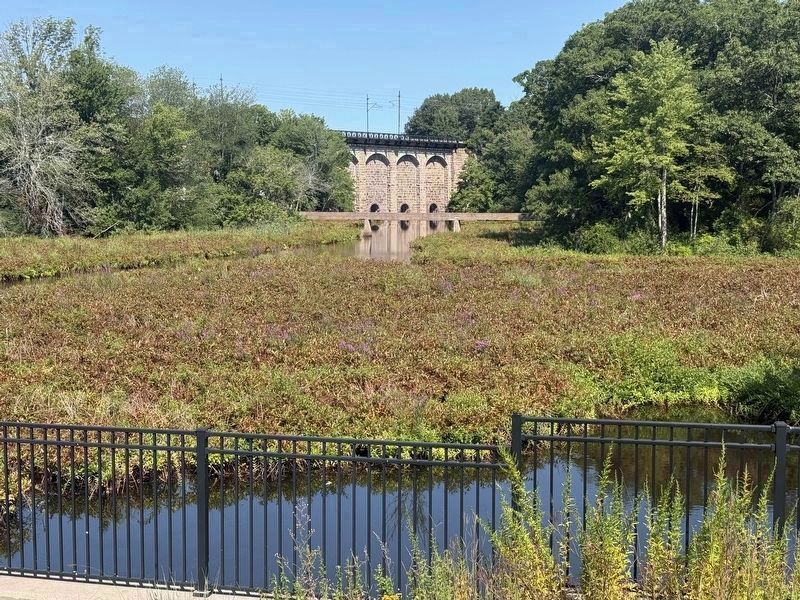
5. The Canton Viaduct Marker
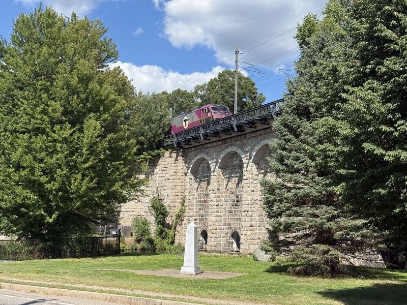
The east side of the Canton Viaduct viewed from a viewing spot on the north side of 15 Revolution Way. The west side of the Canton Viaduct is the dry side. There is a separate historical marker there and parking is available at 341-343 Neponset Avenue.
Photographed by G.W.Bartlett, August 14, 2026
6. The Canton Viaduct West Side
The west side of the Canton Viaduct (pictured on this marker). There is a separate historical marker there and parking is available at 341-343 Neponset Avenue.

Photographed by G.W.Bartlett, August 15, 2026
7. The Canton Viaduct Marker Auto Passage
Credits. This page was last revised on September 15, 2026. It was originally submitted on August 15, 2026, by G.W.Bartlett of Hingham, Massachusetts. This page has been viewed 29 times since then. Photos: 1. submitted on August 15, 2026, by G.W.Bartlett of Hingham, Massachusetts. 2. submitted on September 8, 2026, by G.W.Bartlett of Hingham, Massachusetts. 3, 4, 5, 6, 7. submitted on August 15, 2026, by G.W.Bartlett of Hingham, Massachusetts. • Andrew Ruppenstein was the editor who published this page.
