Downtown in Texarkana in Bowie County, Texas — The American South (West South Central)
Freeman-Custis Red River Expedition
April 19, 1806-August 25, 1806

Photographed by Mansfieldphoto.com, July 19, 2026
1. Freeman-Custis Red River Expedition Marker
The United States doubled in size with the 1803 Louisiana Purchase from France under President Jefferson. The Purchase was based on an 1800 treaty land transfer from Spain to France. Jefferson determined that the SW boundary of the Louisiana Purchase was everything north and east of the Rio Grande, including all of Texas and half of New Mexico, as shown on the 1804 map by Nicholas King. Spain did not agree. Jefferson sent expeditions funded by Congress to explore the new lands with orders to avoid conflict.
The Freeman-Custis Red River Expedition was to find the source of the Red River, map, scientifically describe the area, establish friendly relations, and inform the local population of the change in sovereignty, giving them gifts and U.S. flags with 15 stars and 15 stripes. Thomas Freeman, 35, surveyor and civil engineer of PA, and Peter Custis, 25, naturalist and medical student of VA, had a military escort which included Capt. Richard Sparks, Lt. Enoch Humphreys, 19 soldiers and a black servant. They later added soldiers and guides. They left from Fort Adams near Natchez, Mississippi Territory on April 19, 1806 and entered the Red River on May 2, 1806.
The Expedition crossed the Great Raft, an ancient logjam, in 14 difficult days through the Great Swamp. They were aided by Chiefs Dehahuit of the Caddo and Echean of the Coushatta. While the expedition was making its way 615 miles up the Red River through the present states of Louisiana, Arkansas, and Texas to Oklahoma, they heard reports of a 1000-man Spanish force pursuing them. The Freeman-Custis Expedition pressed on. The Nacogdoches Spanish force crossed through present-day Linden, Cass County, TX and the Texarkana area. On July 29, the Expedition reached “Spanish Bluff”, NE of now New Boston, Bowie Co., TX, where they found Spanish troops
this page online
To prevent war after the tense interception, General James Wilkinson and Commandant Simón de Herrera y Leyva established the Neutral Ground on the Sabine River in November 1806. The U.S. claim to Texas remained until the 1819 Adams-Onís treaty. The Freeman-Custis Expedition helped open the West to U.S. traders and preserved a record of the 1806 Red River.
Erected 2026 by Texas Society U.S.D. 1812.
Topics. This historical marker is listed in this topic list: Exploration. A significant historical date for this entry is April 19, 1806.
Location. 33° 25.489′ N, 94° 2.605′ W. Marker is in Texarkana, Texas, in Bowie County. It is in Downtown. It is at the intersection of North State Line Avenue and West 5th Street, on the right when traveling south on North State Line Avenue. Touch for map. Marker is at or near this postal address: 500 North State Line
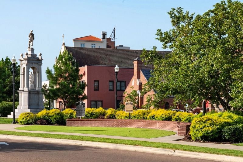
Photographed by Mansfieldphoto.com, July 19, 2026
2. Freeman-Custis Red River Expedition Marker

Regionally, this marker is in the American South, specifically in the Deep South, and in the Piney Woods. Globally, it is in North America, a Gulf of Mexico state, the Western Hemisphere, the Western World, and the Anglosphere. Historically, it finds itself in what was once New Spain, the Republic of Texas, one of the Confederate States of America, and the Antebellum South.
Other nearby markers. At least 8 other markers are within walking distance of this marker: The French in Texas (here, next to this marker); Wavell's Colony (a few steps from this marker); Confederate Mothers Monument (a few steps from this marker); St. James Episcopal Church (within shouting distance of this marker); John F. Kennedy (within shouting distance of this marker); United States Post Office and Courthouse (within shouting distance of this marker); Texarkana World War I Memorial (about 300 feet away, measured in a direct line); “Ace of Clubs” House (about 400 feet away). Touch for a list and map of all markers in Texarkana.
More about this marker. The marker was officially dedicated in Texarkana, Texas, on May 15, 2026. It was the first known historical marker honoring the Freeman–Custis Red River Expedition.
Credits. This page was last revised on August 17, 2026. It was originally submitted on August 15, 2026, by James Hulse of Medina, Texas. This page has been viewed 22 times since then. Photos: 1. submitted on August 15, 2026, by James Hulse of Medina, Texas. 2. submitted on August 17, 2026, by James Hulse of Medina, Texas.
