Near Chatham-Kent, Ontario — Central Canada (North America)
Skirmish at McCrae's House
⎯⎯⎯
Escarmouche a la Maison de McCrae

Photographed by Dale K. Benington, July 23, 2013
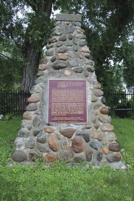
1. Skirmish at McCrae's House Marker
A close-up view of the text on the historical marker.

Skirmish at McCrae's House
Following the defeat of the British at the Battle of the Thames on October 5, 1813, American forces controlled the Thames Valley west of Moraviantown. In early December a detachment of 3 officers and 36 men of the American 26th Regiment established a post near here at the house of Thomas McCrae. Before daybreak on December 15, 1813, they were surprised by Lieutenant Henry Medcalf and 32 members from the Norfolk and Middlesex Militia, the Kent Volunteers and the Provincial Dragoons. After a brief resistance the Americans surrendered and were taken prisoner.
Après la défaite des Britanniques à la bataille de la Thames le 5 octobre 1813, les Américains dominaient la vallée à l'ouest de Moraviantown. Au début de décembre, trois officiers et 36 soldats du 26e régiment américain établirent un poste non loin d'ici, dans la maison de Thomas McCrae. Avant l'aube, le 15 décembre, ils furent surpris par le lieutenant Henry Medcalf qui commandait 32 miliciens du Norfolk and Middlesex, des Kent Volunteers et des Provincial Dragoons. Après une brève
this page online
Erected by Historic Sites and Monuments Board of Canada.
Topics and series. This historical marker is listed in this topic list: War of 1812. In addition, it is included in the Canada, Historic Sites and Monuments Board series list. A significant historical date for this entry is October 5, 1812.
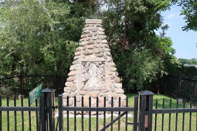
Location. Marker is missing. It was located near 42° 22.909′ N, 82° 15.001′ W. Marker was near Chatham-Kent, Ontario. It was on Riverview Line (County Route 36) 2 kilometers west of Bloomfield Road, on the left when traveling east. The plaque and cairn are 12 miles Northwest of the road, in small fenced area beside a road-side parking area for westbound traffic. Touch for map. Marker was at or near this postal address: 7391 Riverview Line, Chatham-Kent ON N7M 5T1, Canada. Touch for directions.

Regionally, this marker was in the Southwest Ontario Area and in Southwestern Ontario. It was also in Central Canada. Globally, it was in North America, on the Great Lakes, in the Western Hemisphere, in the Western World, and in the Anglosphere. Historically, it found
Photographed by Dale K. Benington, July 23, 2013
2. Skirmish at McCrae's House Marker
Other nearby markers. At least 8 other markers are within 6 kilometers of this location, measured as the crow flies: First Nations Encampment: Thomas McCrae Farm (a few steps from this marker); Skirmish at McCrae's House (a few steps from this marker); British Army River Crossing to Dolsen's Landing (approx. 1.9 kilometers away); Ronald & Hyslop Steamer (approx. 5.5 kilometers away); Ferguson Jenkins (approx. 5.5 kilometers away); William Chrysler (approx. 5.5 kilometers away); Carnegie Library (approx. 5.8 kilometers away); Casualties of the Skirmish / Les Pertes Survenues Lors de l'Escarmouche (approx. 6.1 kilometers away).
Photographed by Dale K. Benington, July 23, 2013
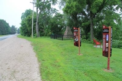
3. Skirmish at McCrae's House Marker
View looking west, along Riverview Line, of the featured historical marker along with two, related, additional markers.
Photographed by Dale K. Benington, July 23, 2013
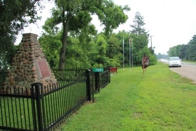
4. Skirmish at McCrae's House Marker
View looking east, along Riverview Line, of the featured historical marker along with two, related, additional markers.
Photographed by Dale K. Benington, July 23, 2013
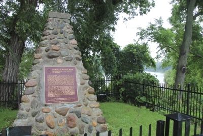
5. Skirmish at McCrae's House Marker
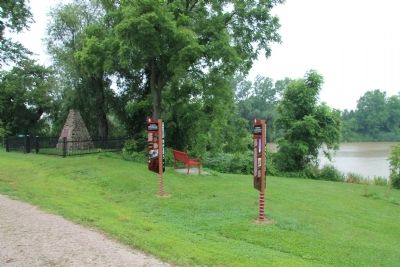
View of the historical marker, in the foreground, with a view of the Thames River (as seen through the nearby trees) in the distant background.
Photographed by Dale K. Benington, July 23, 2013
6. Skirmish at McCrae's House Marker
Another view of both the featured historical marker and the two related markers with the Thames River in the background.
Photographed by Dale K. Benington, July 23, 2013
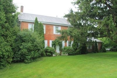
7. McCrae's House
View of the McCrae House, which is the first structure to the east of the historical marker.
Photographed by Trevor L Whited, August 8, 2026
8. Skirmish at McCrae's House / Escarmouche a la Maison de McCrae Marker
Marker is missing
Credits. This page was last revised on August 21, 2026. It was originally submitted on January 16, 2014, by Dale K. Benington of Toledo, Ohio. This page has been viewed 2,261 times since then and 196 times this year. Last updated on August 15, 2026, by Trevor L Whited of Kokomo, Indiana. Photos: 1, 2, 3, 4, 5, 6, 7. submitted on January 16, 2014, by Dale K. Benington of Toledo, Ohio. 8. submitted on August 15, 2026, by Trevor L Whited of Kokomo, Indiana. • Devry Becker Jones was the editor who published this page.
