Regierungsvierte in Berlin in Mitte, Germany — Northeast German Plain (The European Plain)
Wilhelmstraße 70
| — | Geschichtsmeile Wilhelmstraße | — |
Photographed by Andrew Ruppenstein, September 3, 2025
1. Wilhelmstraße 70 Marker

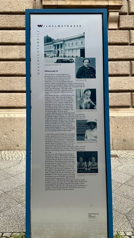
Neuer Besitzer des Palais wurde Fürst Hugo zu Hohenlohe von Ujest. 1884 richtete das Königreich Großbritannien hier seine Botschaft ein. Auf dem rückwärtigen Grundstück wurde wenig später das Hotel Adlon errichtet, in dessen Schatten die Britische Botschaft fortan stand. Das Gebäude, das Botschafter Sir Nevile Henderson als eng, dunkel und muffig beschrieb, war bis zum Abbruch der diplomatischen Beziehungen im September 1939 Sitz des Botschafters und seiner Kanzlei.
Im Zweiten Weltkrieg wurde das denkmalgeschützte Gebäude schwer beschädigt und 1950 abgerissen. In der DDR blieb das Gelände unbebaut. Es gehörte zum grenznahen Gebiet. Nach dem Fall der Mauer 1989 entschied die britische Regierung, ihre Botschaft wieder am historischen Standort zu errichten. Der Neubau des Londoner Architekten Michael Wilford wurde im Juli 2000 durch Königin Elisabeth II. eingeweiht. Das einzige erhaltene Zeugnis des früheren Botschaftsgebäudes, ein schmiedeeisernes, mit dem britischen Wappen versehenes Eingangstor, hat in der Botschaft einen Ehrenplatz erhalten.
this page online
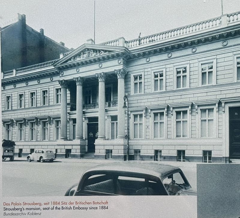
The next owner of the palace was Prince Hugo zu Hohenlohe von Ujest. In 1884 the British Embassy moved into the building. Not long after, Hotel Adlon was built at the back of the site, looming over the British Embassy. The Embassy building, described by Ambassador Sir Nevile Henderson in the 1930s as musty, cramped and dark, was the Ambassador's residence and office until Britain broke off diplomatic relations with Germany in September 1939. The embassy, a designated historic monument, was badly damaged in the Second World War and demolished in 1950. The site was part of the border area between East and West Berlin and remained vacant during the communist era. After the fall of the Berlin Wall in 1989 the British government decided to rebuild its embassy

Photographed by Andrew Ruppenstein, September 3, 2025
2. Wilhelmstraße 70 Marker - wide view
The marker is visible here in front of Wilhelmstraße 68, which has its own marker (visible a bit further down the street). The subject building, however, is not visible here as it is actually directly across the street from the marker.
Topics. This historical marker is listed in this topic list: Notable Buildings. A significant historical month for this entry is September 1939.
Location. 52° 30.941′ N, 13° 22.884′ E. Marker is in Berlin, in Mitte. It is in Regierungsvierte. It is on Wilhelmstraße, on the left when traveling south. Touch for map. Marker is at or near this postal address: Wilhelmstraße 60, Berlin 10117, Germany. Touch for directions.

Regionally, it is in Europe, the European Union, Atlantic Europe, Central Europe, the Schengen Area, Western Europe, and the Western World. Historically, it finds itself in what was once the Holy Roman Empire, the former East Germany, and at the Berlin Wall.
Other nearby markers. At least 8 other markers are within walking distance of this marker: Wilhelmstraße 68 (within shouting distance of this marker); Pariser Platz 5
courtesy Bundesarchiv Koblenz, September 3, 2025
3. Marker photo: Das Palais Strousberg
Credits. This page was last revised on August 16, 2026. It was originally submitted on August 16, 2026, by Andrew Ruppenstein of Lamorinda, California. This page has been viewed 11 times since then. Photos: 1, 2, 3. submitted on August 16, 2026, by Andrew Ruppenstein of Lamorinda, California.
