Butte in Silver Bow County, Montana — The American West (Mountains)
Montana Tech Campus
Butte Historical District

Photographed by Cosmos Mariner, July 6, 2024
1. Montana Tech Campus Marker
The Enabling Act of 1889 laid the foundation for the Montana School of Mines, providing for the first federal land grants for the establishment of mining schools. This landmark provision thus recognized the significance of mining industries to the newly admitted western states of Montana, North Dakota, South Dakota, and Washington. A commission appointed by Governor J. E. Rickards to investigate establishing such a school in Montana determined that the heart of Montana’s mining industry — Butte — would be the ideal location. At the foot of Big Butte, with its sweeping view of the surrounding area rich in mineral ores, the cornerstone of Main Hall was laid in the fall of 1896. Designed by Montana’s premier architect John C. Paulsen, the splendid Renaissance Revival style building was completed in 1897, but it presided over Butte unoccupied for lack of additional funds. Thanks to the generosity of local benefactors, the school finally opened to 39 students in 1900, and the first class graduated in 1903. During the next decades, architects George Carsley, C. S. Haire, Floyd Hamill, and Walter Arnold left their marks on the
this page online
Erected by Montana Historical Society.
Topics and series. This historical marker is listed in these topic lists: Architecture • Education. In addition, it is included in the Montana National Register Sign Program, and the National Register of Historic Places (NRHP) series lists. A significant historical year for this entry is 1896.
Location. 46° 0.75′ N, 112° 33.468′ W. Marker is in Butte, Montana, in Silver Bow County. It is at the intersection of West Park Street and Montana Tech Road, on the right when traveling west on West Park Street. The marker is beside the sidewalk near the southeast corner of the
Photographed by Cosmos Mariner, July 6, 2024
2. Montana Tech Campus Marker
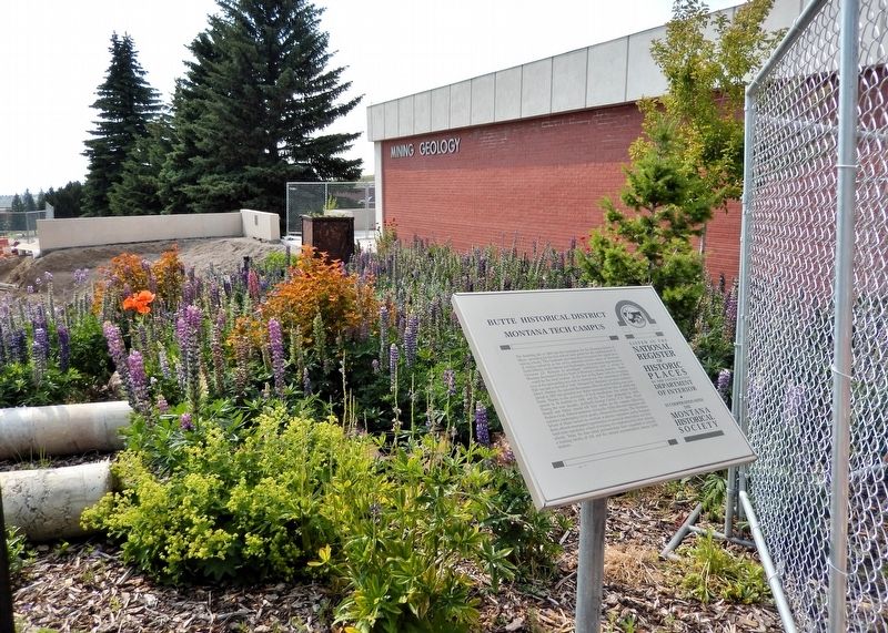
Looking west from Montana Tech Road. The Mining and Geology Building is in the background.

Regionally, this marker is in andspecifically outhwest Montana, in Gold West Country, in Mining Country. It is also in the American Mountain West and in the Lewis & Clark Corridor. Globally, it is in North America, the Rocky Mountains, the Western Hemisphere, the Western World, and the Anglosphere. Historically, it finds itself in what was once Rupert’s Land and also the Louisiana Purchase.
Other nearby markers. At least 8 other markers are within walking distance of this marker: History of the ’M’ (within shouting distance of this marker); Montana Tech Campus President's Residence (within shouting distance of this marker); Montana Tech Campus Gymnasium (about 300 feet away, measured in a direct line); Montana Tech Campus Residence Halls (about 300 feet away); Montana Tech Campus Engineering Building (about 400 feet away); Montana Tech Campus Mill Building (about 400 feet away); Montana Tech Campus Main Hall (about 500 feet away); Montana Tech Campus Library/Museum (about 700 feet away). Touch for a list and map of all markers in Butte.
Regarding Montana Tech Campus. The Montana Tech Campus is a contributing property in Butte–Anaconda Historic District, National Register of Historic Places № 66000438.
From the National Register Nomination prepared by Derek Strahn, 1/2006:
The Montana College of Mineral Science and Technology is a formal circa 1900 campus, located on the edge of Butte's west side. It overlooks the city of Butte from its perch on the ridge sloping down from Big Butte. The historic design of the campus is highly intact and is centered around substantial nineteenth-century brick buildings that date to the founding of the school. The campus with its stately buildings and mature trees can be seen from much of the city. Montana Tech, reflecting the primary role of industrial education in the NHL district, retains a high level of integrity within its historic core. A mature campus setting is well preserved, where courtyards, conifers and brick buildings create a contemplative atmosphere for study. The historic campus design and buildings form the center of and dominate the complex. They are a strong symbol of the abiding ties of this college to the advancement of deep mining, and its importance to the Butte-Anaconda Historic District.Montana Tech had its origins in the Enabling Act of 1889, and its provision of federal land grants to new states, for the purposes of establishing mining schools. Montana's legislature located the state's School of Mines in Butte, and the mining city enthusiastically supported the institution, donating land for the campus and coming to the school's aid financially during its early history. The first class graduated in 1903, launching its long tradition as one of the country's leading programs in mining engineering, with emphasis on mineral sciences and deep mining.
Also see . . . Montana Tech Campus (Story of Butte).
Includes aerial view of the Montana School of Mines, Butte, Montana, circa 1956, and photos of several of the historic campus buildings.(Submitted on August 18, 2026, by Cosmos Mariner of Cape Canaveral, Florida.)
Credits. This page was last revised on August 18, 2026. It was originally submitted on August 16, 2026, by Cosmos Mariner of Cape Canaveral, Florida. This page has been viewed 15 times since then. Photos: 1. submitted on August 17, 2026, by Cosmos Mariner of Cape Canaveral, Florida. 2. submitted on August 18, 2026, by Cosmos Mariner of Cape Canaveral, Florida.
