
Near Canton in Van Zandt County, Texas — The American South (West South Central)
Little Hope Baptist Church
Photographed by Jeff Leichsenring, September 7, 2026
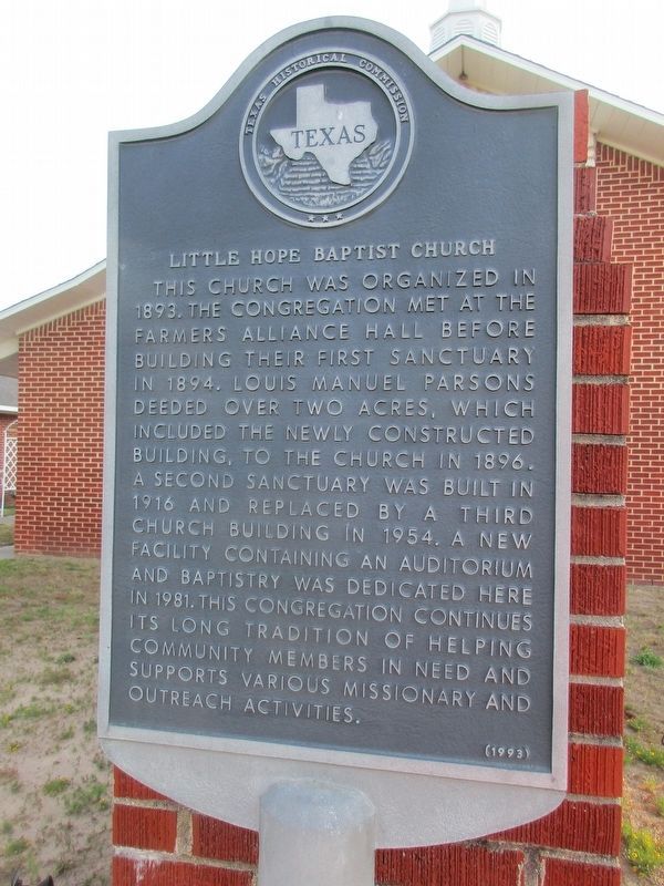
1. Little Hope Baptist Church Marker
This church was organized in 1893. The congregation met at the Farmers Alliance Hall before building their first sanctuary in 1894. Louis Manuel Parsons deeded over two acres, which included the newly constructed building, to the church in 1896. A second sanctuary was built in 1916 and replaced by a third church building in 1954. A new facility containing an auditorium and baptistry was dedicated here in 1981. This congregation continues its long tradition of helping community members in need and supports various missionary and outreach activities.
Erected 1993 by Texas Historical Commission. (Marker Number 11424.)
Topics. This historical marker is listed in this topic list: Religion & Religious Structures. A significant historical year for this entry is 1893.
Location. 32° 28.922′ N, 95° 47.794′ W. Marker is near Canton, Texas, in Van Zandt County. It is at the intersection of County Road 4106 and County Road 4112, on the right when traveling north on County Road 4106. Touch for map. Marker is at or near this postal address: 3257 Co Rd 4106, Canton TX 75103, United States of America. Touch for directions.

Regionally,
this page online
Other nearby markers. At least 8 other markers are within 5 miles of this marker, measured as the crow flies: Carter Cemetery (approx. 0.9 miles away); Mt. Pisgah Cemetery (approx. 2.4 miles away); Mt. Pisgah (approx. 2.4 miles away); Cox Cemetery (approx. 2.6 miles away); Holly Springs United Methodist Church (approx. 3.4 miles away); Holly Springs Cemetery (approx. 3½ miles away); Colfax Cemetery (approx. 4.1 miles away); Prairie Springs Cemetery (approx. 4.2 miles away). Touch for a list and map of all markers in Canton.

Photographed by Jeff Leichsenring, August 16, 2026
2. Little Hope Baptist Church and marker

Photographed by Jeff Leichsenring, August 16, 2026
3. Little Hope Baptist Church and marker
Credits. This page was last revised on September 12, 2026. It was originally submitted on August 16, 2026, by Jeff Leichsenring of Garland, Texas. This page has been viewed 15 times since then. Photos: 1. submitted on September 8, 2026, by Jeff Leichsenring of Garland, Texas. 2, 3. submitted on August 16, 2026, by Jeff Leichsenring of Garland, Texas. • James Hulse was the editor who published this page.
