East Olympia in Thurston County, Washington — The American West (Northwest)
Bell History
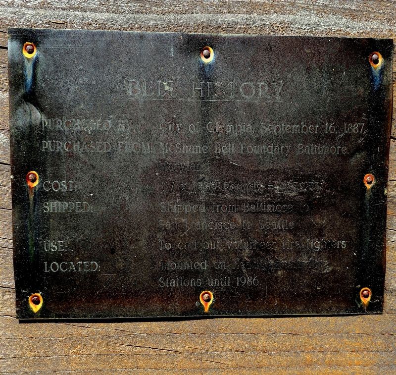
Purchased by: City of Olympia, September 16, 1887
Purchased from: McShane Bell Foundary [sic] Baltimore
Cost: 17 x 1509 pounds = $25,633
Shipped: from Baltimore to San Francisco to Seattle
Use: To call out volunteer fire fighters
Located: Mounted on Hea[illegible] Fire Stations until 1986.
Topics and series. This historical marker is listed in this topic list: Charity & Public Work. In addition, it is included in the Historic Bells series list. A significant historical date for this entry is September 16, 1887.
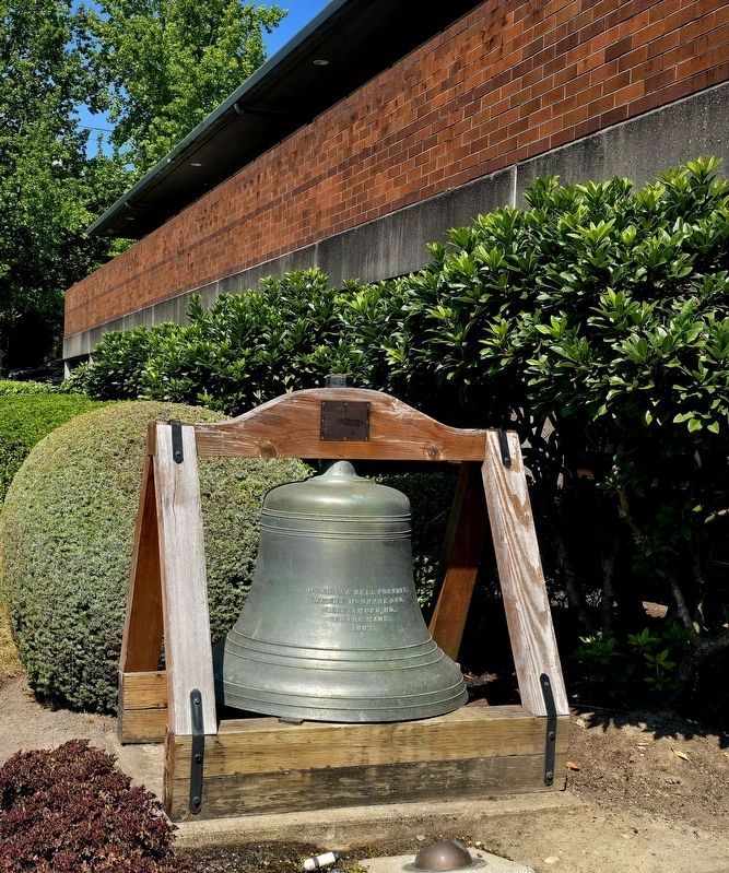
Location. 47° 2.772′ N, 122° 53.285′ W. Marker is in Olympia, Washington, in Thurston County. It is in East Olympia. It is at the intersection of Eastside Street NE and State Street, on the right when traveling north on Eastside Street NE. The bell and marker are located in front of Olympia Fire Department Station 1. Touch for map. Marker is at or near this postal address: 100 Eastside Street NE, Olympia WA, United States of America. Touch for directions.

Regionally, this marker is in Washington’s Colorado River Valley, specifically in Flagstaff & High Country, on the Mogollon Rim, in the Prescott Area, in Verde Valley, in the White Mountains, in The Valley (the San Fernando Valley), in the Inland Empire, in Silicon Valley, in the Coachella Valley, in the Colorado Desert, in the Gold Country, in the High Desert, in the Mojave Desert, in the San Bernardino Mountains, in the San Luis Valley, in the Berkshire Foothills, in the Connecticut River Valley, on the Connecticut Shoreline, on the Gold Coast, in Greater Bridgeport, in Greater Hartford, in Greater New Haven, in Greater New London, in the Knowledge Corridor, in the Litchfield Hills, in Mystic and the Eastern Shore, in the Quiet Corner, in the Thames River Valley, on Delawares Beaches, in Southern New Castle County, in the Everglades, on the Florida Keys, on Hilo and East Hawaii, on the Kona Coast, on North Shore Oahu, on Pearl Harbor and Historic West Oahu, in Upcountry Maui, in Lahaina and West Maui, on Windward Oahu, in the Quad Cities, on the Indiana Dunes and Lake Michigan Shore, in the Calumet Region, in the Spirit Lake Nation, in the Mandan, Hidatsa, and Arikara Nation, in the Turtle Mountain Band of Chippewa, on the Oglala Lakota Pine Ridge Reservation, in the Rosebud Sioux Tribe, in the Standing Rock Sioux Tribe, on the Cheyenne River Reservation, in the Crow Creek Sioux Tribe, on the Coeur d'Alene Reservation, in the Lower Brule Sioux Tribe, on the Kootenai Reservation, in the Sisseton-Wahpeton Oyate, on the Wind River Indian Reservation, on the ShoshonePaiute Duck Valley Reservation, on the Southern Ute Indian Reservation, in the Yankton Sioux Tribe, in the Navajo Nation, on the Shoshone-Bannock Fort Hall Reservation, on the Ute Mountain Ute Indian Reservation, on Nez Perce Tribal Land, in the Blackfeet Nation, in the Crow Nation, in the Flathead Nation, in the Fort Belknap Indian Reservation, on the Fort Peck Indian Reservation, in the Northern Cheyenne Nation, on the Rocky Boys Reservation, in the Tohono Oodham Nation, in the White Mountain Apache Nation, in the Yavapai-Apache Nation, in the Amana Colonies, on Mount Desert Island, in the Kennebec Valley, in the Maine Highlands, in Midcoast Maine, on Penobscot Bay, on Southern Maine Coast, in the Western Maine Lakes and Mountains Region, in Greater Bangor, in Greater Portland, in the Baltimore Metro Region, in Central Maryland, in Historic Boston, on Cape Ann, on the North Shore, in the South Coast, on the South Shore, in Greater Boston, on the Straits of Mackinac, on the Boundary Waters Canoe Area Wilderness, in Greater Duluth The Twin Ports, in Greater Billings, in the Lakes Region, in the Merrimack Valley, in North Jersey, in Central Jersey, on the Jersey Shore, in the Pine Barrens, in Piedmont Triad, on the Cape Fear Coast, on the Crystal Coast, in Greater Asheville, in Greater Charlotte, on the Outer Banks, in the Research Triangle, on the Oregon Coast, in the Blackstone Valley, in Greater Providence, on Narragansett Bay, in Newport and Aquidneck Island, in Historic Charleston, on the Grand Strand, on the Sea Islands, on Waccamaw Neck, in the Ashepoo, Combahee and Edisto Basin, in the Foothills, in Congaree Country, in Greater Burlington, in the Puget Sound Region, in Greater Seattle, in the Mid-Ohio Valley and in the Jackson Hole Area. It is also on the American Pacific Coast, in the Pacific Northwest, in the Ohio River Valley, on the Colorado Plateau, in the Black Hills, in the Lewis & Clark Corridor, in the Chesapeake Bay Region, and on the Eastern Seaboard. Globally, it is in the North Atlantic Region, in North America, in the Inside Passage, in the Great North Woods, on the Ring of Fire, in the Pacific Rim, in the Western Hemisphere, in the Western World, and in the Anglosphere. Historically, it finds itself in what was once Fairfield County, Hartford County, Litchfield County, Middlesex County, New Haven County, New London County, Tolland County, Windham County, the Viceroyalty of New France, and Acadia.
Other nearby markers. At least 8 other markers are within walking distance of this marker: Early Olympia Fire Department (approx. 0.2 miles away); Masonic Lodge 1854-1971, (approx. Ό mile away); Daniel R. Bigelow House (1854) (approx. Ό mile away); Susan B. Anthony Visits Bigelow House (approx. Ό mile away); Historic Bigelow House (approx. 0.3 miles away); Howard Point - An Olympia Black History Landmark (approx. 0.3 miles away); Billy the man (approx. 0.4 miles away); 1903 Washington State Legislative Meeting Site (approx. half a mile away). Touch for a list and map of all markers in Olympia.
Credits. This page was last revised on August 28, 2026. It was originally submitted on August 18, 2026, by Shirley A Stirling of Lacey, Washington. This page has been viewed 14 times since then. Photos: 1. submitted on August 18, 2026, by Shirley A Stirling of Lacey, Washington. 2. submitted on August 28, 2026, by Shirley A Stirling of Lacey, Washington. • Andrew Ruppenstein was the editor who published this page.

