Stadsdriehoek in Rotterdam, South Holland, Netherlands — Northwestern Europe
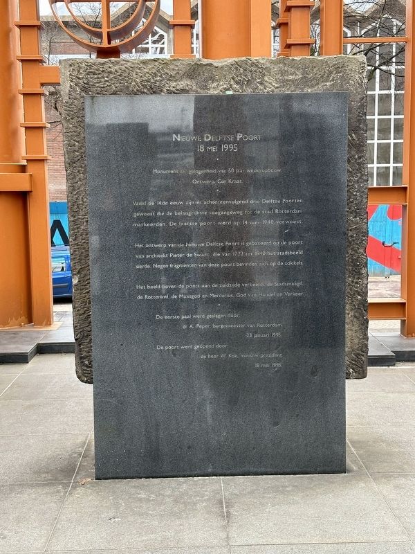
Nieuwe Delftse Poort
⎯⎯⎯
New Delft Gate
Photographed by Andrew Ruppenstein, March 21, 2024
1. Nieuwe Delftse Poort / New Delft Gate Marker

18 mei 1995
Monument ter gelegenheid, van 50 jaar wederopbouw.
Ontwerp: Cor Kraat
Vanaf de 14de eeuw zijn er achtereenvolgend drie Delftse Poorten geweest die de belangrijkste toegangsweg tot de stad Rotterdam markeerden. De laatste poort werd op 14 me 1940 verwoest.
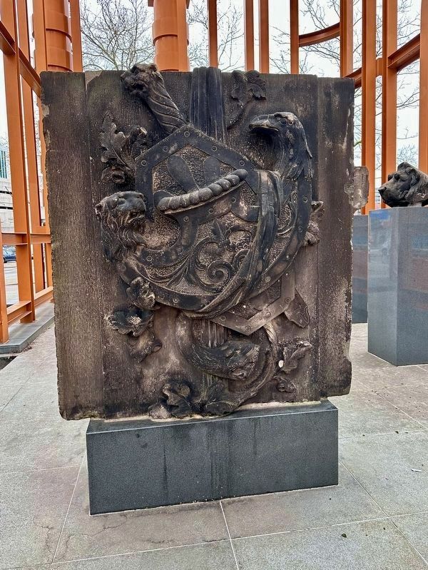
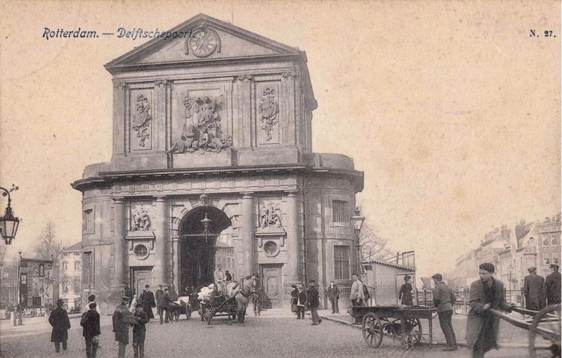
Het ontwerp van de Nieuwe Delftse Poort is gebaseerd op de poort van architekt Pieter de Swart, die van 1772 tot 1940 het stadsbeeld sierde. Negen fragmenten van deze poort bevinden zich op de sokkels.
Het beeld boven de poort aan de zuidzijde verbeeldt de Stadsmaagd; de Rottenimf, de Maasgod en Mercurius, God van Handel en Verkeer.
De eerste paal werd geslagen door:
dr A. Peper, burgemeester van Rotterdam
23 januari 1995.
De poort werd geopend door:
de heer W. Kok, minister-president
18 mei 1995.
New Delft Gate
18 May 1995
A monument marking 50 years of reconstruction.
Design: Cor Kraat
Since the 14th century, there have been three successive Delft Gates marking the main entrance to the city of Rotterdam. The last gate was destroyed on 14 May 1940.
The
this page online
The sculpture above the gate on the south side depicts the City Maiden, the Rotte Nymph, the God of the Maas, and Mercury, the God of Trade and Transport.
The first pile was driven by:
Dr. A. Peper, Mayor of Rotterdam
23 January 1995.
The gate was opened by:
Mr. W. Kok, Prime Minister
18 May 1995.
Topics. This historical marker is listed in these topic lists: Industry & Commerce • War, World II. A significant historical date for this entry is May 14, 1940.
Location. 51° 55.476′ N, 4° 28.818′ E. Marker is in Rotterdam, Zuid-Holland (South Holland). It is in Stadsdriehoek. It is at the intersection of Haagseveer and Pompenburg, on the right when traveling north on Haagseveer. Touch for map. Marker is at or near this postal address: Haagseveer 7, Rotterdam, Zuid-Holland 3011 AW, Netherlands. Touch for directions.

Regionally, it is in Europe, the European Union, Atlantic Europe, the Benelux Low Countries, the Schengen Area, Western
Photographed by Andrew Ruppenstein, March 21, 2024
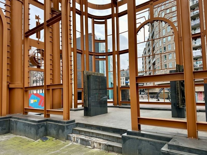
2. Nieuwe Delftse Poort / New Delft Gate Marker - wide view
The marker is located within the Poort and is not really visible from the street.
Other nearby markers. At least 8 other markers are within walking distance of this marker: Verzetskruis Herdenkingsmonument / Resistance Cross Memorial (about 120 meters away, measured in a direct line); March 12, 1945 Hofplein Execution Memorial (about 150 meters away); Monument Voor Joodse Oorlogslachtoffers / Jewish War Victims Memorial (about 180 meters away); Helmersstraat (approx. 0.4 kilometers away); Coolsingelpoort / Coolsingel Gate (approx. 0.6 kilometers away); Rosetta Sobering-Brandel (approx. 0.8 kilometers away); Wijkpark / Neighborhood Park - de Reus van Rotterdam / the Giant of Rotterdam (approx. 0.8 kilometers away); Monument voor Britse Vliegers / Memorial for British Airmen (approx. 0.8 kilometers away). Touch for a list and map of all markers in Rotterdam.
Also see . . .
1. The Delftse Poort (Atlas Obscura). (Submitted on August 19, 2026.)
2. Delftsche Poort (stadspoort) (Wikipedia, in Dutch). Excerpt (in translation):
The Delftsche Poort in Rotterdam was(Submitted on August 19, 2026.)a city gate; the final version was built in 1764 based on a design by architect Pieter de Swart. The stone ornaments on the gate were crafted by Jacob Mattheus Cressant and Johannes Keerbergen. It was actually the third gate to stand on that site; the previous two had been demolished due to dilapidation. The first gate, built in the Middle Ages, was named the Noorderpoort (North Gate) and included an outer gate. The second gate—known as the St. Joris Gate or Delftsche Poort—was built in 1545.Photographed by Andrew Ruppenstein, March 21, 20243. Nieuwe Delftse Poort / New Delft Gate
By the 1930s, the gate was obstructing traffic; Rotterdam sought to improve the flow of the city's increasing traffic. It was decided to relocate the gate by about one hundred meters, as demolishing it entirely met with too much opposition. Work on moving the structure began in 1939. The base structure was completed in 1940, but both this section and the stored sculptures were damaged during the bombing of the city. A year later, the decision was made that, "in the view of the majority of experts consulted, the gate could no longer be completed and had to be removed entirely." A few decorative elements were salvaged.
Photographed by Andrew Ruppenstein, March 21, 2024
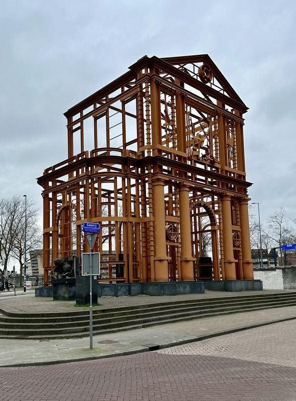
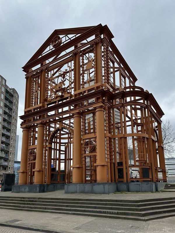
4. Nieuwe Delftse Poort / New Delft Gate
Photographed by Andrew Ruppenstein, March 21, 2024
5. Fragment of former gate (mentioned on the marker)
Although difficult to say for sure, this fragment seemingly matches the figure on the upper right part of the gate in the the next photo.
circa 1900
6. Delftse Poort / Delft Gate
Credits. This page was last revised on August 19, 2026. It was originally submitted on August 19, 2026, by Andrew Ruppenstein of Lamorinda, California. This page has been viewed 19 times since then. Photos: 1, 2, 3, 4, 5, 6. submitted on August 19, 2026, by Andrew Ruppenstein of Lamorinda, California.
