Noordereiland in Rotterdam, South Holland, Netherlands — Northwestern Europe
De Willemsbrug
⎯⎯⎯
“Willems Bridge”
Photographed by Andrew Ruppenstein, March 20, 2024
1. De Willemsbrug / Willems Bridge Marker

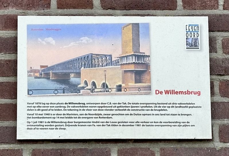
Vanaf 1878 lag op deze plaats de Willemsbrug, ontworpen door C.B. van der Tak. De totale overspanning bestond uit drie vakwerkdelen met op elke oever een aanbrug. De vakwerkdelen waren opgebouwd uit geklonken ijzeren I-profielen. Uit de vier op dit landhoofd geplaatste delen is dit goed af te leiden. De tekening in de vloer van deze vlonder verbeeldt de constructie van de brugdelen.
Vanaf 10 mei 1940 is er door de Mariniers, aan de Noordzijde, zwaar gevochten om de Duitse opmars in ons land tot staan te brengen. Het bombardement op 14 mei leidde tot de overgave van Rotterdam.
Op 1 juli 1981 is de Willemsbrug door burgemeester André van der Louw gesloten voor alle verkeer en kon de voorbereiding van de ontmanteling worden gestart. Drijvende kranen van Fa. van der Tak tilden in december 1981 de laatste overspanning van zijn pijlers om deze af te voeren naar de sloop.
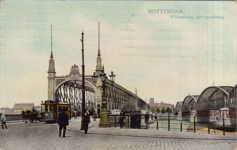
From 1878, the Willemsbrug — designed by C.B. van der Tak — stood at this location. The total span consisted of three truss sections, with an approach span on each bank. The truss sections were
this page online
Starting on May 10, 1940, Dutch Marines fought fiercely on the north side to halt the German advance into the country. The bombing raid on May 14 led to the surrender of Rotterdam.
On July 1, 1981, Mayor André van der Louw closed the Willemsbrug to all traffic, allowing preparations for its dismantling to begin. In December 1981, floating cranes operated by the Van der Tak company lifted the final span off its piers to transport it for scrapping.
Topics. This historical marker is listed in these topic lists: Bridges & Viaducts • War, World II.
Location. 51° 54.884′ N, 4° 29.694′ E. Marker is in Rotterdam, Zuid-Holland (South Holland). It is in Noordereiland. It is on Maaskade, on the left when traveling north. Touch for map. Marker is at or near this postal address: Maaskade 74, Rotterdam, Zuid-Holland 3071 NJ, Netherlands. Touch for directions.

Regionally, it is in Europe, the
Photographed by Andrew Ruppenstein, March 20, 2024
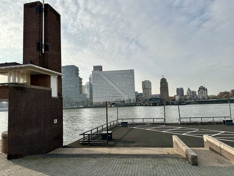
2. De Willemsbrug / “Willems Bridge” Marker - wide view
The marker is visible here mounted to the abutment on the left
Other nearby markers. At least 8 other markers are within walking distance of this marker: May 1940 War Memorial (approx. 0.3 kilometers away); Loods 24 / Warehouse 24 (approx. 0.6 kilometers away); a different marker also named Loods 24 / Warehouse 24 (approx. 0.7 kilometers away); Nationaal Monument Voor De Koopvardij / National Merchant Marine Memorial (approx. 0.8 kilometers away); Waalse kerk / Eglise Wallonne / Walloon Church (approx. one kilometer away); Coolsingelpoort / Coolsingel Gate (approx. 1.3 kilometers away); Monument Voor Joodse Oorlogslachtoffers / Jewish War Victims Memorial (approx. 1.4 kilometers away); Verzetskruis Herdenkingsmonument / Resistance Cross Memorial (approx. 1.4 kilometers away). Touch for a list and map of all markers in Rotterdam.
circa 1910
3. The Willemsbrug (with the railway bridge on the right)
Credits. This page was last revised on August 20, 2026. It was originally submitted on August 20, 2026, by Andrew Ruppenstein of Lamorinda, California. This page has been viewed 11 times since then. Photos: 1, 2, 3. submitted on August 20, 2026, by Andrew Ruppenstein of Lamorinda, California.
