Thorndale in Thames Centre in Middlesex County, Ontario — Central Canada (North America)
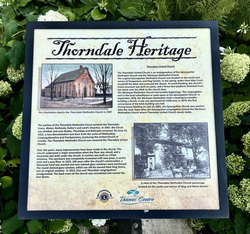
Thorndale United Church
| — | Thorndale Heritage | — |
Photographed by Tim Boyd, August 14, 2026
1. Thorndale United Church Marker
The original Episcopalian Methodist Church was located on the north-east corner of Temperance and King Streets. In the spring, water from Wye Creek would fill the ditch and surround the church. To avoid flooding, the church's frame structure was built on posts, and a three-foot platform stretched from the street over the ditch to the church door.
The Wesleyan Methodist Church had humble beginnings. The congregation met in the local schoolhouse or used space at the Episcopalian Church. In September 1878, the Wesleyan Methodists held a meeting to consider building a church. A site was purchased for $100 and, in 1879, the first cornerstone of the brick building was laid.
During heavy flooding on July 10, 1883, the Episcopalian Church was washed onto the road. Soon after, the Episcopalian congregation joined the Wesleyan Methodists Church where Thorndale United Church stands today.
The pastors of the Thorndale Methodist Circuit serviced the Thorndale, Evans, Wyton, Bethesda, Bailey's and Laird's Churches.
this page online
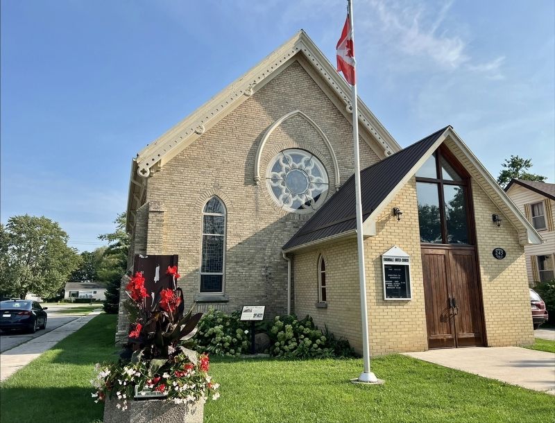
Over the years, many improvements have been made to the church. The church underwent a major renovation when the floor was raised, and a basement was built under the church. A narthex was built as a front entrance. The sanctuary was completely renovated with new pews, a centre aisle and a new floor. In 1979, 100 years after the church's construction, a Memorial Fund was started and new stained-glass windows were purchased. The round stained-glass window, which can still be viewed from King Street, was an original window. In 2023, Zion and Thorndale congregations amalgamated. The back room of the church was remodeled and named the Zion Room.
Erected by Municipality of Thames Centre.
Topics. This historical marker is listed in this topic list: Religion & Religious Structures. A significant historical year for this entry is 1878.
Location. 43° 6.253′ N,
Photographed by Tim Boyd, August 14, 2026
2. Thorndale United Church and Marker

Regionally, this marker is in the Southwest Ontario Area and in Southwestern Ontario. It is also in Central Canada. Globally, it is in North America, the Western Hemisphere, the Western World, and the Anglosphere. Historically, it finds itself in what was once a British colony, the Viceroyalty of New France, the Haudenosaunee (Iroquois) Confederacy, and Rupert’s Land.
Other nearby markers. At least 8 other markers are within 6 kilometers of this marker, measured as the crow flies: St. George’s-on-the-Wye Anglican Church (approx. 0.4 kilometers away); Caverhill House (approx. 6.1 kilometers away); Caverhill Stable (approx. 6.1 kilometers away); Lochaber Carriage Shed (approx. 6.1 kilometers away); Mount Moriah Masonic Lodge (approx. 6.2 kilometers away); Caverhill Woodworking Shop (approx. 6.2 kilometers away); Tavern Carriage Shed (approx. 6.2 kilometers away); Lochaber Church (approx. 6.2 kilometers away).
Credits. This page was last revised on August 21, 2026. It was originally submitted on August 20, 2026, by Tim Boyd of Hamilton, Ontario. This page has been viewed 13 times since then. Photos: 1, 2. submitted on August 20, 2026, by Tim Boyd of Hamilton, Ontario. • Andrew Ruppenstein was the editor who published this page.
