Keyser in Mineral County, West Virginia — The American South (Appalachia)
D-Day
June 6, 1944
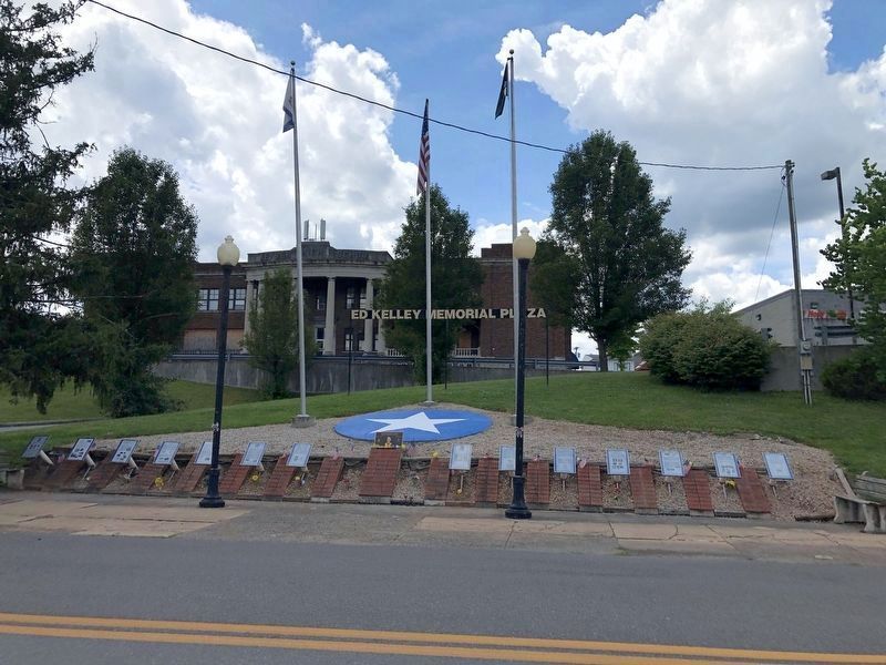
July 12, 2020
1. Ed Kelley Memorial Plaza
You will enter the Continent of Europe and…undertake operations aimed at the heart of Germany and the destruction of her armed forces.
Mission statement to General Eisenhower
The Germans had years to prepare for the coming invasion, so people knew it would be bloody — the main questions were where and when it would land. The obvious place to land a large invasion force on mainland Europe was Calais, France, where the English Channel is the most narrow. In fact, Calais was the focal point for an enormous allied diversion effort, one that confused the Germans and delayed their deploying reserves in time to defeat the real invasion. Other obvious ports, such as Le Havre and Cherbourg, France had become heavily defended German fortresses. The stage was set for the most dramatic invasion in history, the D-Day invasion on the Normandy Coast.
One town, Bedford, Virginia (about the size of Keyser) lost 21 of 35 men sent into battle that day with the 29th Infantry Division. On June 6, 2001, the National D-Day Memorial was opened at Bedford, with four symmetrically placed chords dividing the memorial plaza into five sections,
this page online
Ed Kelley answered with action "above and beyond" the call of duty.
Topics and series. This historical marker is listed in this topic list: War, World II. In addition, it is included in the Former U.S. Presidents: #34 Dwight D. Eisenhower series list. A significant historical date for this entry is June 6, 2001.
Location. This marker has been replaced by another marker nearby. It was located near 39° 26.382′ N, 78° 58.614′ W. Marker was in Keyser, West Virginia, in Mineral County. It was on West Piedmont Street (West Virginia Route 46) just west of North Davis Street, on the left when traveling west. Touch for map. Marker was at or near this postal address: 32 N Davis St, Keyser WV 26726, United States of America. Touch for directions.

Regionally, this marker was in the Eastern Panhandle. It was also in the American South, specifically
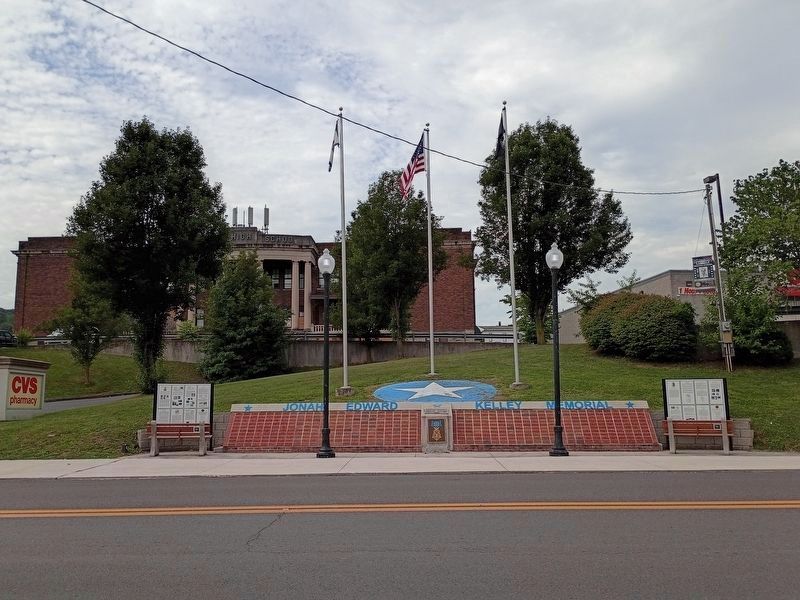
Photographed by Craig Doda, August 1, 2026
2. Ed Kelley Memorial Plaza
Other nearby markers. At least 3 other markers are within walking distance of this location: Jonah Edward Kelley (here, next to this marker); The Ed Kelley Memorial Plaza (here, next to this marker); a different marker also named The Medal of Honor (a few steps from this marker). Touch for a list and map of all markers in Keyser.
Other markers no longer nearby. World War II (was here, next to this marker but has been replaced with another marker now near it); Key Terrain (was here, next to this marker but has been replaced with another marker now near it); Kelley Memorial Plaza (was here, next to this marker but has been replaced with another marker now near it); The First Battle of Kesternich (was here, next to this marker but has been replaced with another marker now near it); The Battle of the Bulge (was here, next to this marker but has been replaced with another marker now near it); Regaining the Initiative (was here, next to this marker but has been replaced with another marker now near it); The Medal of Honor (was here, next to this marker but has been replaced with another marker now near it); The Battle for Kesternich (was here, next to this marker but has been replaced with another marker now near it); The Aftermath of Kesternich / Germans Retreat (was here, next to this marker but has been replaced with another marker now near it); The Bridge at Remagen (was a few steps from this marker but has been replaced with another marker now near it); a different marker also named The Bridge at Remagen (was a few steps from this marker but has been replaced with another marker now near it); a different marker also named The Bridge at Remagen (was a few steps from this marker but has been replaced with another marker now near it); Encircling the Nazi War Machine & German Capitulation (was a few steps from this marker but has been replaced with another marker now near it).
Credits. This page was last revised on August 21, 2026. It was originally submitted on July 14, 2020, by Devry Becker Jones of Washington, District of Columbia. This page has been viewed 302 times since then and 53 times this year. Last updated on August 20, 2026, by Carl Gordon Moore Jr. of North East, Maryland. Photos: 1. submitted on July 14, 2020. 2. submitted on August 12, 2026, by Craig Doda of Napoleon, Ohio.
Editor’s want-list for this marker. A close-up photo of the marker. • Can you help?
