
Richmond in Madison County, Kentucky — The American South (East South Central)
Eastern Kentucky Univ.
Photographed by Lee Hattabaugh, May 12, 2010
1. Eastern Kentucky Univ. Marker
(Front)
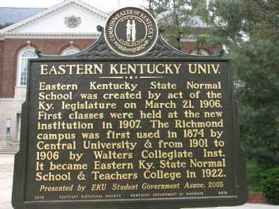
Eastern Kentucky State Normal School was created by act of the Ky. legislature on March 21, 1906. First classes were held at the new institution in 1907. The Richmond campus was first used in 1874 by Central University & from 1901 to 1906 by Walters Collegiate Inst. It became Eastern Ky. State Normal School & Teachers College in 1922.
Presented by EKU Student Government Assoc. 2005
(Reverse)
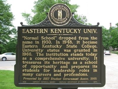
"Normal School" dropped from the name in 1930. In 1948, it became Eastern Kentucky State College. University status was granted in 1966. The institution stands today as a comprehensive university. It treasures its heritage as a school of opportunity and prepares its students for leadership roles in many careers and professions.
Presented by EKU Student Government Assoc. 2005
Erected 2008 by Kentucky Historical Society / Kentucky Department of Highways. (Marker Number 2276.)
Topics and series. This historical marker is listed in this topic list: Education. In addition, it is included in the Kentucky Historical Society series list. A significant historical month for this entry is March 1861.
Location. 37° 44.445′ N, 84° 18′ W. Marker
this page online

Regionally, this marker is in the American South, specifically in the Upper South, in Appalachia, and specifically in Southern Appalachia. Globally, it is in North America, the Western Hemisphere, the Western World, and the Anglosphere. Historically, it finds itself in what was once the territory of the Mississippian Culture and also the Antebellum South.
Other nearby markers. At least 8 other markers are within walking distance of this marker: In Memory Of The Confederate Soldiers (approx. half a mile away); In Memory Of The Fallen Union And Confederate Soldiers (approx. half a mile away); Battle of Richmond (approx. 0.6 miles away); Frances E. Beauchamp / Prohibition Advocate (approx. 0.6 miles away); County Named, 1786 / County Formed (approx. 0.6 miles away); Pioneer Monument
Photographed by Lee Hattabaugh, May 12, 2010
2. Eastern Kentucky Univ. Marker
Photographed by Lee Hattabaugh, May 12, 2010
3. Eastern Kentucky Univ. Marker
Credits. This page was last revised on January 4, 2020. It was originally submitted on May 19, 2010, by Lee Hattabaugh of Capshaw, Alabama. This page has been viewed 1,174 times since then and 44 times this year. Photos: 1, 2, 3. submitted on May 19, 2010, by Lee Hattabaugh of Capshaw, Alabama. • Bill Pfingsten was the editor who published this page.
