Near Megler in Pacific County, Washington — The American West (Northwest)
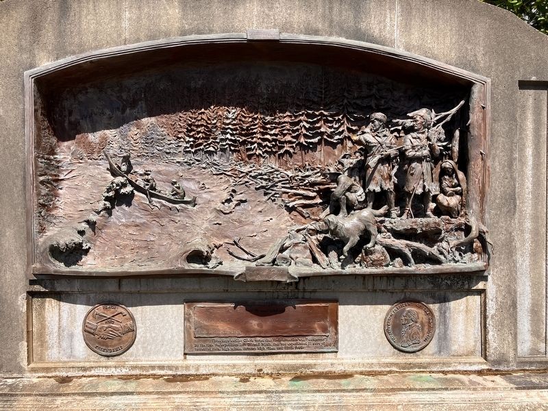
Lewis & Clark at Dismal Nitch
November 13, 1805
Photographed by Barry Swackhamer, June 10, 2026
1. Lewis & Clark at Dismal Nitch Marker
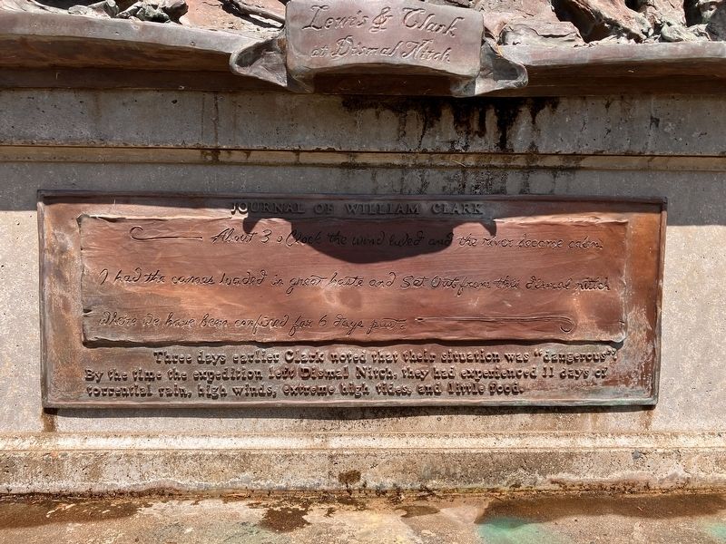
About 3 o’clock the Wind luled and the river became calm. I had the canoes loaded in great haste and set out from this dismal nitch. There We have been confined for 6 days past.
Three days earlier Clark noted that their situation was "dangerous". By the time the exertion left Dismal Nitch, they had experienced 11 day of torrential rain, high winds, extreme high tides, and little food.
Topics and series. This historical marker is listed in this topic list: Exploration. In addition, it is included in the Lewis & Clark Expedition series list. A significant historical date for this entry is November 13, 1805.
Location. 46° 14.931′ N, 123° 51.811′ W. Marker is near Megler, Washington, in Pacific County. It can be reached from Lewis and Clark Trail Highway (State Highway 401), on the right when traveling east. From the pull-out, take the trail west, next to the river . Touch for map. Marker is at or near this postal address: 229 Lewis and Clark Trail Hwy, Naselle WA 98638, United States of America. Touch for directions.

Regionally, this marker is in Southwest Washington State. It is also on the American
this page online
Other nearby markers. At least 8 other markers are within 3 miles of this marker, measured as the crow flies: Chief Skamokawa/"Great joy in camp" (here, next to this marker); Salmon Fortunes (about 600 feet away, measured in a direct line); Crossing the River (about 600 feet away); Dangerous Days in "Dismal Nitch" (approx. 0.2 miles away); St. Mary's Church (approx. 2.2 miles away); The Business of Trade (approx. 2.2 miles away); In Search of Recognition (approx. 2.2 miles away); How Do These Stories Continue? (approx. 2.2 miles away). Touch for a list and map of all markers in Megler.
Another marker is no longer nearby. Columbia River Explorers (was approx. 1.2 miles away but has been confirmed missing).
Photographed by Barry Swackhamer, June 10, 2026
2. Lewis & Clark at Dismal Nitch Marker
Photographed by Barry Swackhamer, June 10, 2026
3. Lewis & Clark at Dismal Nitch Marker
Credits. This page was last revised on August 22, 2026. It was originally submitted on August 22, 2026, by Barry Swackhamer of Brentwood, California. This page has been viewed 12 times since then. Photos: 1, 2, 3. submitted on August 22, 2026, by Barry Swackhamer of Brentwood, California.
