Big Bog State Recreation Area near Waskish in Beltrami County, Minnesota — The American Midwest (Upper Plains)
Fire in the Big Bog

Photographed by McGhiever, August 30, 2021
1. Fire in the Big Bog Marker
Several years of dry weather set the stage for the devastating fire of 1931
Prelude to Disaster
The bog's early settlers often set fires to burn trash or to clear land for planting. During dry spells, these fires created anxiety for fire rangers because, once ignited, dry peat soils can burn for months or years.
A series of dry years prior to 1931 resulted in many pet fires in the Big Bog area. The 1931 fire season began in March. By August, 5,000 acres had already burned, and fire rangers were on high alert. The many miles of dry lands were a tinder box awaiting a spark and small fires smoldered everywhere.
On September 11, 1931, 25-mile-per-hour winds were blowing before 8 a.m. Relative humidity fell and the winds picked up, reaching speeds of 60 miles per hour. By the end of the day, the deadly fire scorched 137,194 acres. Damages exceeded 1.7 million dollars.
Children Left Homeless by Fire, 1931
Remarkably few people died in the fire. Most settlers had enough warning to hunker down in ponds, creeks, or ditches.
Fire Map, 1931
1931 Losses in Lake of the Woods and Koochiching Counties
• 3
this page online
• many livestock
• 43 houses, leaving 150 homeless
• 22 miles of roads
• 18 bridges
• 1,024,000 acres (1,600 square miles)
Witness to the Fire
In 1931, Elizabeth Bachmann was secretary to Grover Conzet, the Director of the Division of State Forestry. Her personal account of the fire appeared in the Division's journal, The Smoke Screen, in October 1931.
Fire losses made difficult lives even more so. These men surveyed the scorched ruins of a car and trailer.
Ruined Fire Patrol Station, 1931
"… we passed long stretches of burned over country. We passed the spot where the Ludlow ranger station used to be. All that remains is the neat rock-bordered path which led to the cabin … We peered into the well in which a man [the fire tower watchman] had saved his life. It must have been a pretty tight squeeze."
"… at the Otto Palm place, we looked over the remains of their home. We picked up some lumps of glass which used to be windows before the heat melted them, and marbles that some little fellow had played with, all their gay colors baked into a dull gray … We just stood and looked around. No one said much."
"The cyclonic blast of fire caused the flames to leap as much as half a mile ahead of the main fire. Although it was seven miles from the village of Baudette, the window sills at the ranger station there were so hot they could not place their hands on them …"
Fire fighting in the Big Bog was a nasty, dirty job—even through it did pay fifteen cents an hour.
Special peat nozzles were used to fight fires in the bog.
Forest Service Shield, circa 1928
The
Photographed by McGhiever, August 30, 2021
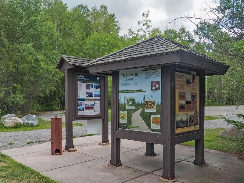
2. Fire in the Big Bog Marker (right) on the kiosks at the bog boardwalk parking lot
Erected by the Minnesota Department of Natural Resources.
Topics. This historical marker is listed in this topic list: Disasters. A significant historical date for this entry is September 11, 1931.
Location. 48° 17.151′ N, 94° 33.958′ W. Marker is near Waskish, Minnesota, in Beltrami County. It is in the Big Bog State Recreation Area. It is on the road to the Big Bog boardwalk west of Minnesota Highway 72. The marker is in the northern unit of Big Bog State Recreation Area (fee area), at the edge of the parking lot. Touch for map. Marker is in this post office area: Waskish MN 56685, United States of America. Touch for directions.

Regionally, this marker is in the Northland. It is also in the American Midwest and in the Corn Belt. Globally, it is in North America, the Great North Woods, the Western Hemisphere, the Western World, and the Anglosphere. Historically, it finds itself in what was once Rupert’s Land, the territory of the Mississippian Culture, the Louisiana Purchase, and the Northwest Territory.
Other nearby markers. At least 8 other markers are within 8 miles of this marker, measured as the crow flies: Ludlow Island History (about 300 feet away, measured in a direct line); The Big Bog's Caribou Band (approx. 0.4 miles away); The Bog That Couldn't Be Tamed (approx. 0.6 miles away); The Patterned Peatland: Rare and Valuable (approx. 0.9 miles away); Before the Big Bog: One Big Lake (approx. one mile away); The Old Waskish Town Site (approx. 8 miles away); Historic Waskish Hatchery 1941–1979 (approx. 8 miles away); Journey along the waters… (approx. 8 miles away). Touch for a list and map of all markers in Waskish.
Credits. This page was last revised on August 23, 2026. It was originally submitted on August 23, 2026, by McGhiever of Minneapolis, Minnesota. This page has been viewed 17 times since then. Photos: 1, 2. submitted on August 23, 2026, by McGhiever of Minneapolis, Minnesota.
