Portland in Louisville in Jefferson County, Kentucky — The American South (East South Central)
Fort-on-Shore
Photographed by Duane and Tracy Marsteller, November 27, 2020
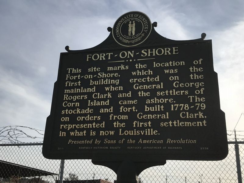
1. Fort-on-Shore Marker (Side A)
This site marks the location of Fort-on-Shore, which was the first building erected on the mainland when General George Rogers Clark and the settlers of Corn Island came ashore. The stockade and fort, built 1778-79 on orders from General Clark, represented the first settlement in what is now Louisville.
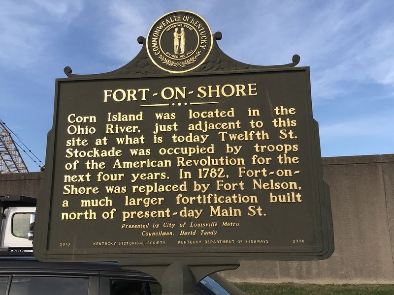
Corn Island was located in the Ohio River, just adjacent to this site at what is today Twelfth St. Stockade was occupied by troops of the American Revolution for the next four years. In 1782, Fort-on-Shore was replaced by Fort Nelson, a much larger fortification built north of present-day Main St.
Erected 2010 by Kentucky Historical Society and Kentucky Department of Highways; presented by the Sons of the American Revolution and the City of Louisville Metro Councilman, David Tandy. (Marker Number 2338.)
Topics and series. This historical marker is listed in these topic lists: Forts and Castles • War, US Revolutionary. In addition, it is included in the Kentucky Historical Society series list. A significant historical year for this entry is 1778.
Location. 38° 15.559′ N, 85° 46.149′ W. Marker is in Louisville,
this page online

Regionally, this marker is in the American South, specifically in the Upper South, and in the Ohio River Valley. Globally, it is in North America, the Western Hemisphere, the Western World, and the Anglosphere. Historically, it finds itself in what was once the territory of the Mississippian Culture and also the Antebellum South.
Other nearby markers. At least 8 other markers are within walking distance of this marker: “Bloody Monday” / American (Know-Nothing) Party (approx. 0.2 miles away); The 32nd Indiana Infantry Monument (approx. ¼ mile away); Louisville to Portland Turnpike (approx. 0.4 miles away); The Stockade On Corn Island, 1778 (approx. 0.4 miles away); Fort Nelson Park (approx. 0.4 miles away); Old Catholic High School (approx. half a mile away); Evan Williams (approx. half a mile away); 125 South Sixth Street (approx. half a mile away).
Photographed by Duane and Tracy Marsteller, November 27, 2020
2. Fort-on-Shore Marker (Side B)
Photographed by Duane and Tracy Marsteller, November 27, 2020
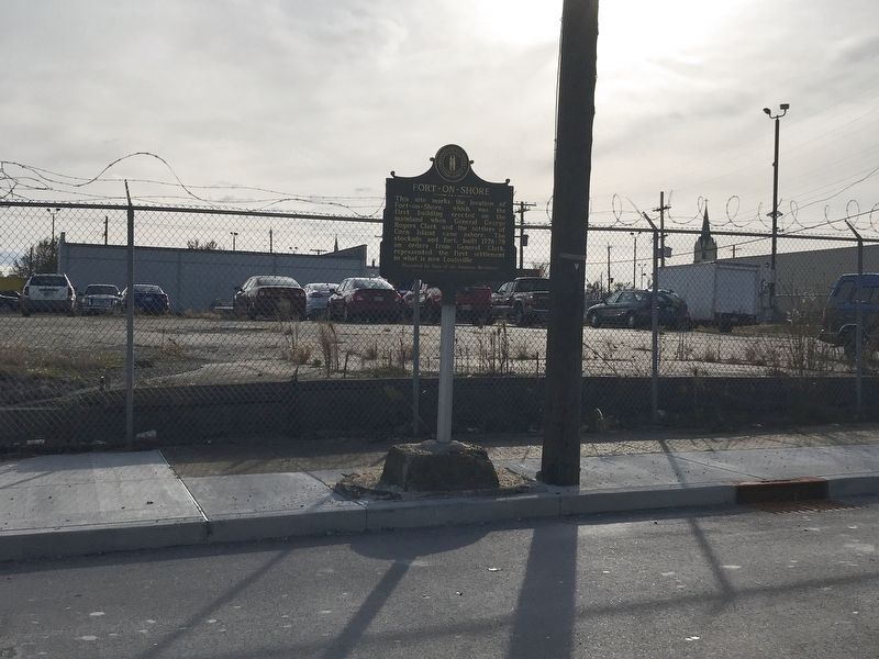
3. Fort-on-Shore Marker
Credits. This page was last revised on August 25, 2026. It was originally submitted on December 4, 2020, by Duane and Tracy Marsteller of Murfreesboro, Tennessee. This page has been viewed 1,151 times since then and 104 times this year. Last updated on August 23, 2026, by Chris Gerstle of Louisville, Kentucky. Photos: 1, 2, 3. submitted on December 4, 2020, by Duane and Tracy Marsteller of Murfreesboro, Tennessee. • Devry Becker Jones was the editor who published this page.
