Springfield in Clark County, Ohio — The American Midwest (Great Lakes)
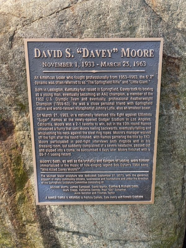
David S. "Davey" Moore
November 1, 1933 - March 25, 1963
Photographed by Craig Doda, August 8, 2026
1. David S. "Davey" Moore Marker
An American boxer who fought professionally from 1953-1963, the 5' 2" dynamo was often referred to as "The Springfield Rifle" and "Little Giant."
Born in Lexington, Kentucky but raised in Springfield, Davey took to boxing as a young man, eventually becoming an AAU champion, a member of the 1952 U.S. Olympic Team and eventually, professional Featherweight Champion (1959-63). He was a close personal friend with Springfield native and world-renown vibraphonist Johnny Lytle, also an amateur boxer.
On March 21, 1963, in a nationally televised title fight against Ultiminio "Sugar" Ramos at the newly-opened Dodger Stadium in Los Angeles, California, Moore was a 2-1 favorite to win, but in the 10th round Ramos unleashed a flurry that sent Moore reeling backwards, eventually falling and whiplashing his neck against the steel ring ropes Moore's manager waived off the fight after the round finished, with Ramos garnering the title by TKO. Moore participated in post-fight interviews both ringside and in his dressing room, but suddenly complained of a severe headache, passed out and slipped into a coma; he succumbed 4 days later.
this page online
Moore's death, as well as the brutality and dangers of boxing, were forever immortalized in the music of folk-singing legend Bob Dylan's 1964 song, "Who Killed Davey Moore?"
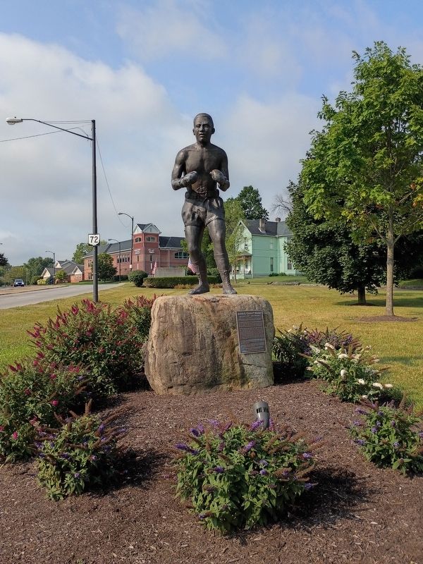
The Michael Major sculpture was dedicated September 21, 2013, with the generous support of many community citizens, businesses and foundations and under the direction of the Springfield Sculpture Committee consisting of:
Michael Morris, James Campbell, David Martin, Corine & Richard Smith, Mark Chepp, Katherine Denney, Paul "Ski" Schanher, Anne Benston and Thomas Taylor.
A special thanks is extended to Patricia Daniels, Dale Henry and Ronald Stephens.
Topics. This historical marker is listed in these topic lists: African Americans • Sports. A significant historical date for this entry is March 21, 1963.
Location. 39° 55.09′ N, 83° 48.521′ W. Marker is in Springfield, Ohio, in Clark County. It is at the intersection of South Limestone Street and East Clark Street, on the right when traveling south on South Limestone Street. Touch for map. Marker is at or near this postal address: 514 S Limestone St, Springfield OH
Photographed by Craig Doda, August 8, 2026
2. David S. "Davey" Moore Marker

Regionally, this marker is in the Dayton Metro and in the Miami Valley. It is also in the American Midwest and in the Corn Belt. Globally, it is in North America, the Western Hemisphere, the Western World, and the Anglosphere. Historically, it finds itself in what was once the Haudenosaunee (Iroquois) Confederacy, the territory of the Mississippian Culture, and the Northwest Territory.
Other nearby markers. At least 8 other markers are within walking distance of this marker: The Springfield Foundation Gateway Garden (within shouting distance of this marker); Thomas W. Burton, M.D. (about 600 feet away, measured in a direct line); Brooks Lawrence (about 800 feet away); Underground Railroad Discovery Walk (circa 1810-1865) (approx. 0.2 miles away); Discover the Journey (approx. 0.2 miles away); Discover the History (approx. 0.2 miles away); Discover the Hope (approx. 0.2 miles away); The George and Sarah Gammon House (approx. 0.2 miles away). Touch for a list and map of all markers in Springfield.
Credits. This page was last revised on August 26, 2026. It was originally submitted on August 23, 2026, by Craig Doda of Napoleon, Ohio. This page has been viewed 21 times since then. Photos: 1, 2. submitted on August 23, 2026, by Craig Doda of Napoleon, Ohio. • Devry Becker Jones was the editor who published this page.
