Bulltown in Braxton County, West Virginia — The American South (Appalachia)
Granary

Photographed by Craig Doda, August 2, 2026
1. Granary Marker
Notice that the corn crib is sided with narrow, diagonally attached boards with spaces between them to provide ventilation.
Topics. This historical marker is listed in this topic list: Architecture.
Location. 38° 47.562′ N, 80° 33.708′ W. Marker is in Bulltown, West Virginia, in Braxton County. It is at the intersection of Bulltown Campground Road and Millstone Run Road, on the right when traveling west on Bulltown Campground Road. Touch for map. Marker is at or near this postal address: 56 Bulltown Campground Road, Napier WV 26631, United States of America. Touch for directions.

Regionally, this marker is in North Central West Virginia. It is also in the American South, specifically in the Upper South, in Appalachia, and specifically in Southern Appalachia. Globally, it is in North America, the Western Hemisphere, the
this page online
Other nearby markers. At least 8 other markers are within walking distance of this marker: West Virginia’s Early Transportation (within shouting distance of this marker); Family Life in Bulltown (within shouting distance of this marker); Spring House (within shouting distance of this marker); Early Industry (within shouting distance of this marker); Battle of Bulltown (within shouting distance of this marker); West Virginia’s “Bushwackers” (within shouting distance of this marker); Cunningham Farmstead (within shouting distance of this marker); Coal-and-Wood House (within shouting distance of this marker). Touch for a list and map of all markers in Bulltown.
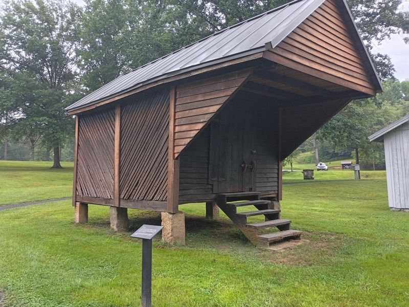
Photographed by Craig Doda, August 2, 2026
2. Granary
Credits. This page was last revised on August 26, 2026. It was originally submitted on August 24, 2026, by Craig Doda of Napoleon, Ohio. This page has been viewed 12 times since then. Photos: 1, 2. submitted on August 24, 2026, by Craig Doda of Napoleon, Ohio. • Andrew Ruppenstein was the editor who published this page.
