
Phelpston in Springwater in Simcoe County, Ontario — Central Canada (North America)
Simcoe County a Leader in Forestry
Photographed by Tim Boyd, August 21, 2026
1. Simcoe County a Leader in Forestry Marker
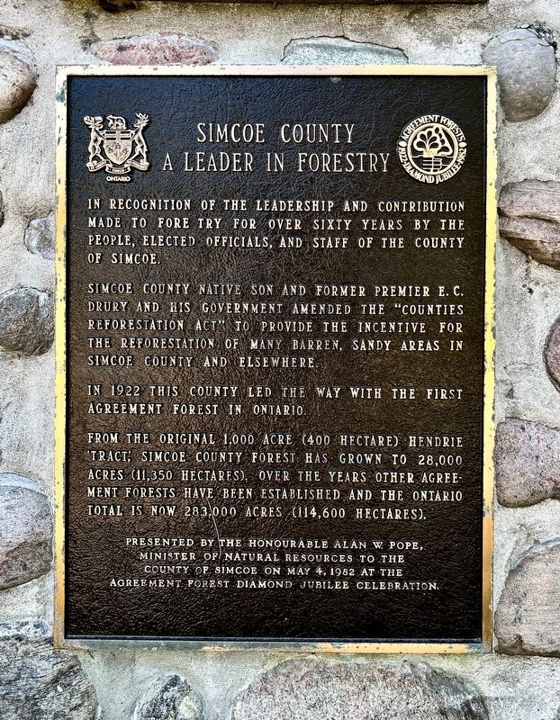
In recognition of the leadership and contribution made to forestry for over sixty years by the people, elected officials, and staff of the County of Simcoe.
Simcoe County native son and former premier E. C. Drury and his government amended the "Counties Reforestation Act” to provide the incentive for the reforestation of many barren, sandy areas in Simcoe County and elsewhere.
In 1922 this county led the way with the first agreement forest in Ontario.
From the original 1,000 acre (400 hectare) Hendrie Tract Simcoe County Forest has grown to 28,000 acres (11,350 hectares). Over the years other Agreement Forests have been established and the Ontario total is now 283,000 acres (114,600 hectares).
Presented by the Honourable Alan W. Pope, Minister of Natural Resources to the County of Simcoe on May 4, 1982 at the Agreement Forest Diamond Jubilee celebration.
Erected 1982 by Government of Ontario.
Topics. This historical marker is listed in this topic list: Horticulture & Forestry. A significant historical year for this entry is 1922.
Location. 44° 29.59′ N, 79° 48.342′ W. Marker is in Springwater,
this page online

Regionally, this marker is in Central Ontario Cottage Country and specifically in Georgian Bay Country. It is also in Central Canada. Globally, it is in North America, on the Great Lakes, in the Western Hemisphere, in the Western World, and in the Anglosphere. Historically, it finds itself in what was once a British colony, the Viceroyalty of New France, the Haudenosaunee (Iroquois) Confederacy, and Rupert’s Land.
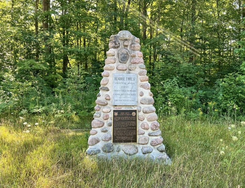
Other nearby markers. At least 8 other markers are within 11 kilometers of this marker, measured as the crow flies: Hendrie Forest (here, next to this marker); Glengarry Landing / Le débarquement du « Glengarry » (approx. 8.9 kilometers away); Edenvale Park (approx. 9 kilometers away); Officer's Cookhouse (approx. 10.9 kilometers away); Officer's Quarters/Commandant's House (approx. 10.9 kilometers away); Indigenous & Settlers' Gardens
Photographed by Tim Boyd, August 21, 2026
2. Simcoe County a Leader in Forestry Marker
Photographed by Tim Boyd, August 21, 2026
3. Simcoe County a Leader in Forestry Marker
Credits. This page was last revised on August 26, 2026. It was originally submitted on August 25, 2026, by Tim Boyd of Hamilton, Ontario. This page has been viewed 4 times since then. Photos: 1, 2, 3. submitted on August 25, 2026, by Tim Boyd of Hamilton, Ontario. • Andrew Ruppenstein was the editor who published this page.
