Tamworth in Staffordshire, England, United Kingdom — Northwestern Europe (the British Isles)
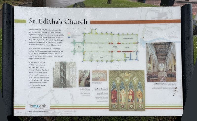
St Editha's Church
Photographed by Ray Gurganus, May 11, 2026
1. St Editha's Church Marker
After a period of Danish control Aethelflaed, Lady of the Mercians and daughter of Alfred the Great, rebuilt the burh defences in 913, and it may be she who rededicated the church to the Anglo-Saxon St. Editha.
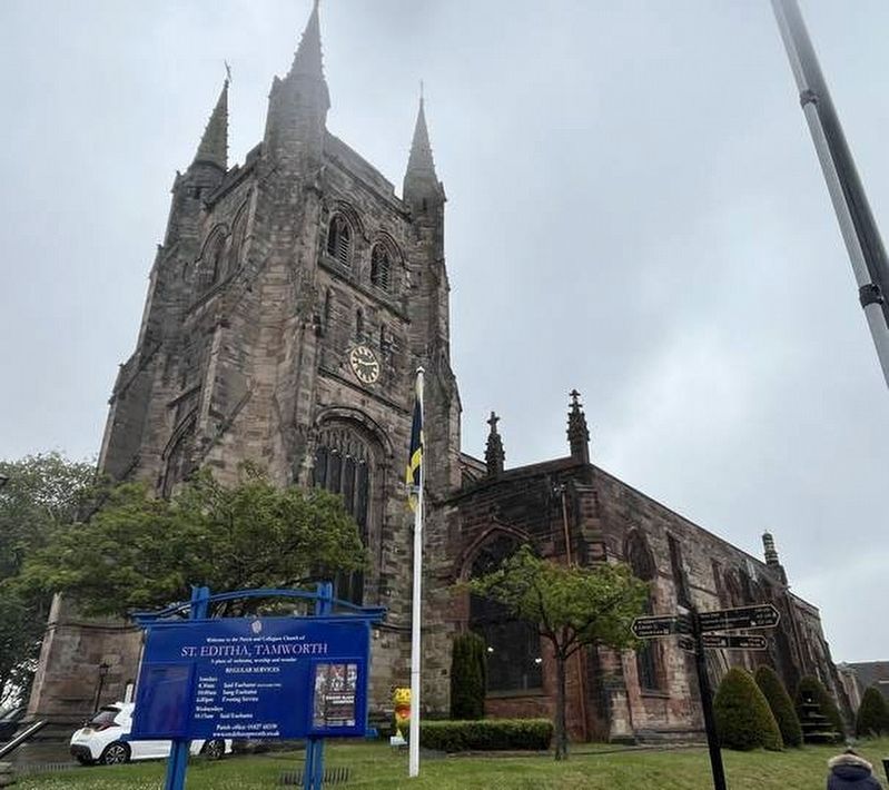
In the twelfth century. probably when Robert Marmion was Lord of Tamworth Castle, the church was substantially rebuilt with a cruciform plan and a large central crossing tower with two impressive arches. Tamworth has witnessed 1200 years of ongoing Christian worship.
Erected by Tamworth Borough Council.
Topics. This historical marker is listed in this topic list: Religion & Religious Structures.
Location. 52° 38.043′ N, 1° 41.692′ W. Marker is in Tamworth, England, in Staffordshire. It is at the intersection of St Editha‘s Close and Church
this page online

Regionally, this marker is in the Midlands. Globally, it is on the Atlantic Ocean, in the North Atlantic Region, in Europe, in Atlantic Europe, on one of the British Isles, in the Western World, and in the Anglosphere. Historically, it finds itself in what was once the Roman Empire.
Other nearby markers. At least 6 other markers are within 23 kilometers of this marker, measured as the crow flies: Aethelflaed (approx. half a kilometer away); Theatres and Thespians (approx. 10.4 kilometers away); Edward Wightman Memorial (approx. 10.5 kilometers away); Promenades and Pleasure Gardens (approx. 10.8 kilometers away); Commander Edward John Smith RD RNR (1850-1912) (approx. 10.8 kilometers away); Vice Admiral Horatio Nelson, 1st Viscount Nelson, KB (1758-1805) (approx. 22 kilometers away).
Photographed by Ray Gurganus, May 11, 2026
2. St Editha's Church
Credits. This page was last revised on August 26, 2026. It was originally submitted on August 26, 2026, by Ray Gurganus of Washington, District of Columbia. This page has been viewed 10 times since then. Photos: 1, 2. submitted on August 26, 2026, by Ray Gurganus of Washington, District of Columbia. • Andrew Ruppenstein was the editor who published this page.
