Great Malvern in Worcestershire, England, United Kingdom — Northwestern Europe (the British Isles)
Malvern's 19th Century Boom
| — | Great Malvern Route to the Hills | — |
Photographed by Ray Gurganus, May 13, 2026
1. Malvern's 19th Century Boom Marker
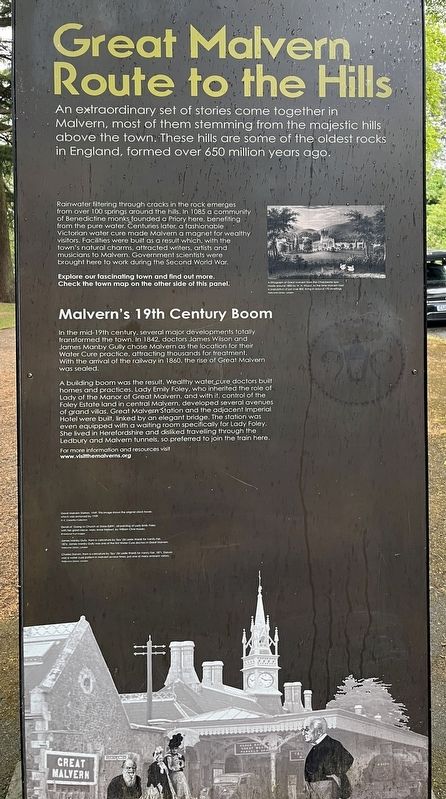
A building boom was the result, Wealthy water cure doctors built homes and practices. Lady Emily Foley, who inherited the role of Lady of the Manor of Great Malvern, and with it, control of the Foley Estate land in central Malvern, developed several avenues of grand villas. Great Malvern Station and the adjacent Imperial Hotel were built, linked by an elegant bridge. The station was even equipped with a waiting room specifically for Lady Foley. She lived in Herefordshire and disliked traveling through the Ledbury and Malvern tunnels, so preferred to join the train here.
Topics. This historical marker is listed in these topic lists: Industry & Commerce • Railroads & Streetcars. A significant historical year for this entry is 1842.
Location. 52° 6.6′ N, 2° 19.132′ W. Marker is in Great Malvern, England, in Worcestershire. It is at the intersection of Avenue Road and Imperial Road on Avenue Road. Touch for map. Marker is at or near this postal address: 20 Avenue Road, Great Malvern, England WR14 3AP, United Kingdom. Touch for directions.

Regionally, this marker is in the Midlands. Globally, it is on the Atlantic Ocean, in the North Atlantic Region, in Europe, in Atlantic Europe, on one of the British Isles, in the Western World, and in the Anglosphere. Historically, it finds itself in what was once the Roman Empire.
Other nearby markers. At least 8 other markers are within 11 kilometers of this marker, measured as the crow flies: The Edinburgh Dome (a few steps from this marker); Frieda Salvendy
this page online
Credits. This page was last revised on August 27, 2026. It was originally submitted on August 27, 2026, by Ray Gurganus of Washington, District of Columbia. This page has been viewed 9 times since then. Photo 1. submitted on August 27, 2026, by Ray Gurganus of Washington, District of Columbia. • Andrew Ruppenstein was the editor who published this page.
Editor’s want-list for this marker. photo of the marker within its surroundings • Can you help?
