Prince Rupert in North Coast, British Columbia — Canada’s West Coast (North America)
Charles Melville Hays
1856 - 1912
| — | "Founder of Our City" | — |
Photographed by Bradley Owen, August 14, 2026
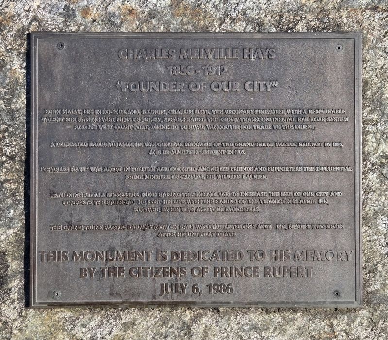
1. Charles Melville Hays Marker
Born 16 May, 1856 in Rock Island, Illinois, Charles Hays, the visionary promoter with a remarkable talent for raising vast sums of money, spear headed this great transcontinental railroad system and its west coast port, designed to rival Vancouver for trade to the Orient.
A dedicated railroad man, he was general manager of the Grand Trunk Pacific Railway in 1896, and became its president in 1905.
"Charles Hays" was adept in politics and counted among his friends and supporters the influential Prime Minister of Canada, Sir Wilfred Laurier.
Returning from a successful fund raising trip in England to increase the size of our city and complete the railroad, he lost his life with the sinking of the Titanic on 15 April 1912, survived by his wife and four daughters.
The Grand Trunk Pacific Railway (now CN rail) was completed on 7 April 1914, nearly two years after his untimbly death.
Erected 1986 by The Citizens of Prince Rupert, BC.
Topics and series. This historical marker is listed in these topic lists: Disasters • Industry & Commerce • Railroads & Streetcars • Settlements & Settlers.
this page online
Location. 54° 18.765′ N, 130° 19.505′ W. Marker is in Prince Rupert, British Columbia, in North Coast. It is on 3 Avenue West just south of 3 Street, on the right when traveling south. Touch for map. Marker is at or near this postal address: 424 3 Avenue West, Prince Rupert BC V8J 1L3, Canada. Touch for directions.

Regionally, this marker is in Northern BC. Globally, it is in North America, on the Ring of Fire, on the Pacific Rim, in the Western Hemisphere, in the Western World, and in the Anglosphere. Historically, it finds itself in what was once a British colony.
Other nearby markers. At least 8 other markers are within walking distance of this marker: Former Federal Building/City Hall (here, next to this marker); Anget Pole of Ninstints (here, next to this marker); Alder House Frontal Pole (a few steps from this marker); Pillsbury House (approx. 0.3 kilometers away); MacKenzie Furniture Ltd. (approx. 0.3 kilometers away); Mother Grey Whale and Calf (approx. 0.4 kilometers away); Kwinitsa Railway Museum (approx.
Photographed by Bill Coughlin, September 3, 2026
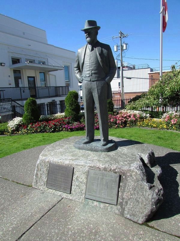
2. Charles Melville Hays
Photographed by Bradley Owen, August 14, 2026
3. Charles Melville Hays Marker
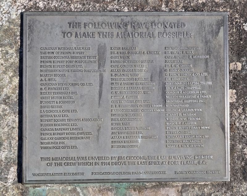
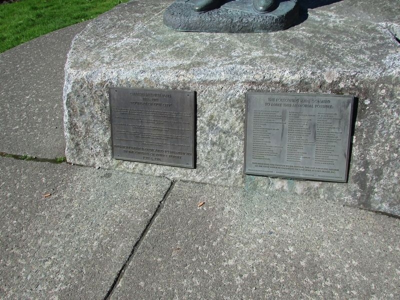
The marker is located on the left of the base. A donor plaque is on the right.
Photographed by Bradley Owen, August 14, 2026
4. Donor Plaque
This memorial was unveiled by Jim Ciccone, the last surviving member of the crew which in 1914 drove the last spike at Fort Fraser, B.C.
Photographed by Bill Coughlin, September 3, 2026
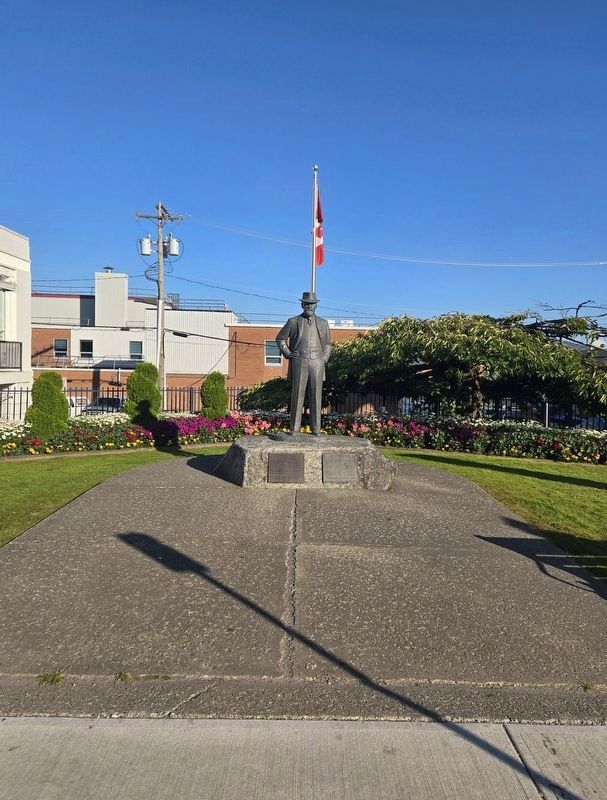
5. Charles Melville Hays Markers
Credits. This page was last revised on September 30, 2026. It was originally submitted on August 27, 2026, by Bradley Owen of Morgantown, West Virginia. This page has been viewed 16 times since then. Photos: 1. submitted on August 27, 2026, by Bradley Owen of Morgantown, West Virginia. 2. submitted on September 10, 2026, by Bill Coughlin of Woodland Park, New Jersey. 3, 4. submitted on August 27, 2026, by Bradley Owen of Morgantown, West Virginia. 5. submitted on September 10, 2026, by Bill Coughlin of Woodland Park, New Jersey.
