Near Vancouver in Clark County, Washington — The American West (Northwest)
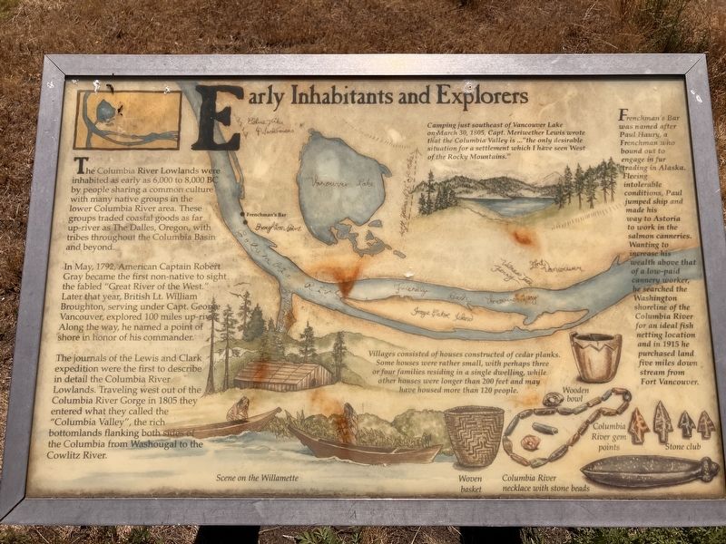
Early Inhabitants and Explorers
Photographed by Barry Swackhamer, June 11, 2026
1. Early Inhabitants and Explorers Marker
Illustrations: Scene on the Willamette, Woven basket, Columbia River necklace with stone beads, Wooden bowl, Columbia River gem points, Stone club.
In May, 1792, American Captain Robert Gray became the first non-native to sight the fabled "Great River of the West." Later that year British Lt. William Broughton, serving under Cap. George Vancouver, explored 100 miles up river. Along the way, he named a point of shore in honor of his commander.
The journals of the Lewis and Clark expedition were the first to describe in detail the Columbia River Lowlands. Traveling west out of the Columbia River Gorge in 1805 they entered what they called the "Columbia Valley", the rich bottomland flanking bot sides of the Columbia from Washougal to the Cowlitz River.
Camping just southeast of Vancouver Lake on March 30, 1805, Capt. Meriwether Lewis wrote that the Columbia Valley is..."the only desirable situation for a settlement which I have seen West of the Rocky Mountains.
Villages
this page online
Frenchman's Bar was named after Paul Haury, a Frenchman who bound out to engage in fur trading in Alaska. Fleeing intolerable conditions, Paul jumped ship and made his way to Astoria to work in the salmon canneries. Wanting to increase his wealth above that of a low-paid cannery worker, he searched the Washington shoreline of the Columbia River for an ideal fish netting location and in 1915 he purchased land five miles down stream from East Vancouver.
Topics and series. This historical marker is listed in this topic list: Exploration. In addition, it is included in the Lewis & Clark Expedition series list.
Location. 45° 40.654′ N, 122° 46.013′ W. Marker is near Vancouver, Washington, in Clark County. It is on Northwest Old Lower River Road near Northwest Lower River Road. The marker is located in Frenchman's Bar Regional Park. Touch for map. Touch for directions.

Regionally,
Photographed by Barry Swackhamer, June 11, 2026
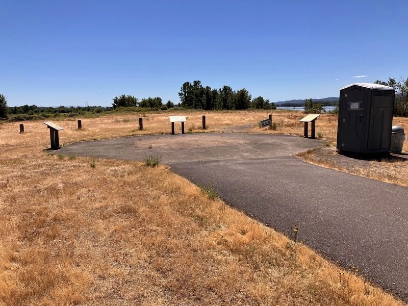
2. Early Inhabitants and Explorers Marker on the right
Other nearby markers. At least 8 other markers are within 6 miles of this marker, measured as the crow flies: Exploring the "Mult-no-mâh" (approx. 1.2 miles away); Fort William (approx. 4.9 miles away in Oregon); a different marker also named Fort William (approx. 4.9 miles away in Oregon); In Memory of the Pioneers of the Oregon Trail 1844 (approx. 5.1 miles away); Covington House (approx. 5.2 miles away); Clark County Courthouse (approx. 5.4 miles away); Esther Short (approx. 5.7 miles away); Captain George Vancouver Monument Plaza (approx. 5.9 miles away). Touch for a list and map of all markers in Vancouver.
Credits. This page was last revised on August 27, 2026. It was originally submitted on August 27, 2026, by Barry Swackhamer of Brentwood, California. This page has been viewed 13 times since then. Photos: 1, 2. submitted on August 27, 2026, by Barry Swackhamer of Brentwood, California.
