Chatham in Chatham-Kent, Ontario — Central Canada (North America)
Casualties of the Skirmish
Monday, October 4, 1813
⎯⎯⎯
Les Pertes Survenues Lors de l'Escarmouche
Le Lundi 4 Octubre 1813
| — | Tecumseh Parkway / La Route de Tecumseh | — |
Photographed by Dale K. Benington, July 23, 2013
1. Casualties of the Skirmish Marker
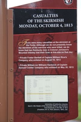
Close-up view, looking west, of the English text side of the historical marker.

There were many casualties at the skirmish at the Forks. Although we do not presently know the identities of the warriors who were killed, we do know that two Kentucky men in Colonel Johnson's Mounted Infantry lost their lives at this site on that day:
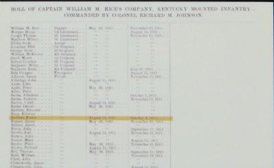
• Private Foster Bartlett of Captain William Rice's Company who enlisted on August 15, 1813.
• Private William (or Wilham) Hardwick of Captain Samuel Combs' company who enlisted on May 20, 1813.
Erected by Tecumseh Parkway.
Topics. This historical marker is listed in this topic list: War of 1812. A significant historical date for this entry is May 20, 1813.
Location. 42° 24.399′ N, 82° 11.068′ W. Marker is in Chatham, Ontario, in Chatham-Kent. It can be reached from the intersection of William Street North and Murray Street, on the left when traveling north. The historical marker is located in Chatham, at the point of "The Forks" of the Thames River, in Tecumseh Park, situated along a park walkway. Touch for map. Marker is at or near this postal address: 89 William Street North, Chatham ON N7M 1E2, Canada. Touch for directions.

Regionally, this marker is in the Southwest Ontario Area and in Southwestern Ontario. It is also in Central Canada. Globally, it is in North America, on the Great Lakes, in the Western Hemisphere, in the Western World, and in the Anglosphere. Historically, it finds itself in what was once a British colony, the Viceroyalty of New France, the Haudenosaunee (Iroquois) Confederacy, and Rupert’s Land.
Other nearby markers. At least 8 other markers are within walking distance of this marker: A different marker also named Skirmish at the Forks (here, next to this marker); The Forks (here, next to this marker); Tecumseh (within shouting distance of this marker); Chatham Blockhouse (within shouting distance
this page online
Other markers no longer nearby. Skirmish at the Forks (was here, next to this marker but has been confirmed missing); British Encampment: Forks of the Thames / Campement Britanique: Les Fourches De La Rivière Thames (was here, next to this marker but has been confirmed missing).
Photographed by Dale K. Benington, July 23, 2013
2. Casualties of the Skirmish Marker
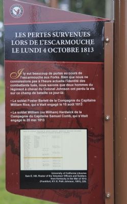
Close-up view, looking east, of the French text side of the historical marker.
Photographed by Dale K. Benington, July 23, 2013
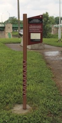
3. Casualties of the Skirmish Marker
Photographed by Dale K. Benington, July 23, 2013
4. Casualties of the Skirmish Marker
Close-up view of the "Roll of Captain William M. Rice's Company, Kentucky Mounted Infantry," that is displayed on the historical marker.
Photographed by Dale K. Benington, July 23, 2013
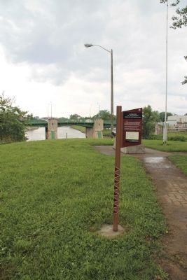
5. Casualties of the Skirmish Marker
View of the historical marker in the foreground, with a view of the "The Forks" of the Thames River in the background.
Photographed by Dale K. Benington, July 23, 2013
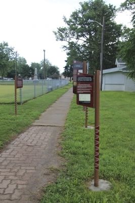
6. Casualties of the Skirmish Marker
View, looking east, of the historical marker, with a distant view of Tecumseh Park in the background.
Photographed by Dale K. Benington, July 23, 2013
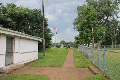
7. Casualties of the Skirmish Marker
View of the park walkway that leads to "The Forks" of the Thames River, where several Tecumseh Parkway historical markers are located.
Photographed by Dale K. Benington, July 23, 2013
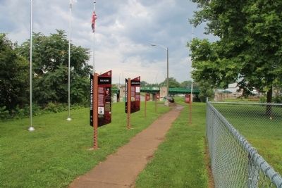
8. Casualties of the Skirmish Marker
View of the "The Forks" of the Thames River, where several Tecumseh Parkway historical markers are located.
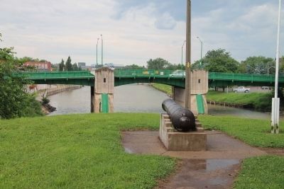
Photographed by Dale K. Benington, July 23, 2013
9. View of The Forks
View of the cannon situated at "The Forks" of the Thames River.
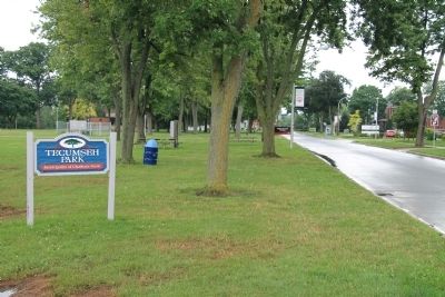
Photographed by Dale K. Benington, July 23, 2013
10. Tecumseh Park Sign
View, looking north on William Street North, of the sign for Tecumseh Park, where the historical marker is located, and a distant view of the Tecumseh Parkway sign used to alert motorists of the presence of these historical markers.
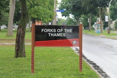
Photographed by Dale K. Benington, July 23, 2013
11. The Forks of the Thames
View, looking north on William Street North, of the Tecumseh Parkway sign used to alert motorists of the presence of these historical markers in Tecumseh Park.
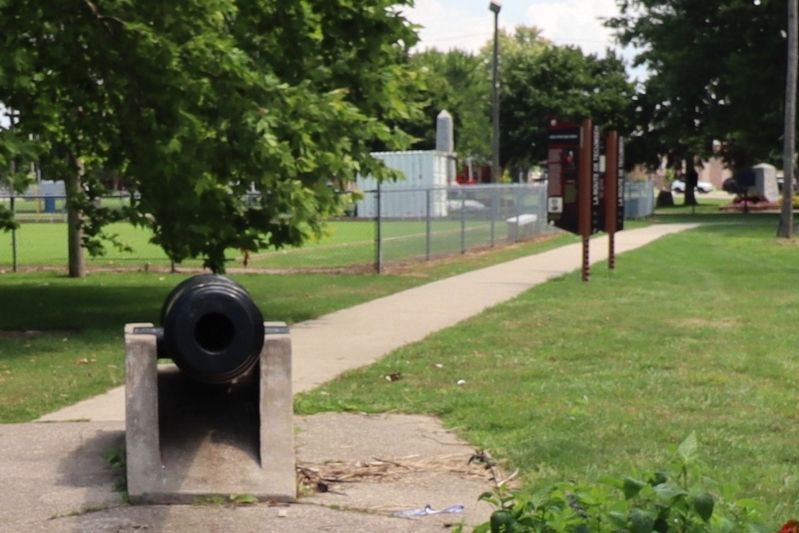
Photographed by Trevor L Whited, August 8, 2026
12. Casualties of the Skirmish Marker Site
Only 2 markers of the 5 remain.
Credits. This page was last revised on August 28, 2026. It was originally submitted on January 20, 2014, by Dale K. Benington of Toledo, Ohio. This page has been viewed 774 times since then and 42 times this year. Last updated on August 27, 2026, by Trevor L Whited of Kokomo, Indiana. Photos: 1, 2, 3, 4, 5, 6, 7, 8, 9, 10, 11. submitted on January 20, 2014, by Dale K. Benington of Toledo, Ohio. 12. submitted on August 27, 2026, by Trevor L Whited of Kokomo, Indiana. • Devry Becker Jones was the editor who published this page.
Editor’s want-list for this marker. Transcription of the French text • Can you help?
