
Vancouver in Clark County, Washington — The American West (Northwest)
Lewis's Vision of the Future
Photographed by Barry Swackhamer, June 11, 2026
1. Lewis's Vision of the Future Marker
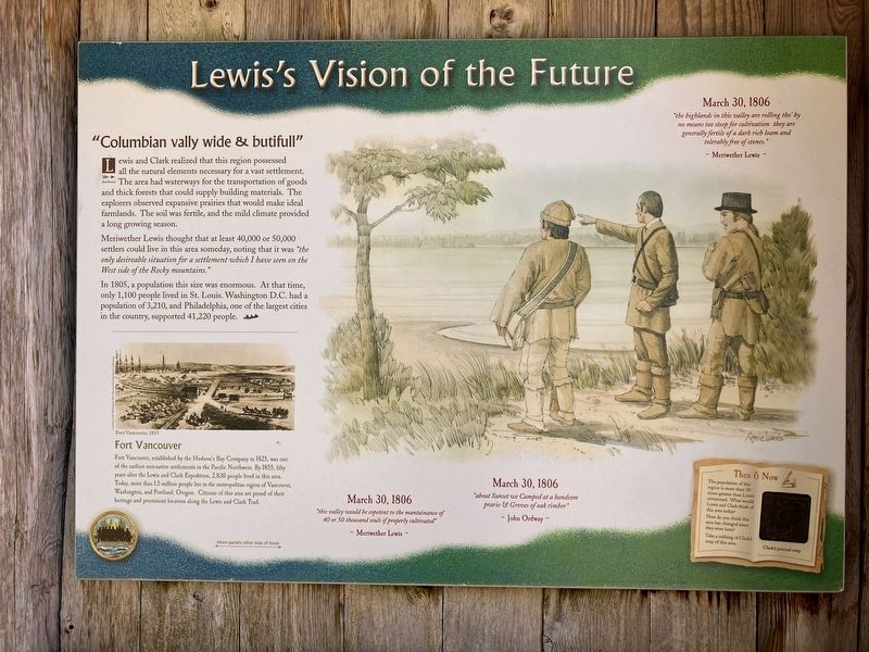
Columbian vally wide & butifull
Lewis and Clark realized that this region possessed all the natural elements for a vast settlement. The area had waterways for the transportation of goods and thick forests that could supply buildings materials. The explorers observed expansive prairies that would make ideal farmlands. The soil was fertile, and the mild climate provided a long growing season.
Meriwether Lewis thought that at least 40,000 to 50,000 settlers could live in this area someday, noting that it was " the only desireable situation for settlement which I have seen on the West side of the Rocky Mountains.
In 1805, a population this size was enormous. At that time, only 1,100 people lived in St. Louis. Washington D.C. had a population of 3,210, and Philadelphia, one of the largest cities in the county, supported 41,220 people.
Fort Vancouver
Fort Vancouver, established by the Hudson;'s Bay Company in 1825, was one of the earliest non-native settlements in the Pacific Northwest.. By 1855, fifty years after the Lewis and Clark Expedition, 2,839 people lived in this area. Today, more than 1.5 million
this page online
"this valley would be copetent to the mantainance of 40 or 50 thousand souls if properly cultivated."
Meriwether Lewis
March 30, 1806
"about Sunset we Camped at a handsom prarie & Groves of oak timber"
John Ordway
March 30, 1806
"the highlands in this valley are rolling tho'by no means too steep for cultivation they are generally fertile of a dark rich loam and tolerably free of stones."
Meriwether Lewis
Erected by Washington Lewis & Clark Bicentennial Commission.
Topics and series. This historical marker is listed in these topic lists: Exploration • Forts and Castles. In addition, it is included in the Lewis & Clark Expedition series list. A significant historical date for this entry is March 30, 1806.
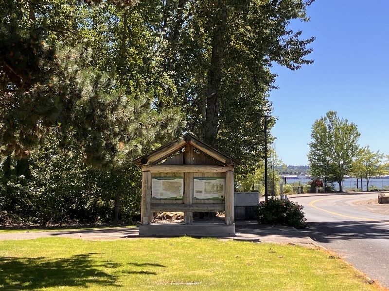
Location. 45° 36.879′ N, 122° 37.639′ W. Marker is in Vancouver, Washington, in Clark County. It is on Southeast Marine Park Way near Southeast Columbia Way, on the right when traveling north.
Photographed by Barry Swackhamer, June 11, 2026
2. Lewis's Vision of the Future Marker

Regionally, this marker is in Greater Portland Area and in Southwest Washington State. It is also on the American Pacific Coast, in the Pacific Northwest, and in the Lewis & Clark Corridor. Globally, it is in North America, the Pacific Rim, the Western Hemisphere, the Western World, and the Anglosphere.
Other nearby markers. At least 8 other markers are within 2 miles of this marker, measured as the crow flies: Lewis and Clark National Historic Trail (here, next to this marker); Lewis and Clark on the Lower Columbia (here, next to this marker); Densely Populated Region (a few steps from this marker); The First Fort Vancouver (approx. 0.9 miles away); From Military to Municipal Airfield (approx. 1.2 miles away); Ilchee (approx. 1.3 miles away); U. S. Grant Memorial (approx. 1.4 miles away); Whose Anchor? (approx. 1.6 miles away). Touch for a list and map of all markers in Vancouver.
Credits. This page was last revised on August 27, 2026. It was originally submitted on August 27, 2026, by Barry Swackhamer of Brentwood, California. This page has been viewed 3 times since then. Photos: 1, 2. submitted on August 27, 2026, by Barry Swackhamer of Brentwood, California.
