Limehouse in Halton Hills in Halton Region, Ontario — Central Canada (North America)
Limehouse and Early Industries
Photographed by Tim Boyd, August 26, 2026
1. Limehouse and Early Industries Marker
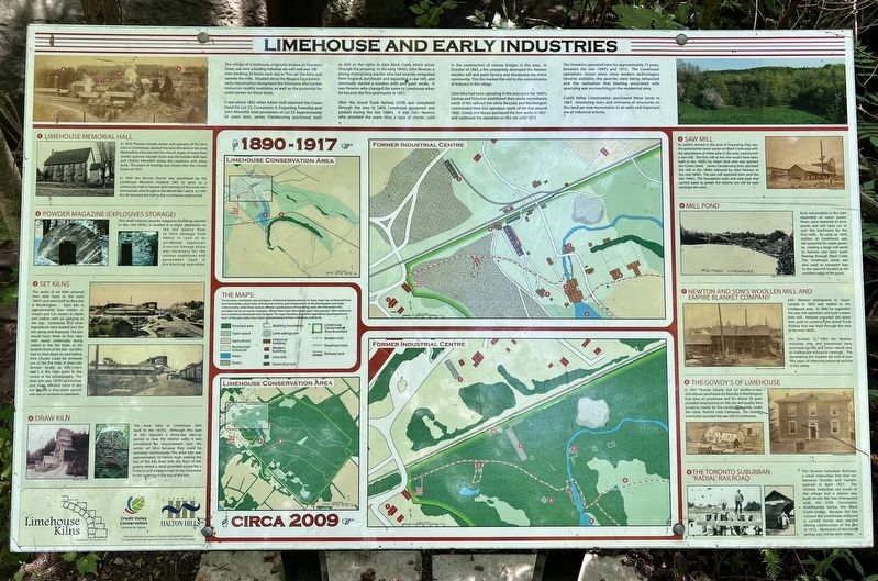
The village of Limehouse, originally known as Fountain Green, was once a bustling industrial site with well over 100 men working 24 hours each day to "fire-up" the kilns and operate the mills. Situated along the Niagara Escarpment, early industrialists recognized the limestone and lumber resources readily available, as well as the potential for water power on these lands.
It was about 1862 when Adam Stull obtained the Crown Deed for Lot 22, Concession 6, Esquesing Township and John Meredith took possession of Lot 23. Approximately 20 years later, James Clendenning purchased both as well as the rights to dam Black Creek which winds through the property. In the early 1840's, John Newton, a young, enterprising teacher who had recently emigrated from England, purchased and expanded a saw mill, and eventually started a woollen mills and paint works. It was Newton who changed the name to Limehouse when he became the first postmaster in 1857.
After the Grand Trunk Railway (GTR) was completed through the area in 1856, Limehouse prospered and peaked during the late 1880's. It was John Newton who provided the water lime, a type
this page online
Lime kilns had been operating in the area since the 1840's. Lindsay and Farquhar established their works immediately north of the railroad line while Bescoby and Worthington commended their kiln operation south of the line around 1850. Gowdy and Moore purchased the lime works in 1857 and continued the operation on this site until 1915.
The lime kilns operated here for approximately 75 years, between the late 1840's and 1915. The Limehouse operations closed when more modern technologies became available, the quarries were being exhausted and the realization that blasting associated with quarrying was encroaching on the residential area.
Credit Valley Conservation purchased these lands in 1967. Interesting ruins and remnants of structures on this land are now monuments to an early and important era of industrial activity.
Erected by Town of Halton Hills.
Photographed by Tim Boyd, August 26, 2026
2. Limehouse and Early Industries Marker
Topics. This historical marker is listed in these topic lists: Industry & Commerce • Settlements & Settlers. A significant historical month for this entry is October 1893.
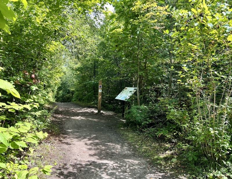
Location. 43° 38.231′ N, 79° 58.687′ W. Marker is in Halton Hills, Ontario, in Halton Region. It is in Limehouse. It can be reached from Fifth Line. The marker is in the Limehouse Conservation Area, on the Bruce Trail, approx. 150 metres from the entrance at 5th Like and 22 Sideroad, near the Limehouse Memorial Hall. Touch for map. Marker is at or near this postal address: 12169 Fifth Line, Halton Hills ON L0P 1H0, Canada. Touch for directions.

Regionally, this marker is in Greater Toronto, specifically on the Golden Horseshoe, in the Hamilton-Halton-Brant Area, and specifically in the Toronto Metropolitan Area. It is also in Central Canada. Globally, it is in North America, on the Great Lakes, in the Western Hemisphere, in the Western World, and in the Anglosphere. Historically, it finds itself in what was once a British colony, the Viceroyalty of New France, the Haudenosaunee (Iroquois) Confederacy, and Rupert’s Land.
Other nearby markers. At least
Photographed by Tim Boyd, August 26, 2026
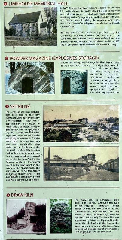
3. Limehouse and Early Industries marker photos and captions detail (left)
Photographed by Tim Boyd, August 26, 2026
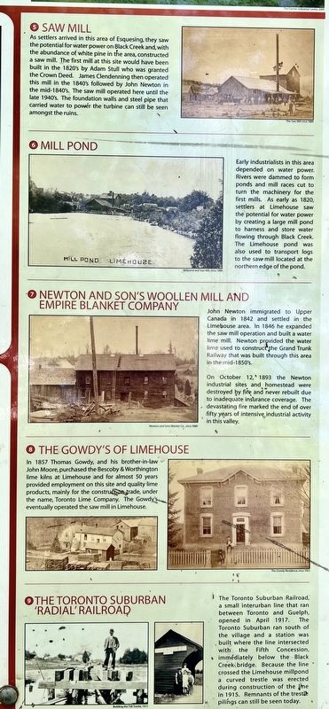
4. Limehouse and Early Industries marker photos and captions detail (right)
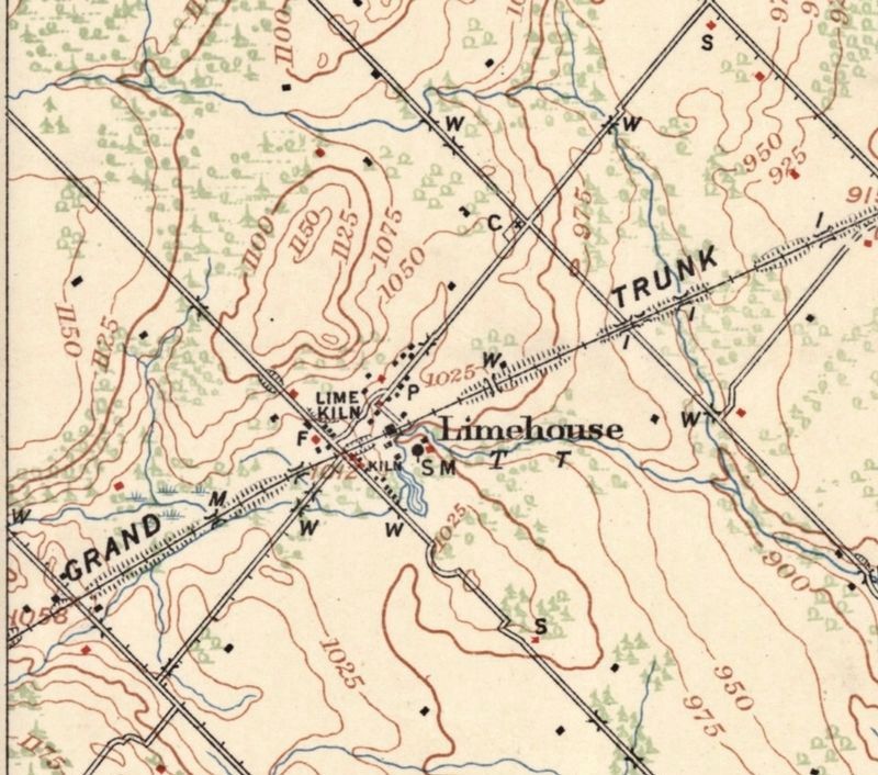
5. Limehouse in 1909
University of Toronto (public domain)
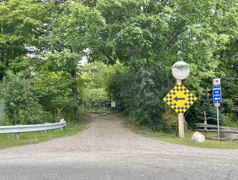
Photographed by Tim Boyd, August 26, 2026
6. Entrance to Limehouse Conservation Area from 5th Line
Marker is 150 metres along the trail
Credits. This page was last revised on August 28, 2026. It was originally submitted on August 28, 2026, by Tim Boyd of Hamilton, Ontario. This page has been viewed 8 times since then. Photos: 1, 2, 3, 4. submitted on August 28, 2026, by Tim Boyd of Hamilton, Ontario. 5. submitted on August 28, 2026. 6. submitted on August 28, 2026, by Tim Boyd of Hamilton, Ontario. • Andrew Ruppenstein was the editor who published this page.
