
Washougal in Clark County, Washington — The American West (Northwest)
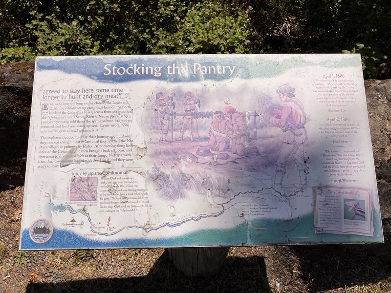
Stocking the Pantry
Photographed by Barry Swackhamer, June 11, 2026
1. Stocking the Pantry Marker
One week into the long journey home, the Lewis and Clark Expedition set up camp here on the north bank of the Columbia River, across from the mouth of the "Quicksand river" (Sandy River). Native people who visited their camp told they the spring salmon had not yet returned and food was scarce upriver. Lewis wrote, "This information gave us much uneasiness ..."
The explorers decided to delay their journey and hunt until they stocked enough meat to last until they reached the New Perce villages in present-day Idaho. After hunting along both sides of the Columbia, the men brought back elk, bear, and deer meat to dry on scaffolds at their camp. Nearly a week later, their canoes were loaded with dried meat and they were ready to leave.
Journey up the "Multnomah"
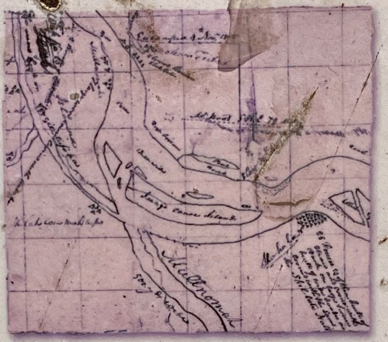
William Clark and several men took a side trip from this campsite to the Willamette River. Clark was eager to explore and map this large tributary, so he hired a man from a local tribe to guide his party. The explorers had missed the river previously because islands obscured its mouth. On his
this page online
:"We were visited by several canoes of natives'... they informed us that they resided at the great rapids ... they had consumed their winter store of dryed fish and that those of the present season had not yet arrived ... they complained much of the scarcity of food among them."
Meriwether Lewis
April 2, 1806
"our officers determined to delay at this place untill the hunters kill 9 or 10 Elk and jurk the meat to take along with us."
John Ordway
The natives ... informed our Officers, that there was a large River which emptied itself to there Columbia River ... Captain Clark took me & Six more of our party and one Indian as a guide ... to take a view of that River ...."
Joseph Whitehouse
Erected by Washington Lewis & Clark Bicentennial Commission.
Topics. This historical marker is listed in these topic lists: Animals • Exploration • Natural Resources. A significant historical date for this entry is April 1, 1806.
Location. 45° 34.565′ N, 122° 21.339′ W. Marker is in Washougal, Washington, in Clark County.
Photographed by Barry Swackhamer, June 11, 2026
2. Stocking the Pantry Marker (detail)
Captions: (lower left) Clark's journal map of the Columbia/Willamette confluence;

Regionally, this marker is in Greater Portland Area and in Southwest Washington State. It is also on the American Pacific Coast, in the Pacific Northwest, and in the Lewis & Clark Corridor. Globally, it is in North America, the Pacific Rim, the Western Hemisphere, the Western World, and the Anglosphere.
Other nearby markers. At least 8 other markers are within 5 miles of this marker, measured as the crow flies: William R. Broughton R.N. (about 500 feet away, measured in a direct line); Camas-Washougal War Memorial (approx. 2.4 miles away); Crown Zellerbach Employee World War II Memorial (approx. 2.6 miles away); The First School in Camas (approx. 2.7 miles away); Lewis and Clark and the Three Bears (approx. 2.7 miles away); Sandy River Bridge (approx. 2.8 miles away in Oregon); Tad's Chicken 'N Dumplin's (approx. 3 miles away in Oregon); Corbett
Photographed by Barry Swackhamer, June 11, 2026
3. Stocking the Pantry Marker
Credits. This page was last revised on August 28, 2026. It was originally submitted on August 28, 2026, by Barry Swackhamer of Brentwood, California. This page has been viewed 4 times since then. Photos: 1, 2, 3. submitted on August 28, 2026, by Barry Swackhamer of Brentwood, California.
