Hendrix in Bryan County, Oklahoma — The American South (West South Central)
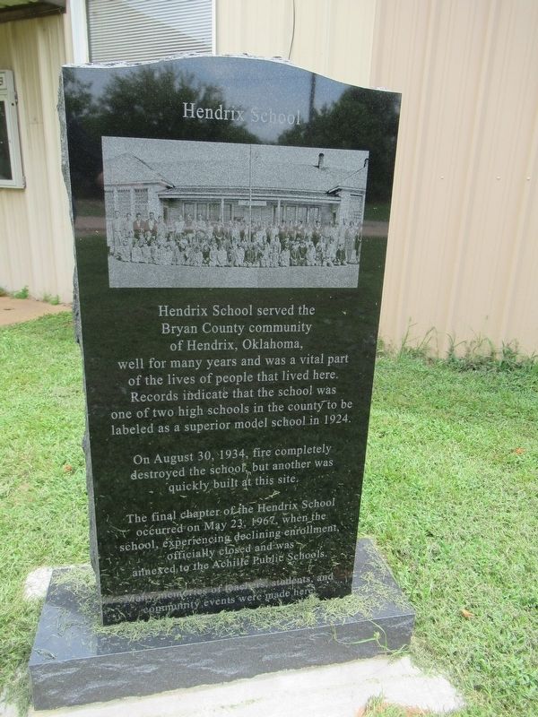
Hendrix School
Photographed by Jason Armstrong, July 15, 2023
1. Hendrix School Marker
On August 30, 1934, fire completely destroyed the school but another was quickly built at this site.
The final chapter of the Hendrix School occurred on May 23, 1967, when the school, experiencing declining enrollment, officially closed and was annexed to the Achille Public Schools.
Many memories of teachers, students, and community events were made here.
Topics. This historical marker is listed in this topic list: Education. A significant historical year for this entry is 1924.
Location. 33° 46.526′ N, 96° 24.306′ W. Marker is in Hendrix, Oklahoma, in Bryan County. It is on Main Street west of 4th Street, on the left when traveling east. Touch for map. Marker is at or near this postal address: 306 Main Street, Hendrix OK 74741, United States of America. Touch for directions.

Regionally, this marker is in the Choctaw Nation and in Southeast
this page online
Other nearby markers. At least 8 other markers are within 8 miles of this marker, measured as the crow flies: Carpenters Bluff Bridge (approx. 1½ miles away in Texas); Site of Colbert'S Ferry (approx. 7 miles away); L.A. Washington, Jr. and wife Martha A. (approx. 7.2 miles away in Texas); Joseph G. McCoy (approx. 7.3 miles away in Texas); The E. M. Kohl Building (approx. 7.4 miles away in Texas); North-South Railway Connection (approx. 7½ miles away in Texas); Katy Park Rededication (approx. 7.6 miles away in Texas); Waples-Platter Grocery Company (approx. 7.6 miles away in Texas).

Photographed by Jason Armstrong, July 15, 2023
2. Hendrix School Marker (Back)
There were three schools that comprised Oklahoma School District 69. Booker T. Washington North of Hendrix, Hendrix at this site, and Mashburn west of Hendrix.
Photographed by Jason Armstrong, July 15, 2023
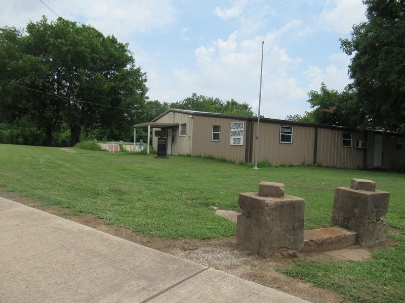
3. Hendrix Community Center
Credits. This page was last revised on September 1, 2026. It was originally submitted on September 1, 2026, by Jason Armstrong of Talihina, Oklahoma. This page has been viewed 10 times since then. Photos: 1, 2, 3. submitted on September 1, 2026, by Jason Armstrong of Talihina, Oklahoma. • Andrew Ruppenstein was the editor who published this page.
