Central Business District in Melbourne, Victoria, Australia — Oceania
Market Opening - Floor Plaque
| — | Queen Victoria Market | — |
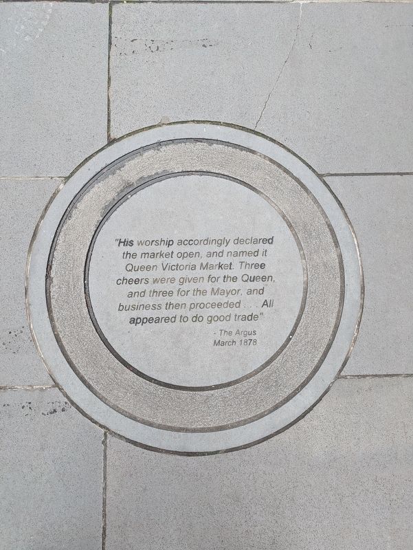
Photographed by Dean Barton-Ancliffe, July 16, 2026
1. Market Opening - Floor Plaque Marker
March 1878
Erected by Queen Victoria Market.
Topics. This historical marker is listed in this topic list: Industry & Commerce. A significant historical year for this entry is 1878.
Location. 37° 48.372′ S, 144° 57.434′ E. Marker is in Melbourne, Victoria. It is in the Central Business District. It is at the intersection of Victoria Street (Victoria Route 32) and Cobden Street, on the left when traveling west on Victoria Street. Touch for map. Marker is at or near this postal address: 133 Victoria Street, Melbourne VIC 3000, Australia. Touch for directions.

Regionally, it is in Oceania, in Australasia, in the Pacific Ocean, in South Pacific, on the Pacific Rim, in the Western World, and in the Anglosphere. Historically, it finds itself in what was once a British colony.
Other nearby markers. At least 8 other markers are within walking distance of this marker: Saving the Market (here,
this page online
Also see . . . 1878 Queen Victoria Market opens in Melbourne. Australian Food Timeline
The Queen Victoria Market was built on the site of Melbourne’s first cemetery. It is now the largest open-air market in the southern hemisphere, with a colourful (and criminal) history, from mafia killings and extortion rackets to piracy crackdowns. As well as stalls for meat, fish, deli goods fruit and vegetables and general goods it has a range of permanent shops and eating places including the famous American Doughnut Kitchen food van.(Submitted on September 1, 2026, by Dean Barton-Ancliffe of Rowville, Victoria.)
The Queen Victoria Market was not the first Melbourne market. The first official fruitand vegetable market was the Western Market. It was established in 1841, close to the Yarra River in the block bounded by Market, Collins and Williams Streets and Flinders Lane. The location of the Western Market meant goods could easily be unloaded from boats and transported to the market halls. As the railways expanded, the market’s proximity to Flinders Street Station was also an advantage.Photographed by Dean Barton-Ancliffe, July 16, 20262. Market Opening - Floor Plaque Marker in the Middle of the Laneway
Other city markets included the Eastern Market (originally the Hay Market) on the corner of Little Collins and Exhibition Streets, which officially opened in 1847, and the later, splendidly elaborate, Melbourne Fish Market with its clock towers, turrets and copper spires, which opened in 1890.
The opening of the Queen Victoria Market in March 1878 was celebrated with a free breakfast for the market gardeners given by the Mayor of Melbourne. Initially, the market was open every day except Sundays, Christmas Day and Good Friday. The wholesale market operated in the morning from 6 am to 10 am, while the evening general market ran from 3 pm to 9 pm, or 11 pm on Saturdays.

Credits. This page was last revised on September 1, 2026. It was originally submitted on September 1, 2026, by Dean Barton-Ancliffe of Rowville, Victoria. This page has been viewed 11 times since then. Photos: 1, 2. submitted on September 1, 2026, by Dean Barton-Ancliffe of Rowville, Victoria. • Andrew Ruppenstein was the editor who published this page.
