
Hill City in Pennington County, South Dakota — The American Midwest (Upper Plains)
Over a Century of Service
Photographed by Cosmos Mariner, August 17, 2023
1. Over a Century of Service Marker
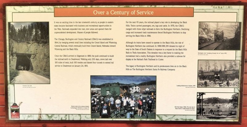
It was an exciting time in the late nineteenth century, as people in eastern states became fascinated with business and recreational opportunities in the West. Railroads expanded into vast, new areas and opened them for unprecedented development. Masses of people followed.
The Chicago, Burlington and Quincy Railroad (CB&Q) was established in 1864, by merging several small lines including the Grand Island and Wyoming Central Railroad, which eventually built from Grand Island, Nebraska toward Wyoming and the Black Hills.
Once the CB&Q arrived in Edgemont in 1889, the push continued to build the railroad north to Deadwood. Working only 255 days, crews laid over 100 miles of track, built 100 trestles and blasted four tunnels to extend rail service to Deadwood on January 24, 1891.
For the next 95 years, the railroad played a key role in developing the Black Hills. Trains carried passengers, ore, logs and cattle. In 1970, the CB&Q merged with three other railroads to form the Burlington Northern. Declining cargo and increased track maintenance forced Burlington Northern to stop serving the Black Hills in 1986.
Although its trains
this page online
The legacy of Burlington Northern and its predecessors lives on in the Black Hills as The Burlington Northern Santa Fe Railway Company.
[bottom center photo caption] Bicycle event at the caboose donated by Burlington Northern in Custer, SD [Photo courtesy of South Dakota Game, Fish and Parks]
Topics. This historical marker is listed in these topic lists: Industry & Commerce • Railroads & Streetcars. A significant historical date for this entry is January 24, 1891.
Location. 43° 55.651′ N, 103° 34.43′ W. Marker is in Hill City, South Dakota, in Pennington County. It is on South Newton Avenue just south of Poplar Street, on the left when traveling south. The marker is in Tracy Park, at the Burlington Northern Hill City Trailhead shelter on the George

Courtesy South Dakota Game, Fish and Parks
2. Marker detail: Tunnel on the Trail

Regionally, this marker is in South Dakota’s West River, in the Badlands, and in Greater Rapid City. It is also in the American Black Hills, in the Lewis & Clark Corridor, on the prairies, and on the Northern Plains. Globally, it is in North America, the Western Hemisphere, the Western World, and the Anglosphere. Historically, it finds itself in what was once Rupert’s Land and also the Louisiana Purchase.
Other nearby markers. At least 8 other markers are within walking distance of this marker: Dreams Can Come True (here, next to this marker); Welcome To Hill City (within shouting distance of this marker); The Little White Church (about 700 feet away, measured in a direct line); Hill City (approx. 0.2 miles away); Von Woehrman Building (approx. ¼ mile away); BNSF Railroad Signal (approx. 0.3 miles away); Semaphore & Telegraph (approx. 0.3 miles away); Hill City Depot (approx. 0.3 miles away). Touch for a list and map of all markers in Hill

Ed Gerken Collection
3. Marker detail: Burlington Crew
Burlington crew “pumping through the cut” about 1895.
Also see . . . George S. Mickelson Trail History (TrailLink).
Excerpt: The George S. Mickelson Trail provides visitors with breathtaking views of South Dakota’s beautiful Black Hills. The corridor is more than 100 miles long and travels over the entire Chicago, Burlington & Quincy (the CB&Q, or simply, “the Burlington”) branch line that ran from Edgemont, South Dakota, to Deadwood. The route was known as the “High Line” for its glimpses of granite mountains (where the right-of-way is sometimes cut directly into the hillside). It travels along creeks, across open valleys, and through forests and passes over more than 100 bridges. You’ll also encounter four tunnels. Add to this scenery the rich history of the region, steeped in legend of men flocking to the area in search of gold. As a result, several small towns popped up, such as Deadwood, Lead, Hill City, and others. Eventually, the towns brought in the railroads. The Burlington line opened in the early 1890s and competed with several other railroads. By the 1970s, the railroads began to pull out of the region when traffic dried up. The CB&Q followed suit,(Submitted on September 2, 2026, by Cosmos Mariner of Cape Canaveral, Florida.)cutting ties and abandoning its line in 1983, which brought about the development of the trail.Ed Gerken Collection4. Marker detail: Loading Railroad Ties or Timbers, 1895The history of railroads in South Dakota’s Black Hills can be traced back to 1874, when the infamous Lt. Colonel George A. Custer discovered gold as part of an exploration team. This discovery caused an explosion of growth, and many folks hoped to strike it rich. Within a few years, many other towns were founded and quickly grew. What led to the development of railroads, however, was not to transport the gold itself, but to move people and supplies.

Ed Gerken Collection
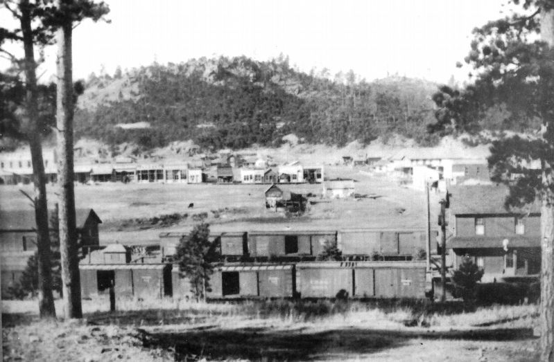
5. Marker detail: Hill City’s Depot, 1920s
The west side of Main Street is visible beyond the depot.
Photographed by Cosmos Mariner, August 17, 2023
6. Over a Century of Service Marker
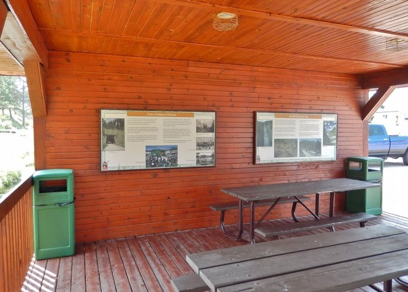
This marker is the leftmost of two interpretive panels mounted on the south wall of the Burlington Northern Hill City Trailhead shelter on the George S. Mickelson Rail Trail.
Photographed by Cosmos Mariner, August 17, 2023
7. Hill City Trailhead Shelter
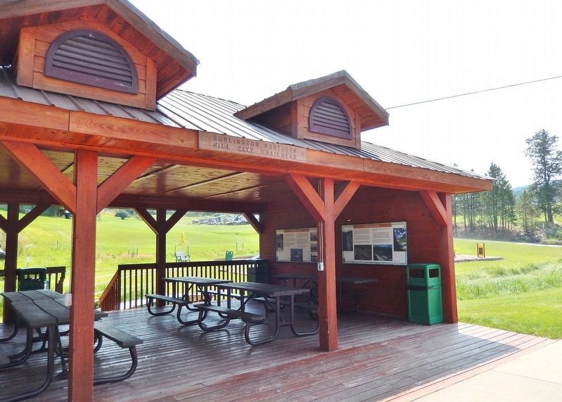
The Burlington Northern Hill City Trailhead shelter on the George S. Mickelson Rail Trail at Tracy Park.
Credits. This page was last revised on September 2, 2026. It was originally submitted on September 1, 2026, by Cosmos Mariner of Cape Canaveral, Florida. This page has been viewed 9 times since then. Photos: 1, 2, 3, 4, 5, 6, 7. submitted on September 2, 2026, by Cosmos Mariner of Cape Canaveral, Florida.
