Melissa in Collin County, Texas — The American South (West South Central)
The Mallow Place

Photographed by James Hulse
1. The Mallow Place Marker
This site was the homeplace of one of Melissa’s leading citizens, John H. Mallow (1860-1953), and wife Dollie Rattan Mallow (1862-1946).
A lifelong resident of Collin County, he was a farmer, raised and sold registered pedigreed Poland-China swine. He was a member of Cumberland Presbyterian Church.
This homesite was located in the middle of a true 97 acre blackland prairie surrounded by large mature trees, mostly pecan. One of the two original wells is featured here. It is still lined with brick and retaining water. The well, although no longer in use, has been preserved for observation and education.
The house was a small and modest wooden structure and was later taken down along with the barn to be repurposed for a tractor barn elsewhere. This piece of Collin County ground had never been cultivated or plowed until the 1950’s after Mallow’s death. Until then it had remained blackland prairie.
Mr. Mallow was a staunch supporter of local Congressmen Sam Rayburn and Joe Bailey. He was proud to have been a former student of Texas A&M. He was a longtime member of the Melissa Cemetery Board, where he served as secretary
this page online
Erected 2022 by Collin County Historical Commission.
Topics. This historical marker is listed in this topic list: Settlements & Settlers. A significant historical year for this entry is 1953.
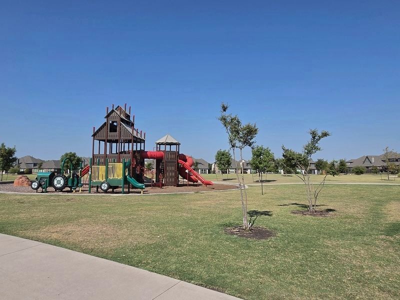
Location. 33° 16.836′ N, 96° 34.941′ W. Marker is in Melissa, Texas, in Collin County. It is at the intersection of Legacy Ranch Drive and Vista Ridge Road on Legacy Ranch Drive. The marker is located at the north side of the Legacy Ranch Playground. Touch for map. Marker is at or near this postal address: 2309 Vista Ridge Rd, Melissa TX 75454, United States of America. Touch for directions.

Regionally, this marker is in the Prairies & Lakes Region and in the Dallas-Fort Worth Metropolitan Area. Globally, it is in North America, a Gulf of Mexico state, the Western Hemisphere, the Western World, and the Anglosphere. Historically, it finds itself in what was once New Spain, the Republic of Texas, one of the Confederate States of America, and the Antebellum South.
Other nearby markers. At least 8 other markers are

Photographed by James Hulse, September 1, 2026
2. The Mallow Place Marker
Another marker is no longer nearby. St. Paul Baptist Church (was approx. half a mile away but has been confirmed missing).

Photographed by James Hulse, September 1, 2026
3. The Mallow Place Marker
The reverse side of the marker.
Photographed by James Hulse, September 1, 2026
4. The Mallow Place Marker
The view of the Legacy Ranch Playground with the marker off camera on the right side.
Credits. This page was last revised on September 2, 2026. It was originally submitted on September 1, 2026, by James Hulse of Medina, Texas. This page has been viewed 14 times since then. Photos: 1, 2, 3, 4. submitted on September 2, 2026, by James Hulse of Medina, Texas.
