
Southwest Portland in Multnomah County, Oregon — The American West (Northwest)
August 15, 1945
| — | The Oregonian | — |
Photographed by Ian Lefkowitz, June 26, 2026
1. August 15, 1945 Marker
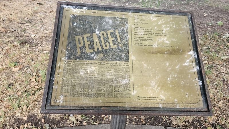
August 15, 1945.
Portland’s Population:
415,675.
News of the year:
President Franklin Delano Roosevelt dies April 12. Germany surrenders May 7. The atomic bomb is dropped on Hiroshima, Japan, August 6. Japan surrenders August 15, ending World War II.
The Oregonian’s Circulation:
Daily circulation: 186,899.
Sunday circulation: 235,750.
On this site:
The Windsor Hotel. The address at the time is 626 SW First.
This marker was donated by:
The Oregonian Publishing Company.
Erected 1983 by The Oregonian.
Topics. This historical marker is listed in these topic lists: Communications • Industry & Commerce • Peace • War, World II. A significant historical date for this entry is August 15, 1945.
Location. 45° 31.069′ N, 122° 40.399′ W. Marker is in Portland, Oregon, in Multnomah County. It is in Southwest Portland. It is at the intersection of Southwest Morrison Street and Southwest 1st Avenue, on the right when traveling west on Southwest Morrison Street. Touch for map. Marker is at or near this postal address: 50 SW Morrison Street, Portland OR 97204, United States of America. Touch for directions.

Regionally, this marker
this page online
Other nearby markers. At least 8 other markers are within walking distance of this marker: November 23, 1963 (here, next to this marker); November 11, 1918 (here, next to this marker); July 21, 1969 (here, next to this marker); December 4, 1850 (here, next to this marker); May 19, 1980 (here, next to this marker); First Issue of The Oregonian (a few steps from this marker); Centennial Block, 1878 (about 500 feet away, measured in a direct line); Mill Ends Park (about 600 feet away). Touch for a list and map of all markers in Portland.

Photographed by Ian Lefkowitz, June 26, 2026
2. August 15, 1945 Marker
This marker is third in a series of historical covers of the Oregonian newspaper.
Credits. This page was last revised on September 2, 2026. It was originally submitted on September 2, 2026, by Ian Lefkowitz of New York, New York. This page has been viewed 7 times since then. Photos: 1, 2. submitted on September 2, 2026, by Ian Lefkowitz of New York, New York. • Andrew Ruppenstein was the editor who published this page.
