
Belfast, Prince Edward Island — The Atlantic Provinces (North America)
The Croft House
Home of the Belfast Historical Society
Photographed by Jay Noble, August 22, 2026
1. The Croft House Marker

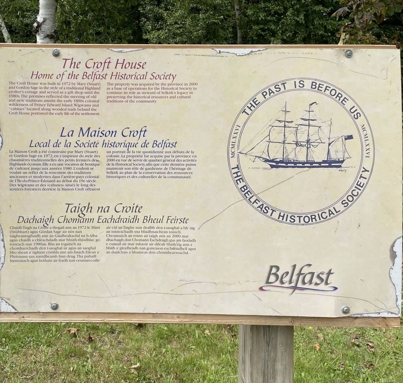
Home of the Belfast Historical Society
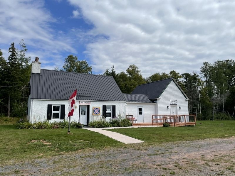
The Croft House was built in 1972 by Mary (Stuart) and Gordon Sage in the style of a traditional Highland 'crofter's cottage and served as a gift shop until the 1980s. The premises reflected the meeting of old and new traditions amidst the early 1800s colonial wilderness of Prince Edward Island. Wigwams and "cabines" located along wooded trails behind the Croft House portrayed the early life of the settlement.
The property was acquired by the province in 2000 as a base of operations for the Historical Society to continue its role as steward of Selkirk's legacy in preserving the historical resources and cultural traditions of the community.
Local de la Societé historique de Belfast
La Maison Croft a été construite par Mary (Stuart) et Gordon Sage en 1972, en s'inspirant du style des chaumières traditionnelles des petits fermiers des Highlands écossais. Elle a eu une vocation de boutique de cadeaux jusqu'aux années 1980. L'endroit se voulait un reflet de la rencontre des traditions anciennes et modernes dans l'arrière-pays colonial
this page online
Dachaigh Chomann Eachdraidh Bheul Feirste
Chaidh Taigh na Croite a thogail ann an 1972 le Mairi (Stiùbhart) agus Gòrdan Sage air nos nan taigheantughaidh ann an Gaidhealtachd na h-Alba agus chaidh a chleachdadh mar bhùth-thiodhlac go toiseach nan 1980an. Bha an togalach na chomharrchadh den t-saoghal ùr agus an saoghal bho shean a' tighinn còmhla ann am fasach Eilean a' Phrionnsa san naoidheamh linn deug. Tha pubaill Innseanach agus bothain air feadh nan ceuman-coille air cùl an Taighe nan dealbh den t-saoghal a bh' aig an tuineachadh sna bliadhnaichean toisich. Cheannaich an roinn an taigh ann an 2000
Photographed by Jay Noble, August 22, 2026
2. The Croft House Marker
Topics. This historical marker is listed in these topic lists: Architecture • Settlements & Settlers. A significant historical year for this entry is 1972.
Location. 46° 5.628′ N, 62° 54.687′ W. Marker is in Belfast, Prince Edward Island. It is on Selkirk Park Road, on the right when traveling north. Touch for map. Marker is in this post office area: Belfast PE C0A 1A0, Canada. Touch for directions.

Regionally, this marker is in the Maritimes and in Atlantic Canada. Globally, it is in the North Atlantic Region, North America, the Western Hemisphere, the Western World, and the Anglosphere. Historically, it finds itself in what was once a British colony and also the Viceroyalty of New France.
Other nearby markers. At least 8 other markers are within walking distance of this marker: The Honourable J. Angus MacLean (within shouting distance of this marker); To Commemorate the Honourable J. Angus MacLean P.C, O.C., D.F.C. 1914-2000
Photographed by Jay Noble, August 22, 2026
3. The Croft House Marker
Credits. This page was last revised on September 5, 2026. It was originally submitted on September 2, 2026, by Jay Noble of Charlottetown, Prince Edward Island. This page has been viewed 5 times since then. Photos: 1, 2, 3. submitted on September 2, 2026, by Jay Noble of Charlottetown, Prince Edward Island. • Andrew Ruppenstein was the editor who published this page.
