Woburn in Middlesex County, Massachusetts — The American Northeast (New England)
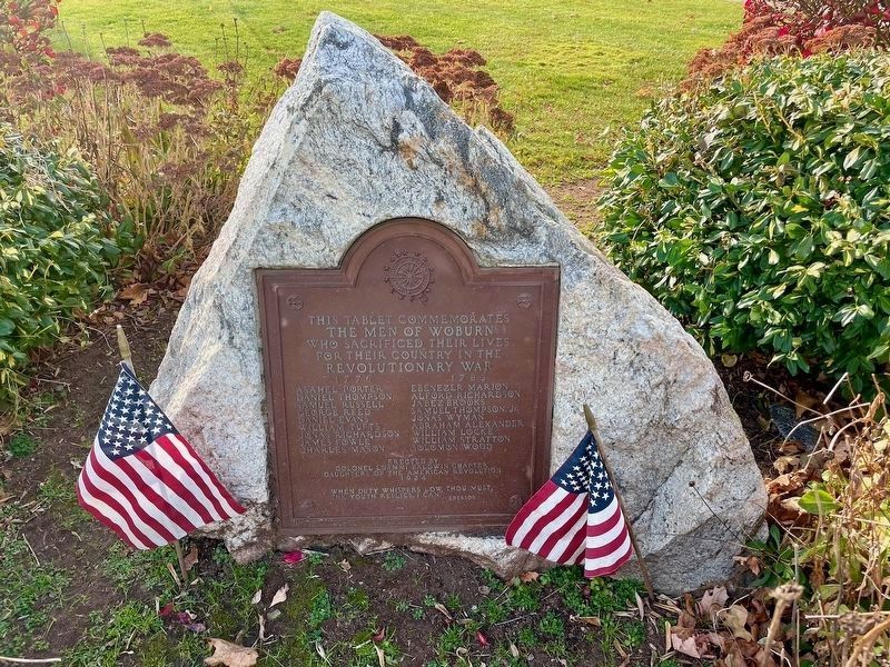
Woburn Revolutionary War Memorial
November 10, 2024
1. Woburn Revolutionary War Memorial
the men of Woburn
who sacrificed their lives
for their country in the
Revolutionary War
1776 1783
Asahel Porter · Daniel Thompson · Samuel Russell · George Reed · Daniel Evans · William Tufts · Jonas Richardson · James Fowle · Charles Mason · Ebenezer Marion · Alford Richardson · Jabez Brooks · Samuel Thompson, Jr. · Jonas Wyman · Abraham Alexander · William Locke · William Stratton · Solomon Wood
Daughters of the American Revolution
1924
When duty whispers low, thou must,
The youth replies, I can.
- Emerson
Erected 1924 by Colonel Loammi Baldwin Chapter, Daughters of the American Revolution.
Topics. This memorial is listed in this topic list: War, US Revolutionary.
Location. 42° 29.078′ N, 71° 9.125′ W. Memorial is in Woburn, Massachusetts, in Middlesex County. It is at the intersection of Main Street and Plympton Street, on the left when traveling north on Main Street. Located in Revolution Memorial Square. Touch for map. Touch for directions.

Regionally,
this page online
Other nearby markers. At least 8 other markers are within 3 miles of this marker, measured as the crow flies: Woburn (approx. 0.3 miles away); Woburn Public Library (approx. 0.4 miles away); Old Middlesex Canal (approx. one mile away); John Harvard's Land (approx. 1.8 miles away); Battle Road (approx. 2.2 miles away); Converse Bridge (approx. 2.4 miles away); Site of First House (approx. 2.4 miles away); The Symmes Farm (approx. 3 miles away). Touch for a list and map of all markers in Woburn.
Credits. This page was last revised on September 10, 2026. It was originally submitted on September 3, 2026, by Doug Bates of Loveland, Ohio. This page has been viewed 19 times since then. Photo 1. submitted on September 3, 2026, by Doug Bates of Loveland, Ohio. • Michael Herrick was the editor who published this page.
Editor’s want-list for this marker. A wide view photo of the marker and its surroundings • Can you help?
