Danforth East York in Toronto, Ontario — Central Canada (North America)
Dieppe Park
Photographed by Tim Boyd, September 1, 2026
1. Dieppe Park Marker
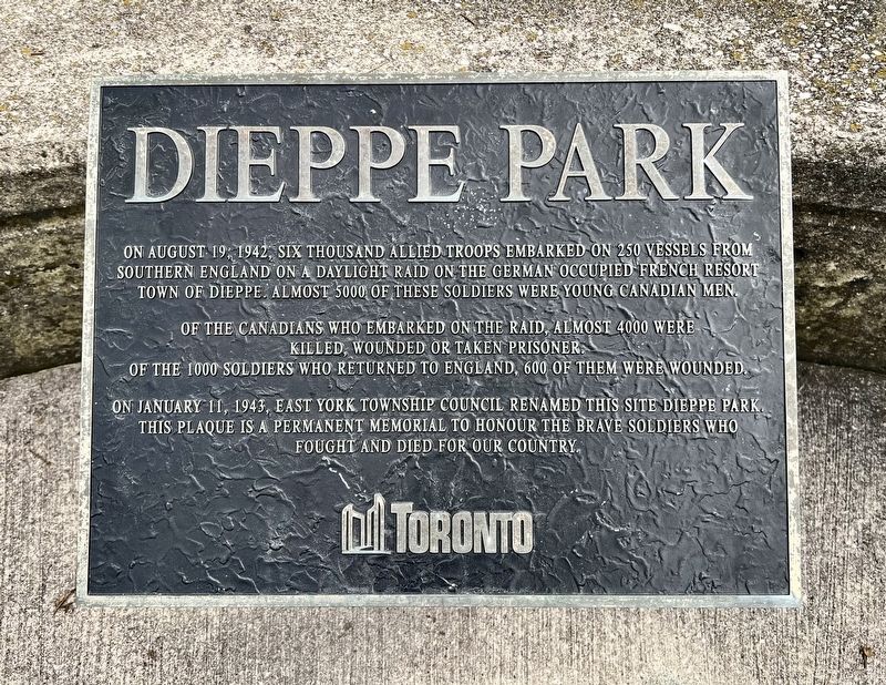
Of the Canadians who embarked on the raid, almost 4000 were killed, wounded or taken prisoner. Of the 1000 soldiers who returned to England, 600 of them were wounded.
On January 11, 1943, East York Township Council renamed this site Dieppe Park. This plaque is a permanent memorial to honour the brave soldiers who fought and died for our country.
Erected by City of Toronto.
Topics. This historical marker is listed in this topic list: War, World II. A significant historical date for this entry is August 19, 1942.
Location. 43° 41.542′ N, 79° 20.137′ W. Marker is in Toronto, Ontario. It is in Danforth East York. It is at the intersection of Cosburn Avenue and Athlone Road, on the right when traveling east on Cosburn Avenue. Touch for map. Marker is at or near this postal address: 455 Cosburn Avenue, Toronto ON M4J 2N2, Canada. Touch for directions.

Regionally, this marker is in Greater Toronto and
this page online
Other nearby markers. At least 8 other markers are within 3 kilometers of this marker, measured as the crow flies: Jean Gertrude “True” Davidson (approx. 0.4 kilometers away); William (Billy) McKay Jr. (1862 - 1943) (approx. 0.7 kilometers away); “The Church Built in a Day” (approx. 1.1 kilometers away); The Taylor Cemetery (approx. 1.2 kilometers away); “Coca-Cola” by Walter Yarwood (approx. 1.9 kilometers away); Leaside: A Railway Town (approx. 2.6 kilometers away); J. Tuzo Wilson (approx. 2.7 kilometers away); East Toronto & the Railways (approx. 2.8 kilometers away). Touch for a list and map of all markers in Toronto.
Also see . . . Dieppe Raid (Wikipedia). Lessons learned:
Both sides learnt important lessons regarding coastal assaults. The Allies learnt lessons that influenced(Submitted on September 4, 2026.)the success of the Normandy landings. Artificial harbours were declared crucial, tanks were adapted specifically for beaches, a new integrated tactical air force strengthened ground support, and capturing a major port at the outset was no longer seen as a priority. Churchill and Mountbatten both stated that these lessons had outweighed the cost. The Germans also believed that Dieppe was a learning experience and made a considerable effort to improve the way they defended the occupied coastlines of Europe.Photographed by Tim Boyd, September 1, 20262. Dieppe Park Marker
Credits. This page was last revised on September 4, 2026. It was originally submitted on September 3, 2026, by Tim Boyd of Hamilton, Ontario. This page has been viewed 6 times since then. Photos: 1, 2. submitted on September 3, 2026, by Tim Boyd of Hamilton, Ontario. • Andrew Ruppenstein was the editor who published this page.
