Danforth Village in Toronto, Ontario — Central Canada (North America)
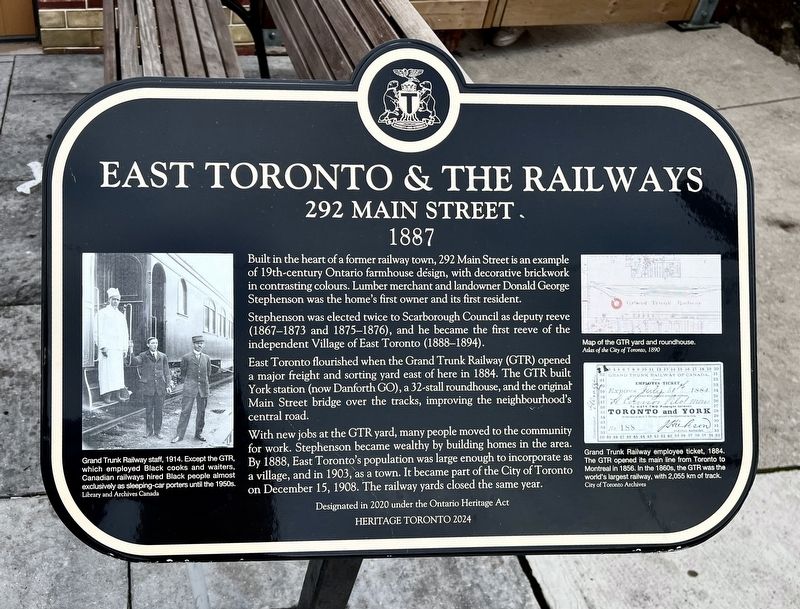
East Toronto & the Railways
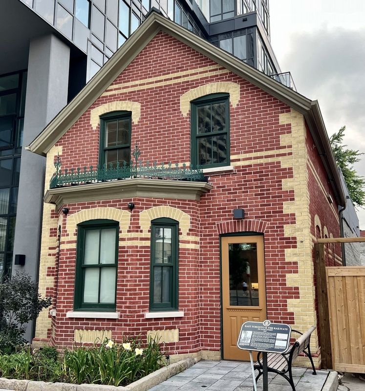
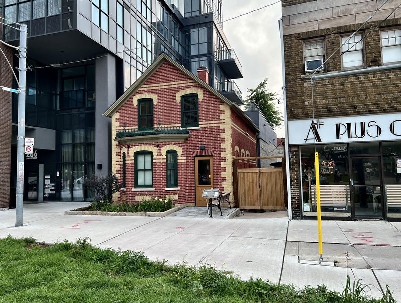
292 Main Street
| — | 1887 | — |
Photographed by Tim Boyd, September 1, 2026
1. East Toronto & the Railways Marker
Stephenson was elected twice to Scarborough Council as deputy reeve (1867-1873 and 1875-1876), and he became the first reeve of the independent Village of East Toronto (1888-1894).
East Toronto flourished when the Grand Trunk Railway (GTR) opened a major freight and sorting yard east of here in 1884. The GTR built York station (now Danforth GO), a 32-stall roundhouse, and the original Main Street bridge over the tracks, improving the neighbourhood's central road.
With new jobs at the GTR yard, many people moved to the community for work. Stephenson became wealthy by building homes in the area. By 1888, East Toronto's population was large enough to incorporate as a village, and in 1903, as a town. It became part of the City of Toronto on December 15, 1908. The railway yards closed the same year.
Erected 2024 by Heritage Toronto.
Topics and series.
this page online
Location. 43° 41.267′ N, 79° 18.117′ W. Marker is in Toronto, Ontario. It is in Danforth Village. It is at the intersection of Main Street and Danforth Avenue, on the right when traveling south on Main Street. Touch for map. Marker is at or near this postal address: 298 Main Street, Toronto ON M4C 1L1, Canada. Touch for directions.

Regionally, this marker is in Greater Toronto and on the Golden Horseshoe. It is also in Central Canada. Globally, it is in North America, on the Great Lakes, in the Western Hemisphere, in the Western World, and in the Anglosphere. Historically, it finds itself in what was once a British colony, the Viceroyalty of New France, the Haudenosaunee (Iroquois) Confederacy, and Rupert’s Land.
Other nearby markers. At least 8 other markers are within 5 kilometers of this marker, measured as the crow flies: William (Billy) McKay Jr. (1862 - 1943) (approx. 2 kilometers away); Jean Gertrude “True” Davidson
Photographed by Tim Boyd, September 1, 2026
2. East Toronto & the Railways Marker
Photographed by Tim Boyd, September 1, 2026
3. East Toronto & the Railways Marker
courtesy Library and Archives CanadA
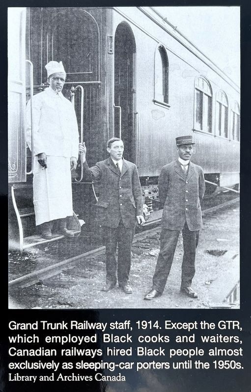
4. East Toronto & the Railways marker photo and caption detail (left)
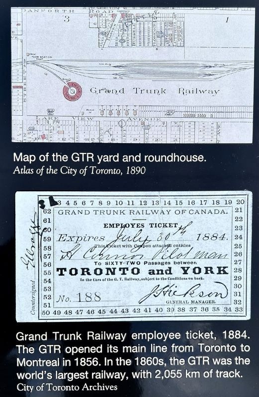
Photographed by Tim Boyd, September 1, 2026
5. East Toronto & the Railways marker illustrations and caption detail (right)
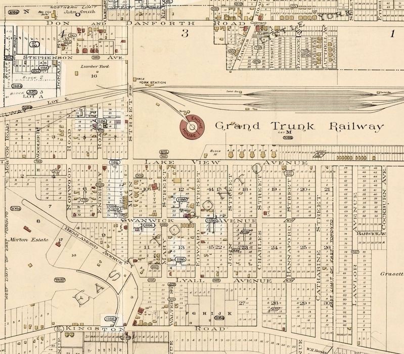
6. East Toronto on a 1899 fire insurance map
Source: City of Toronto (public domain)
Credits. This page was last revised on September 3, 2026. It was originally submitted on September 3, 2026, by Tim Boyd of Hamilton, Ontario. This page has been viewed 11 times since then. Photos: 1, 2, 3, 4, 5, 6. submitted on September 3, 2026, by Tim Boyd of Hamilton, Ontario. • Andrew Ruppenstein was the editor who published this page.
