Richmond in Madison County, Kentucky — The American South (East South Central)
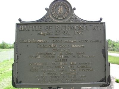
Battle of Richmond, Ky.
August 29-30, 1862
Confederates: 12,000 Infantry, 4,000 Cavalry
Federals: 7,000 Infantry
Generals
Confederate, E. Kirby Smith
Federal, William Nelson, M.D. Manson
Losses
Confederate, 75 killed, 200 wounded
Federal, 206 killed, 844 wounded 4,303 prisoners (many men escaped) 9 pieces of artillery 10,000 stands of small arms large quantity of supplies
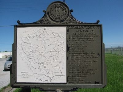
(Legend to Map on Back):
Madison County Kentucky
1 - Clay Home - Whitehall
2 - Republican Church - Baptist
3 - Fort Boonesborough
4 - Cane Spring Church
5 - Flatwoods Church
6 - Woodlawn
7 - Twetty's Fort
8 - Fort Estill
9 - Castlewood
10 - Jonathan Estill Home
11 - Mount Zion Church
12 - Hancock Taylor's Grave
13 - Milford - Original County Seat
14 - New Hope Church
15 - U.S. Grant House
16 - Indian Mound
17 - Kit Carson's Birthplace
18 - Original Location - Squire Boone Rock
19 - U.S. Ordnance
Erected 1955 by Fiscal Court of Madison County.
Topics and series. This historical marker is listed in this topic list: War, US Civil. In addition, it is included in the Former U.S. Presidents: #18 Ulysses S. Grant series list.
Location. 37° 42.764′ N, 84° 16.133′ W. Marker is in Richmond, Kentucky, in Madison County. Marker is at the intersection of Berea Road (U.S. 25/421) and Pace Ramsey Road, on the left when traveling south on Berea Road. Location is a small rest area along the highway. Multiple markers are located here. Touch for map. Marker is in this post office area: Richmond KY 40475, United States of America. Touch for directions.
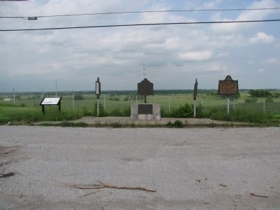
Other nearby markers. At least 8 other markers are within walking distance of this marker. Twitty's or Little Fort (here, next to this marker); Fort Estill (here, next to this marker); Daniel Boone's Trace (here, next to this marker); Daniel Boone's Trail (here, next to this marker); Race to Richmond (a few steps from this marker); Site of Fort Twetty (approx. 0.7 miles away); "Defeat and Destruction Seemed Inevitable" (approx. 0.9 miles away); "Rally, boys! Rally to the Colors!" (approx. 0.9 miles away). Touch for a list and map of all markers in Richmond.
Credits. This page was last revised on June 16, 2016. It was originally submitted on May 21, 2010, by Lee Hattabaugh of Capshaw, Alabama. This page has been viewed 2,283 times since then and 44 times this year. Photos: 1, 2, 3, 4, 5. submitted on May 21, 2010, by Lee Hattabaugh of Capshaw, Alabama. • Craig Swain was the editor who published this page.


