
Southwest Portland in Multnomah County, Oregon — The American West (Northwest)
May 19, 1980
| — | The Oregonian | — |
Photographed by Ian Lefkowitz, June 26, 2026
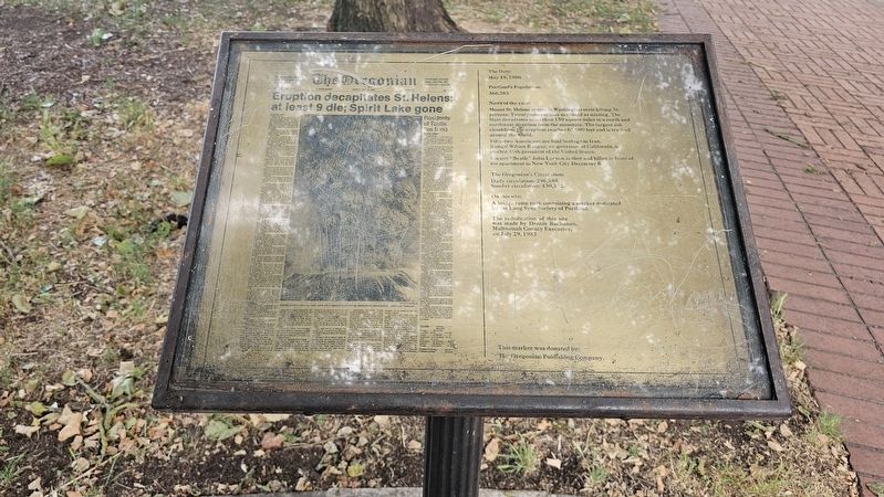
1. May 19, 1980 Marker
May 19, 1980.
Portland’s Population:
366,383
News of the year:
Mount St. Helens erupts in Washington state killing 36 persons. Twenty-one persons are listed as missing. The blast devastates more than 150 square miles in a north and northwest direction from the mountain. The largest ash cloud from the eruption reaches 67,000 feet and is tracked around the world.
Fifty-two Americans are held hostage in Iran. Ronald Wilson Reagan, ex-governor of California, is elected 40th president of the United States. Former “Beatle” John Lennon is shot and killed in front of his apartment in New York City December 8.
The Oregonian’s Circulation:
Daily circulation: 296,589.
Sunday’s circulation: 430,532.
On this site:
A bridge ramp park containing a marker dedicated by the Lang Syne Society of Portland.
The rededication of this site was made by Dennis Buchanan, Multnomah County Executive, on July 29, 1983.
This marker was donated by:
The Oregonian Publishing Company.
Erected 1983 by The Oregonian Publishing Company.
Topics. This historical marker is listed in these topic lists: Communications • Disasters. A significant historical date for this entry is May 19, 1980.
Location. 45° 31.065′ N,
this page online

Regionally, this marker is in Oregon’s Columbia River Gorge and in the Willamette Valley. It is also on the American Pacific Coast, in the Pacific Northwest, and in the Lewis & Clark Corridor. Globally, it is in North America, on the Ring of Fire, in the Pacific Rim, in the Western Hemisphere, in the Western World, and in the Anglosphere.
Other nearby markers. At least 8 other markers are within walking distance of this marker: July 21, 1969 (here, next to this marker); December 4, 1850 (here, next to this marker); November 11, 1918 (here, next to this marker); November 23, 1963 (here, next to this marker); August 15, 1945 (here, next to this marker); First Issue of The Oregonian (a few steps from this marker); Centennial Block, 1878
Photographed by Ian Lefkowitz, June 26, 2026
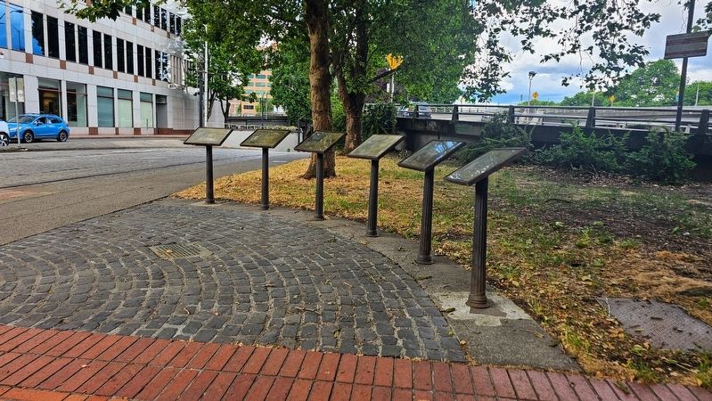
2. May 19, 1980 Marker
The 1980 marker is the most recent before the 1983 founding of the Oregonian Printing Press Park, and the closest to the camera in this image.
Credits. This page was last revised on September 5, 2026. It was originally submitted on September 4, 2026, by Ian Lefkowitz of New York, New York. This page has been viewed 9 times since then. Photos: 1. submitted on September 4, 2026, by Ian Lefkowitz of New York, New York. 2. submitted on September 5, 2026, by Ian Lefkowitz of New York, New York. • Andrew Ruppenstein was the editor who published this page.
