Ouderkerk aan de Amstel in Ouder-Amstel, North Holland, Netherlands — Northwestern Europe
Huis met de kettingen
⎯⎯⎯
House with the Chains
Photographed by Andrew Ruppenstein, September 1, 2026
1. Huis met de kettingen / House with the Chains Marker

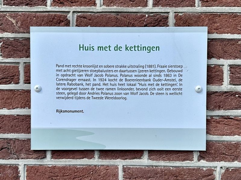
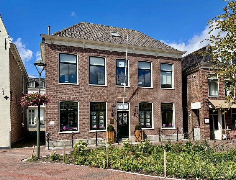
Pand met rechte kroonlijst en sobere strakke uitstraling (1881). Fraaie sierstoep met acht gietijzeren stoepbalusters en daartussen ijzeren kettingen. Gebouwd in opdracht van Wolf Jacob Polanus. Polanus woonde al sinds 1863 in De Corendrager ernaast. In 1924 kocht de Boerenleenbank Ouder-Amstel, de latere Rabobank, het pand. Het huis heet lokaal "Huis met de kettingen. In de voorgevel tussen de twee ramen linksonder, bevond zich ooit een eerste steen, gelegd door Andries Polanus zoon van Wolf Jacob. De steen is wellicht verwijderd tijdens de Tweede Wereldoorlog.
Rijksmonument.
House with the Chains
Building with a straight cornice and a simple, sleek appearance (1881). Beautiful ornamental steps with eight cast-iron balusters and iron chains between them. Built on commission for Wolf Jacob Polanus. Polanus had already been living in De Corendrager building next door since 1863. In 1924, the Boerenleenbank Ouder-Amstel, later Rabobank, purchased the building. Locally, the house is known as "House with the Chains." In the front facade, between the two
this page online
National Monument.
Topics. This historical marker is listed in these topic lists: Architecture • Industry & Commerce. A significant historical year for this entry is 1863.
Location. 52° 17.79′ N, 4° 54.189′ E. Marker is in Ouderkerk aan de Amstel, Noord-Holland (North Holland), in Ouder-Amstel. It is on Kerkstraat, on the right when traveling south. Touch for map. Marker is at or near this postal address: Kerkstraat 54, Ouderkerk aan de Amstel, Noord-Holland 1191 JD, Netherlands. Touch for directions.

Regionally, it is in Europe, the European Union, Atlantic Europe, the Benelux Low Countries, the Schengen Area, Western Europe, and the Western World. Historically, it finds itself in what was once the Holy Roman Empire.
Other nearby markers. At least 8 other markers are within walking distance of this marker: D’Corendrager / “The Grain Carrier” (a few steps from this marker); Ouderkerk sinds het jaar 1000 / Ouderkerk Since the Year 1000 (within shouting
Photographed by Andrew Ruppenstein, September 1, 2026
2. Huis met de kettingen / House with the Chains and marker
Credits. This page was last revised on September 5, 2026. It was originally submitted on September 5, 2026, by Andrew Ruppenstein of Lamorinda, California. This page has been viewed 13 times since then. Photos: 1, 2. submitted on September 5, 2026, by Andrew Ruppenstein of Lamorinda, California.
