Gouda, South Holland, Netherlands — Northwestern Europe
Weeshuis
⎯⎯⎯
Orphanage
Photographed by Andrew Ruppenstein, September 2, 2026
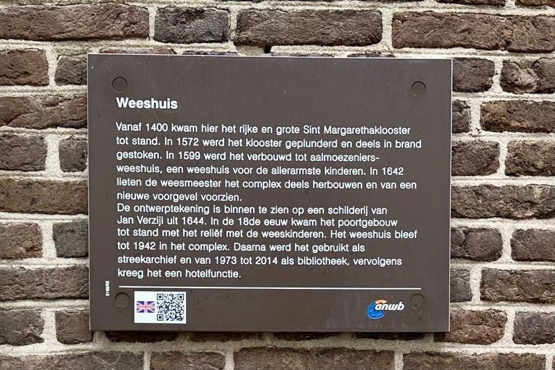
1. Weeshuis / Orphanage Marker

Vanaf 1400 kwam hier het rijke en grote Sint Margarethaklooster tot stand. In 1572 werd het klooster geplunderd en deels in brand gestoken. In 1599 werd het verbouwd tot aalmoezeniers-weeshuis, een weeshuis voor de allerarmste kinderen. In 1642 lieten de weesmeester het complex deels herbouwen en van een nieuwe voorgevel voorzien.
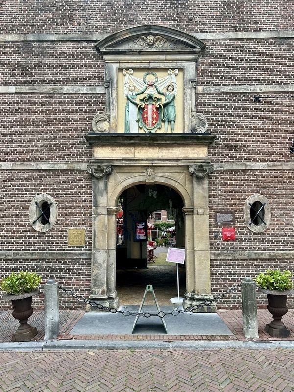
De ontwerptekening is binnen te zien op een schilderij van Jan Verzijl uit 1644. In de 18de eeuw kwam het poortgebouw tot stand met het reliëf met de weeskinderen. Het weeshuis bleef tot 1942 in het complex. Daarna werd het gebruikt als streekarchief en van 1973 tot 2014 als bibliotheek, vervolgens kreeg het een hotelfunctie.
Orphanage
From 1400 onwards, the rich and large St. Margaret's Convent was established here. In 1572, the convent was plundered and partially set on fire. In 1599, it was converted into an almoners' orphanage, an orphanage for the poorest children. In 1642, the orphanage master had the complex partially rebuilt and provided with a new facade.
The design drawing can be seen inside on a painting by Jan Verzijl from
this page online
Erected by the ANWB. (Marker Number 2162/02.)
Topics. This historical marker is listed in these topic lists: Charity & Public Work • Religion & Religious Structures. A significant historical year for this entry is 1400.
Location. 52° 0.63′ N, 4° 42.786′ E. Marker is in Gouda, Zuid-Holland (South Holland). It is at the intersection of Spieringstraat and Molenwerf, on the right when traveling north on Spieringstraat. Touch for map. Marker is at or near this postal address: Spieringstraat 1, Gouda, Zuid-Holland 2806 CC, Netherlands. Touch for directions.

Regionally, it is in Europe, the European Union, Atlantic Europe, the Benelux Low Countries, the Schengen Area, Western Europe, and the Western World. Historically, it finds itself in what was once the Roman Empire and specifically also the Holy Roman Empire.
Other nearby markers. At least 8 other markers
Photographed by Andrew Ruppenstein, September 2, 2026
2. Weeshuis / Orphanage entrance and marker
Also see . . . Weeshuis (Gouda, in Dutch). Origins (in translation):
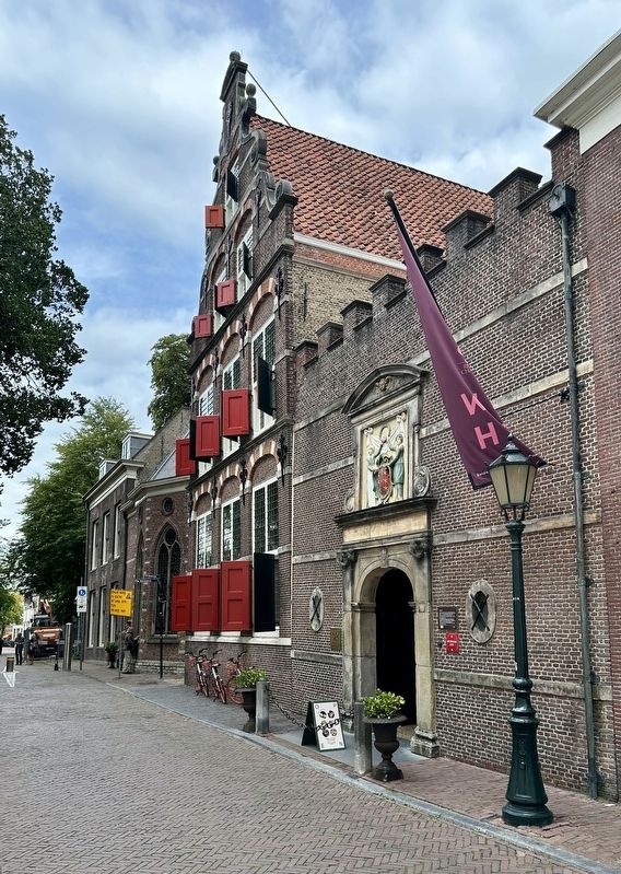
In 1586, an almoners' chamber was established in Gouda, which was charged with poor relief in the city. In 1599, the Almoners' Orphanage was put into use, where orphans were housed who could not be admitted to the existing Holy Spirit Orphanage. In principle, the orphaned children of burghers were placed in the latter orphanage. In the first half of the seventeenth century, care(Submitted on September 6, 2026.)for the orphans expanded further, and the almoners purchased six houses located on Spieringstraat. In 1642, the new orphanage was built on the site of the purchased houses.Photographed by Andrew Ruppenstein, September 2, 20263. Weeshuis / Orphanage
Credits. This page was last revised on September 6, 2026. It was originally submitted on September 6, 2026, by Andrew Ruppenstein of Lamorinda, California. This page has been viewed 19 times since then. Photos: 1, 2, 3. submitted on September 6, 2026, by Andrew Ruppenstein of Lamorinda, California.
