Niagara Falls in Niagara County, New York — The American Northeast (Mid-Atlantic)
Niagara Falls Hydraulic Canal
(1881-1961)
Photographed by Anton Schwarzmueller, September 5, 2026
1. Niagara Falls Hydraulic Canal Marker
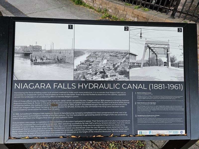
One of those efforts was the Niagara Falls Hydraulic Canal, which ran past this site. It began with an 1825 prospectus issued by brothers Augustus and Peter B. Porter in the same year the Erie Canal was completed, but it took more than fifty years and several failed startup companies before the Hydraulic Canal found success. In 1878, Jacob F. Schoellkopf bought the equipment and facilities of the bankrupt Niagara Falls Canal Company at public auction for $71,000. At the time, the unfinished mile-long Canal had been under back-breaking construction for more than 20 years.
In 1881, Schoellkopf's Niagara Falls Hydraulic Power & Manufacturing Company completed the initial components of what was to be one of the great technological marvels of the 19th century. The first hydroelectric
this page online
Industrialists were eager to capitalize on the availability of abundant hydroelectric power. Their factories and manufacturing byproducts profoundly impacted the surrounding landscape. After operating successfully for over half a century, tensions between man and nature erupted on June 7, 1956. Shortly after 5:00 PM that day, a rock slide followed by three electrical explosions buried two-thirds of the Schoellkopf Station at the base of the Gorge. The Hydraulic Canal was abandoned. Over the next 60 years, nature reclaimed the High Bank where the Schoellkopf Station once dominated the landscape, and the City of Niagara Falls grew over the Hydraulic Canal's path. Today, little can be seen of the Canal that once powered U.S. innovation at the height of the Industrial Revolution. Yet the landscape surrounding Niagara Falls bears witness to its complicated legacy.
1 Workers Drilling in Canal Unknown Photographer, c. 1913. Workers use drills on a barge in the Hydraulic Canal. The Canal powered massive generators at
Photographed by Anton Schwarzmueller, September 5, 2026
2. Niagara Falls Hydraulic Canal Marker
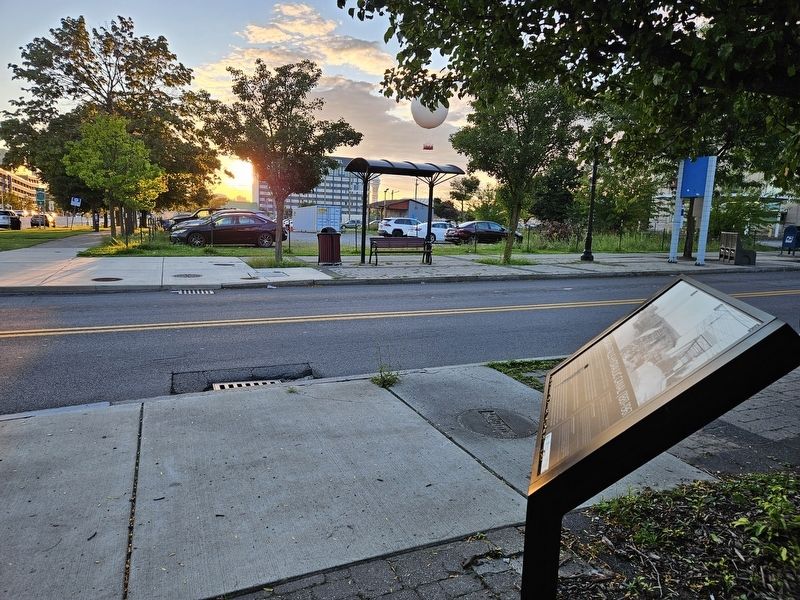
Westward view towards the Rainbow Bridge to Canada.
2 Canal Terminus at the High Bank Unknown Photographer, July 11, 1896. The Canal began at Port Day on the upper Niagara River, passed under the intersection of Niagara and Third Streets where you are now standing, and discharged its contents down the brink of the Gorge into the lower Niagara at the High Bank. The Hydraulic Canal powered many manufactories on the High Bank and surrounding areas. The end of the Canal is visible at the center of this image. Photograph courtesy of the Niagara Falls Public Library, provided through a grant from the Niagara Falls National Heritage Area.
3 Navigating the Infrastructure of Power Unknown Photographer, June 4, 1923. For nearly 200 years, Niagara Falls has coexisted as a tourist mecca, electrical powerhouse, and home to generations of families. Blending the demands of residents, tourists, and industrialists required municipal solutions to navigate the massive hydraulic infrastructure, such as this Buffalo Avenue bridge that spanned the Hydraulic Canal. Photograph courtesy of the Niagara Falls Public Library, provided through a grant from the Niagara Falls National Heritage Area.
Erected by Downtown Niagara Falls Business Association [and two more].
Topics. This historical marker is listed in this topic list: Industry & Commerce. A significant historical year for this entry is 1825.
Location. 43° 5.312′ N, 79° 3.549′ W. Marker is in Niagara Falls, New York, in Niagara County. It is at the intersection of Third Street and Niagara Street, on the right when traveling north on Third Street. Touch for map. Marker is in this post office area: Niagara Falls NY 14303, United States of America. Touch for directions.

Regionally, this marker is in Upstate New York, specifically in Western New York, and in the Buffalo Metropolitan Area. It is also in the American Northeast and in the Mid-Atlantic. Globally, it is in North America, on the Great Lakes, in the Western Hemisphere, in the Western World, and in the Anglosphere. Historically, it finds itself in what was once the Viceroyalty of New France, the Haudenosaunee (Iroquois) Confederacy, New Netherland, and one of the original Thirteen Colonies.
Other nearby markers. At least 8 other markers are within walking distance of this marker: The Grounds of this Canal (within shouting distance of this marker); Votes For Women (approx. 0.2 miles away); First Presbyterian Church (approx. 0.2 miles away); Replica of the Statue of Liberty (approx. 0.2 miles away); Bridges of Niagara (approx. ¼ mile away); Protecting Our Shared Waters (approx. 0.3 miles away); The Boundary Waters Treaty (approx. 0.3 miles away); a different marker also named Protecting Our Shared Waters (approx. 0.3 miles away). Touch for a list and map of all markers in Niagara Falls.
Credits. This page was last revised on September 6, 2026. It was originally submitted on September 6, 2026, by Anton Schwarzmueller of Wilson, New York. This page has been viewed 8 times since then. Photos: 1, 2. submitted on September 6, 2026, by Anton Schwarzmueller of Wilson, New York.
