Victoria, Prince Edward Island — The Atlantic Provinces (North America)
Victoria By-The-Sea
Photographed by Jay Noble, September 6, 2026
1. Victoria By-The-Sea Marker
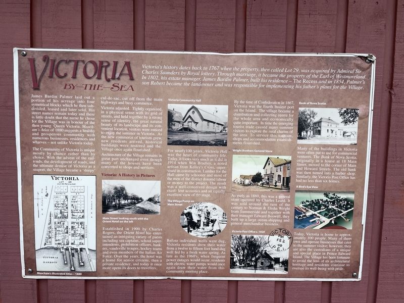
James Bardin Palmer laid out a portion of his acreage into four symetrical blocks which he then subdivided, leased and later sold. His street names remain today and there is little doubt that the name he chose for the Village was in honour of the then young Queen Victoria. Meacham's Atlas of 1880 suggests a healthy and prosperous community with numerous businesses, residences and wharves - not unlike Victoria today.
The Community of Victoria is unique mostly by chance rather than by choice. With the advent of the railroads, the development of roads, and the ultimate demise of Victoria as a seaport, the Village became a 'sleepy' cul-de-sac, cut off from the main highways and busy commerce.
Victoria
this page online
Architecture of the Village remains in great part unchanged even though many of the houses have been converted to shops and services.
Established in 1900 by Charles Rogers, the Orient Hotel has entertained an intriguing variety of guests including sea captains, school superintendents, prohibition officers, bankers, vaudeville troupes, hockey teams and even members of the Italian Air Force. Over the years, the hotel was a home for senior citizens, then a private residence, and today it once more opens its doors to travellers.
For nearly 100 years, Victoria Hall was the heart of community life. Today, it looks very much as it did in 1914 when Win Bradley, a noted artisan from Kelley's Cross, supervised its construction. Lumber for the Hall came by
Photographed by Jay Noble, September 6, 2026
2. Victoria By-The-Sea Marker
Before individual wells were dug, Victoria residents drew their water from a twelve to fifteen foot hand-dug well fed by a fresh water spring. As late as the 1960's, when frequent power outages would occur, residents with electric water pumps would once again draw their water from this community meeting place.
By the time of Confederation in 1867, Victoria was the fourth busiest port on the Island. The village became a distribution and collecting centre for the whole area and economically quite important. In time the emerging tourist trade caused many summer visitors to explore the rural charms of the area. To service this tourism, shops and accommodation establishments flourished.
As early as 1880, this was a general store operated by Charles Leard. It was sold around the turn of the century to Norman & Elisha Wright from Summerside and together with their manager Edward Boswell, they built up a large ocean-shipping and general merchandise business.
Many of the buildings in Victoria were often put to use for commercial ventures. The Bank of Nova Scotia originally in a house at 18 Main Street, moved to the corner of Main and Howard Streets. The old bank was then turned into a barber shop. Similarly, the Victoria Post Office has had no less than six homes.
Today, Victoria is home to approximately 100 people. Many of them own and operate businesses that cater to the summer visitor; however, they are also the custodians of a unique and special place in Prince Edward Island. The Village has been fortunate to avoid the loss of its architectural heritage and residents continue to oversee its well-being with pride.
Topics. This historical marker is listed in these topic lists: Industry & Commerce • Settlements & Settlers. A significant historical year for this entry is 1767.
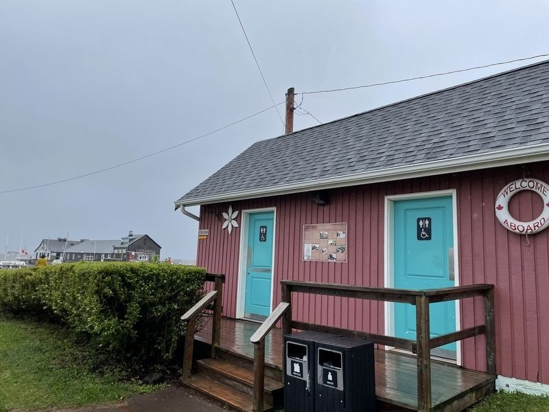
Location. 46° 12.824′ N, 63° 29.365′ W. Marker is in Victoria, Prince Edward Island. It is on Water Street, on the right when traveling east. The marker is mounted to the exterior of the public washrooms building. Touch for map. Marker is at or near this postal address: 5 Water Street, Victoria PE C0A 1J0, Canada. Touch for directions.

Regionally, this marker is in the Maritimes and in Atlantic Canada. Globally, it is in the North Atlantic Region, North America, the Western Hemisphere, the Western World, and the Anglosphere. Historically, it finds itself in what was once a British colony and also the Viceroyalty of New France.
Other nearby markers. At least 8 other markers are within 16 kilometers of this marker, measured as the crow flies: Hotbed of Culture and Art / Un Foyer de Culture et d'art (approx. 0.7 kilometers away); 200 Years of Worship and Service (approx. 5 kilometers away); Tryon United Church / L'Église Unie de Tryon (approx. 5 kilometers away); Tryon Great War and WWII Memorial (approx. 5.1 kilometers away); Franklin Knight Lane (approx. 6.4 kilometers away); Agriculture in Kinkora / L’agriculture à Kinkora (approx. 14.9 kilometers away); Kinkora (approx. 14.9 kilometers away); Granite Mill Stone (approx. 14.9 kilometers away).
Credits. This page was last revised on September 10, 2026. It was originally submitted on September 6, 2026, by Jay Noble of Charlottetown, Prince Edward Island. This page has been viewed 6 times since then. Photos: 1, 2. submitted on September 6, 2026, by Jay Noble of Charlottetown, Prince Edward Island. • Andrew Ruppenstein was the editor who published this page.
