
Northampton in West Northamptonshire, England, United Kingdom — Northwestern Europe (the British Isles)
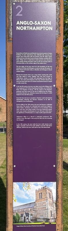
Anglo-Saxon Northampton
Photographed by Ray Gurganus, May 25, 2026
1. Anglo-Saxon Northampton Marker
The true origin of the town may lie in the foundation of the twin churches of St Peter and St Gregory, as early as the late 7th century. St Peter's Church still stands today on Marefair, but St Gregory's Church remains hidden.
Between the churches there was a large timber meeting hall, which was later rebuilt in stone. Together, they may have formed an Anglo-Saxon minster, no doubt with patronage from the Kings of Mercia, who ruled central England at this time. St Peter's Church may have even been built next to an ancient round burial mound, to respect an older sacred site.
In the late 9th century, the town was taken over by the Vikings, but it was recaptured in 917
this page online
From this time, the town is recorded as 'Hamtun', and it only became Northampton following the Norman Conquest, to be able to distinguish it from Southampton.
By the middle of the 10th century the town had become a defended Saxon burh. The security of a defended burh would have helped to attract traders, merchants, and craftsmen to set up business in the town, and coins were being minted in the town during this period. Coins were minted in Northampton for over 250 years which shows the significance of Northampton as a major royally approved centre.
Definition: What is a 'Burh'? A defended settlement. The modern word 'Borough' is derived from Burh but the meaning has changed.
In the 12th century, the area inside the town walls became much bigger, especially south of the castle. Builders reused the older Saxon defences, with the new town wall,
Photographed by Ray Gurganus, May 25, 2026
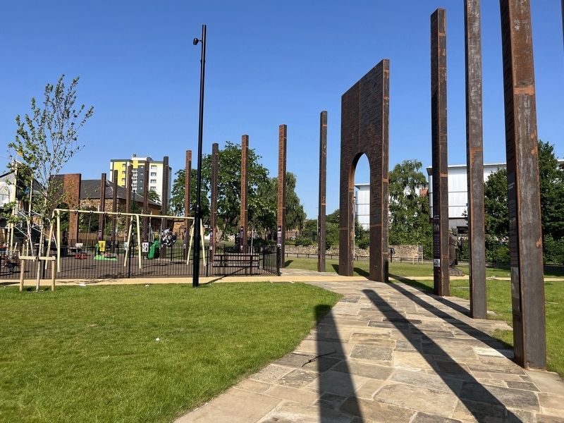
2. Site of Northampton Castle
Image: St Peters Church (courtesy of Churches Conservation Trust) (Marker Number 2.)
Topics. This historical marker is listed in these topic lists: Religion & Religious Structures • Settlements & Settlers.
Location. 52° 14.267′ N, 0° 54.23′ W. Marker is in Northampton, England, in West Northamptonshire. It is on Chalk Lane. The marker is by the Chalk Lane car park, just south of Northampton Castle. Touch for map. Marker is at or near this postal address: 14 Chalk Lane, Northampton, England NN1 2RW, United Kingdom. Touch for directions.

Regionally, it is on the Atlantic Ocean, in the North Atlantic Region, in Europe, in Atlantic Europe, on one of the British Isles, in the Western World, and in the Anglosphere. Historically, it finds itself in what was once the Roman Empire.
Other nearby markers. At least 5 other markers are within 11 kilometers of this marker, measured as the crow flies: Earl of Northampton (here, next to this marker); The Story of Simon de Senlis (here, next to this marker); The Castle (a few steps from this marker); Where Northampton Began (a few steps from this marker); Birth Of Radar Memorial (approx. 11 kilometers away).
Credits. This page was last revised on September 10, 2026. It was originally submitted on September 7, 2026, by Ray Gurganus of Washington, District of Columbia. This page has been viewed 4 times since then. Photos: 1, 2. submitted on September 7, 2026, by Ray Gurganus of Washington, District of Columbia. • Andrew Ruppenstein was the editor who published this page.
