Michigan City in LaPorte County, Indiana — The American Midwest (Great Lakes)
Franklin Street Commercial Historic District
Photographed by Daniel Barriball, September 7, 2026
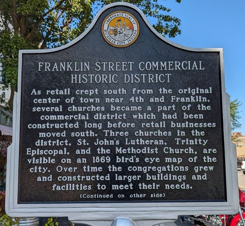
1. Franklin Street Commercial Historic District Marker, Side One
As retail crept south from the original center of town near 4th and Franklin, several churches became a part of the commercial district which had been constructed long before retail businesses moved south. Three churches in the district, St. John's Lutheran, Trinity Episcopal, and the Methodist Church, are visible on an 1869 bird's eye map of the city. Over time the congregations grew and constructed larger buildings and facilities to meet their needs.
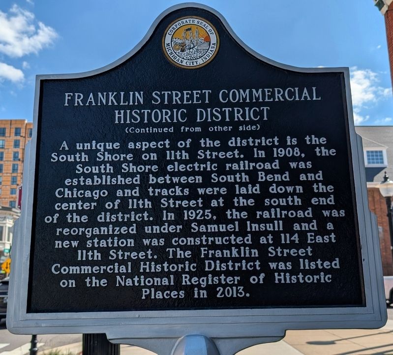
A unique aspect of the district is the South Shore on 11th Street. In 1908, the South Shore electric railroad was established between South Bend and Chicago and tracks were laid down the center of 11th Street at the south end of the district. In 1925, the railroad was reorganized under Samuel Insull and a new station was constructed at 114 East 11th Street. The Franklin Street Commercial Historic District was listed on the National Register of Historic Places in 2013.
Erected by Michigan City, Indiana.
Topics. This historical marker is listed in these topic lists: Industry & Commerce • Railroads & Streetcars • Religion & Religious Structures. A significant historical year for this entry is 1869.
Location. 41° 42.78′ N,
this page online

Regionally, this marker is in Northwest Indiana, specifically on the Indiana Dunes and Lake Michigan Shore, and in Greater South Bend. It is also in the American Midwest and in the Corn Belt. Globally, it is in North America, on the Great Lakes, in the Western Hemisphere, in the Western World, and in the Anglosphere. Historically, it finds itself in what was once the territory of the Mississippian Culture and also the Northwest Territory.
Other nearby markers. At least 8 other markers are within walking distance of this marker: Elston Grove Historic District (approx. 0.2 miles away); Haskell & Barker Historic District (approx. 0.2 miles away); Barker Civic Center (approx.
Photographed by Daniel Barriball, September 7, 2026
2. Franklin Street Commercial Historic District Marker, Side Two
Regarding Franklin Street Commercial Historic District.
Excerpt from the Statement of Significance in the National Register of Historic Places application:
The congregation of Trinity Episcopal Church selected the Romanesque Revival style for their church's design when it was constructed in 1889 at 600 Franklin Street (photo 0016). The style was made popular by architect Henry H. Richardson, particularly on public buildings located along the east coast. The style often used large rusticated stone blocks for its wall construction. Wide arched windows and towers or turrets were also frequently used. Trinity Episcopal Church is an excellent example of the style. The corner tower has broad arched openings and turrets on each corner of the belfry. The front gable of thechurch has a very broad arched opening that is composed of several art glass windows. The walls of the building are composed entirely of large rusticated stone blocks. The building is also the only example of the Romanesque Revival style in the district.Photographed by Daniel Barriball, September 7, 20263. Franklin Street Commercial Historic District Marker in context, facing north
An example of a unique style that relates to the early German heritage found in Michigan City is located at 901 Franklin Street. The building was the home to the congregation of St. John's Lutheran Church, composed largely of German immigrants. The church was constructed in 1867 and is the oldest extant building in the district. The builder, a German immigrant himself, constructed the building in a style popular in early 19th century Germany. Known as "Rundbogenstil" the style is a form of Early Romanesque Revival. The style was a revival of the German Romanesque and the Renaissance.
Also see . . . Franklin Street Commercial Historic District. Indiana State Historic Architectural and Archaeological Research Database (SHAARD) National Register of Historic Places Application
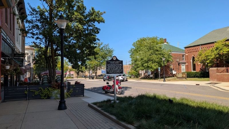
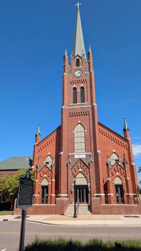
The original hub of the commercial district was located nearer the harbor on Franklin Street between(Submitted on September 7, 2026, by Daniel Barriball of Chesterton, Indiana.)Second and Michigan Streets. This was until about 1864 when commercial activity started to creep southward on Franklin Street, which had previously been a residential area. Franklin Street was the first to receive sidewalks in 1840 and the first to be planked in 1850. Prior to about 1890 very few commercial buildings were located south of Fifth Street (which was also called Market Street). An interurban line down the center of Franklin Street to neighborhoods on the south side of town, and the South Shore interurban line on 11th Street continued to draw commercial development southward on Franklin Street. This essentially created the city's sole commercial "main street" throughout the period of significance.Photographed by Daniel Barriball, September 7, 20264. Franklin Street Commercial Historic District Marker in contextThe markers stands across the street from St. Paul Lutheran Church
Credits. This page was last revised on September 11, 2026. It was originally submitted on September 7, 2026, by Daniel Barriball of Chesterton, Indiana. This page has been viewed 7 times since then. Photos: 1, 2, 3, 4. submitted on September 7, 2026, by Daniel Barriball of Chesterton, Indiana. • Devry Becker Jones was the editor who published this page.
