Forest in Bedford County, Virginia — The American South (Mid-Atlantic)
Poplar Forest
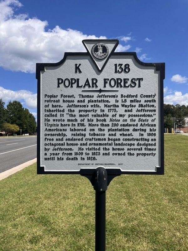
Photographed by Stephen Escalera
1. Poplar Forest Marker
Erected 2017 by Department of Historic Resources. (Marker Number K-138.)
Topics. This historical marker is listed in this topic list: Notable Places.
Location. 37° 21.975′ N, 79° 15.66′ W. Marker is in Forest, Virginia, in Bedford County. It is on Forest Road (U.S. 221) just west of Newcomb Boulevard, on the left when traveling west. Touch for map. Marker is at or near this postal address: 16890 Forest Rd, Forest VA
this page online

Regionally, this marker is in Southwest Virginia. It is also in the American South and specifically in the Upper South. Globally, it is in North America, the Western Hemisphere, the Western World, and the Anglosphere. Historically, it finds itself in what was once the territory of the Mississippian Culture, one of the original Thirteen Colonies, one of the Confederate States of America, and the Antebellum South.
Other nearby markers. At least 8 other markers are within 3 miles of this marker, measured as the crow flies: "A Culture Productive of Infinite Wretchedness” (approx. 1.3 miles away); Transforming a Plantation into a Private Retreat, 1806—1826 (approx. 1.3 miles away); Plantation Worker Housing (approx. 1.3 miles away); Poplar Forest Planting Memorandum 1812 (approx. 1.3 miles away); Mounds Made of Ideas and Sweat (approx. 1.3 miles away); “I have this summer built a wing of offices...” (approx. 1.3 miles away); Crafting a Masterpiece, Longing for Home (approx. 1.3 miles away); St. Stephen's Church (approx. 2.1 miles away). Touch for a list and map of all markers in Forest.
Other markers no longer nearby. How was the landscape partitioned? (was approx. 1.2 miles away but has been replaced with another marker now near it); Commemorating Lewis and Clark (was approx. 1.3 miles away but has been replaced with another marker now near it); Why build the mounds? (was approx. 1.3 miles away but has been replaced with another marker now near it); Why is the lawn sunken? (was approx. 1.3 miles away but has been replaced with another marker now near it); What happened to Poplar Forest after Jefferson's death? (was approx. 1.3 miles away but has been replaced with another marker now near it).
Credits. This page was last revised on September 8, 2026. It was originally submitted on September 8, 2026, by Stephen Escalera of Roanoke, Virginia. This page has been viewed 8 times since then. Photo 1. submitted on September 8, 2026, by Stephen Escalera of Roanoke, Virginia. • Bernard Fisher was the editor who published this page.
